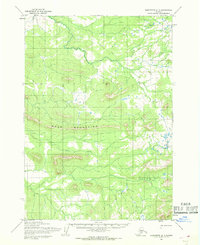
1954 Map of Sleetmute A-1
USGS Topo · Published 1968About this map
The Door Mountains dominate this 1950s interior landscape, providing a topographical anchor for the surrounding wilderness in what is now the Bethel area. The map illustrates a remote terrain where seasonal navigation was a primary necessity, highlighted by the presence of a Winter Trail cutting through the northern section of the quadrangle. This designated route signifies the region's reliance on frozen ground and snowpack for overland travel before more permanent infrastructure reached this part of Alaska. Drainage for the western slopes is provided by Door Creek, which winds through the central valley. The sparse nomenclature on this sheet reflects the undeveloped nature of the territory at the time, focusing almost entirely on physical geography and the essential paths required to traverse it.
Find a feature on this map
3 named features on this map. Tap any name to fly to it.
Don’t see what you’re looking for? This feature index may not catch every label — zoom into the map to look around manually.
Map Details
Editions of this 1954 Sleetmute A-1 Map
This is the sole edition of this map. No revisions or reprints were ever made.
Other maps of this area

1946 · Lake Clark
USGS Topo · 1:250,000

1950 · Sleetmute
USGS Topo · 1:250,000

1950 · Taylor Mountains
USGS Topo · 1:250,000

1951 · Lake Clark
USGS Topo · 1:250,000

1951 · Taylor Mountains
USGS Topo · 1:250,000

1951 · Lime Hills
USGS Topo · 1:250,000

1954 · Lime Hills A-8
USGS Topo · 1:63,360

1954 · Lake Clark D-8
USGS Topo · 1:63,360

1954 · Sleetmute
USGS Topo · 1:250,000

1954 · Taylor Mountains
USGS Topo · 1:250,000