
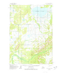
1954 Map of Lime Hills A-8
USGS Topo · Published 1964About this map
Tundra Lake dominates the northern reaches of this remote Alaskan interior landscape, its expansive waters serving as a focal point for the surrounding marsh and tundra. The hydrology of the region is defined by the winding course of the Stink River and the braided drainage of Hook Creek, which carves through the undulating terrain of the Lime Hills.
Find a feature on this map
4 named features on this map. Tap any name to fly to it.
Don’t see what you’re looking for? This feature index may not catch every label — zoom into the map to look around manually.
Map Details
Editions of this 1954 Lime Hills A-8 Map
2 editions found
Other maps of this area

1946 · Lake Clark
USGS Topo · 1:250,000

1950 · Sleetmute
USGS Topo · 1:250,000

1950 · Taylor Mountains
USGS Topo · 1:250,000

1951 · Lake Clark
USGS Topo · 1:250,000

1951 · Taylor Mountains
USGS Topo · 1:250,000

1951 · Lime Hills
USGS Topo · 1:250,000

1954 · Lake Clark D-8
USGS Topo · 1:63,360

1954 · Lake Clark D-7
USGS Topo · 1:63,360

1954 · Sleetmute
USGS Topo · 1:250,000

1954 · Taylor Mountains
USGS Topo · 1:250,000