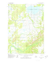
1954 Map of Lime Hills A-8
USGS Topo · Published 1977About this map
Tundra Lake dominates the northern reaches of this Alaskan interior landscape, its irregular shoreline surrounded by a network of drainage channels and low-lying terrain. The hydrography of the region is defined by the Stink River, which flows north from the lake's western edge, and Caribou Snare Creek feeding in from the east. In the southern portion of the quadrangle, Hook Creek winds through the hills, illustrating the complex water systems that characterize this part of the Bethel area. Mapped by the Army Map Service using aerial photography from the mid-1950s, the terrain remains largely devoid of permanent human infrastructure or settlements, offering a detailed look at the natural drainage patterns and elevation contours before later revisions. This survey provides a baseline for understanding the unchanged wilderness of the Lime Hills region during the mid-twentieth century.
Find a feature on this map
4 named features on this map. Tap any name to fly to it.
Don’t see what you’re looking for? This feature index may not catch every label — zoom into the map to look around manually.
Map Details
Editions of this 1954 Lime Hills A-8 Map
2 editions found
Other maps of this area

1946 · Lake Clark
USGS Topo · 1:250,000

1950 · Sleetmute
USGS Topo · 1:250,000

1950 · Taylor Mountains
USGS Topo · 1:250,000

1951 · Lake Clark
USGS Topo · 1:250,000

1951 · Taylor Mountains
USGS Topo · 1:250,000

1951 · Lime Hills
USGS Topo · 1:250,000

1954 · Lime Hills A-8
USGS Topo · 1:63,360

1954 · Lake Clark D-8
USGS Topo · 1:63,360

1954 · Lake Clark D-7
USGS Topo · 1:63,360

1954 · Sleetmute
USGS Topo · 1:250,000