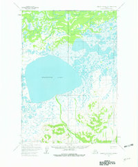
1952 Map of Russian Mission B-3
USGS Topo · Published 1980About this map
Whitefish Lake dominates this 1952 landscape, a massive expanse of water surrounded by a complex network of wetlands and smaller unnamed lakes. The terrain is defined by the contrast between these low-lying swampy areas and the elevated peaks to the south and east, including Salat, Pole, Fish, and Ophir. These named summits provide the only significant relief in a region otherwise characterized by meandering waterways like Discovery Creek and Ophir Creek.
Find a feature on this map
8 named features on this map. Tap any name to fly to it.
Don’t see what you’re looking for? This feature index may not catch every label — zoom into the map to look around manually.
Map Details
Editions of this 1952 Russian Mission B-3 Map
2 editions found
Other maps of this area

1947 · Russian Mission
USGS Topo · 1:250,000

1950 · Russian Mission
USGS Topo · 1:250,000

1952 · Russian Mission C-3
USGS Topo · 1:63,360

1952 · Russian Mission C-2
USGS Topo · 1:63,360

1952 · Russian Mission B-2
USGS Topo · 1:63,360

1952 · Russian Mission B-3
USGS Topo · 1:63,360

1954 · Russian Mission A-4
USGS Topo · 1:63,360

1954 · Russian Mission C-4
USGS Topo · 1:63,360

1954 · Russian Mission B-4
USGS Topo · 1:63,360

1954 · Russian Mission A-3
USGS Topo · 1:63,360