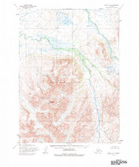
1954 Map of Bethel A-4
USGS Topo · Published 1984About this map
The Eek Mountains dominate this mid-century survey, a wilderness landscape characterized by sharp peaks and a complex drainage system. Two prominent landmarks, Sawtooth Mountain and Breast Mountain, serve as essential navigational markers for this region of the Bethel quadrangle. These heights give way to the winding course of the Eek River and the Kwethiluk River, which define the low-lying wetlands and tundra to the north.
Find a feature on this map
9 named features on this map. Tap any name to fly to it.
Don’t see what you’re looking for? This feature index may not catch every label — zoom into the map to look around manually.
Map Details
Editions of this 1954 Bethel A-4 Map
3 editions found
Other maps of this area

1950 · Bethel
USGS Topo · 1:250,000

1951 · Goodnews
USGS Topo · 1:250,000

1954 · Bethel A-5
USGS Topo · 1:63,360

1954 · Bethel A-4
USGS Topo · 1:63,360

1954 · Bethel B-3
USGS Topo · 1:63,360

1954 · Bethel B-4
USGS Topo · 1:63,360

1954 · Goodnews D-4
USGS Topo · 1:63,360

1954 · Bethel B-5
USGS Topo · 1:63,360

1954 · Goodnews D-5
USGS Topo · 1:63,360

1979 · Bethel A-3
USGS Topo · 1:63,360