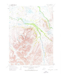
1954 Map of Bethel A-4
USGS Topo · Published 1976About this map
The Eek Mountains dominate this 1950s Alaskan landscape, characterized by dramatic elevation changes and a network of glacial river systems. Significant peaks like Sawtooth Mountain and Breast Mountain anchor the central and eastern portions of the quadrangle, with the terrain falling away into the Eek River and Kwethluk River valleys.
Find a feature on this map
9 named features on this map. Tap any name to fly to it.
Don’t see what you’re looking for? This feature index may not catch every label — zoom into the map to look around manually.
Map Details
Editions of this 1954 Bethel A-4 Map
3 editions found
Other maps of this area

1950 · Bethel
USGS Topo · 1:250,000

1951 · Goodnews
USGS Topo · 1:250,000

1954 · Bethel A-5
USGS Topo · 1:63,360

1954 · Bethel A-4
USGS Topo · 1:63,360

1954 · Bethel B-3
USGS Topo · 1:63,360

1954 · Bethel B-4
USGS Topo · 1:63,360

1954 · Goodnews D-4
USGS Topo · 1:63,360

1954 · Bethel B-5
USGS Topo · 1:63,360

1954 · Goodnews D-5
USGS Topo · 1:63,360

1979 · Bethel A-3
USGS Topo · 1:63,360