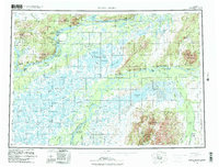
1980 Map of Russian Mission
USGS Topo · Published 1983About this map
Yukon River and Kuskokwim River dominate this vast stretch of the Alaskan interior, revealing a landscape where water and winter travel dictate the rhythm of life. The survey highlights several established riverfront settlements, including Russian Mission, Upper Kalskag, and Aniak, which serves as a central hub with its Airport and Radio Towers. The intricate web of the Portage Lakes and smaller tributaries like the Kuyukutuk River and Aniak River connect various fish camps and seasonal sites such as Tuckers Fish Camp and Dogfish Village.
Find a feature on this map
68 named features on this map. Tap any name to fly to it.
Don’t see what you’re looking for? This feature index may not catch every label — zoom into the map to look around manually.
Map Details
Editions of this 1980 Russian Mission Map
3 editions found

Other maps of this area

1947 · Russian Mission
USGS Topo · 1:250,000

1950 · Russian Mission
USGS Topo · 1:250,000

1950 · Sleetmute
USGS Topo · 1:250,000

1950 · Bethel
USGS Topo · 1:250,000

1950 · Taylor Mountains
USGS Topo · 1:250,000

1951 · Marshall
USGS Topo · 1:250,000

1951 · Taylor Mountains
USGS Topo · 1:250,000

1951 · Holy Cross
USGS Topo · 1:250,000

1951 · Iditarod
USGS Topo · 1:250,000

1951 · Baird Inlet
USGS Topo · 1:250,000