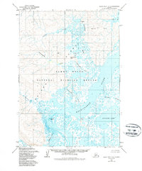
1954 Map of Baird Inlet C-7
USGS Topo · Published 1988About this map
Nelson Island and the surrounding coastal wetlands of western Alaska are captured here during the mid-1950s, a period prior to the major federal conservation designations that would later define the region. The map shows the Yukon Delta National Wildlife Refuge across a landscape dominated by tidal flux and intricate drainage networks. A significant cultural anchor is identified at Chakchak (Site) in the northern portion of the quadrangle, situated near the headwaters of Chakchak Creek.
Find a feature on this map
20 named features on this map. Tap any name to fly to it.
Don’t see what you’re looking for? This feature index may not catch every label — zoom into the map to look around manually.
Map Details
Editions of this 1954 Baird Inlet C-7 Map
3 editions found
Other maps of this area

1951 · Baird Inlet
USGS Topo · 1:250,000
1953 · Baird Inlet C-6
USGS Topo · 1:63,360

1954 · Baird Inlet D-6
USGS Topo · 1:63,360

1954 · Baird Inlet C-7
USGS Topo · 1:63,360

1954 · Baird Inlet D-7
USGS Topo · 1:63,360

1954 · Baird Inlet
USGS Topo · 1:250,000

1954 · Baird Inlet B-6
USGS Topo · 1:63,360

1954 · Baird Inlet B-7
USGS Topo · 1:63,360

1954 · Baird Inlet C-8
USGS Topo · 1:63,360

1954 · Baird Inlet D-8
USGS Topo · 1:63,360