
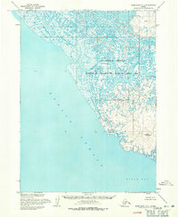
1954 Map of Baird Inlet B-8
USGS Topo · Published 1971About this map
Nelson Island dominates this mid-century survey, revealing a landscape defined by its intricate network of tidal sloughs and coastal marshes. The settlement patterns shown here reflect the seasonal subsistence rhythms of the region, anchored by the permanent village of Nightmute along the Toksook River. Further inland and along the coast, seasonal sites like Knugormiut Summer Camp and Nyortulermiut Summer Camp indicate how the local population moved across the tundra to utilize coastal resources. The map also identifies the Kanloyak (Site) near the river bend, marking an important location for genealogical and historical research. Bordered by the Etolin Strait and the Kolavinarak River, this area forms part of the Clarence Rhode National Wildlife Range Area No 2, highlighting the intersection of traditional land use and federal conservation efforts during the 1950s.
Find a feature on this map
11 named features on this map. Tap any name to fly to it.
Don’t see what you’re looking for? This feature index may not catch every label — zoom into the map to look around manually.
Map Details
Editions of this 1954 Baird Inlet B-8 Map
This is the sole edition of this map. No revisions or reprints were ever made.
Other maps of this area

1951 · Nunivak Island
USGS Topo · 1:250,000

1951 · Baird Inlet
USGS Topo · 1:250,000

1954 · Nunivak Island
USGS Topo · 1:250,000

1954 · Baird Inlet C-7
USGS Topo · 1:63,360

1954 · Baird Inlet
USGS Topo · 1:250,000

1954 · Baird Inlet B-7
USGS Topo · 1:63,360

1954 · Baird Inlet C-8
USGS Topo · 1:63,360
1954 · Baird Inlet A-7
USGS Topo · 1:63,360

1954 · Nunivak Island B-1
USGS Topo · 1:63,360

1954 · Nunivak Island C-1
USGS Topo · 1:63,360