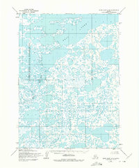
1954 Map of Baird Inlet A-5
USGS Topo · Published 1975About this map
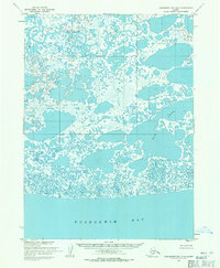
Clarence Rhode National Wildlife Range dominates this landscape in the mid-1950s, revealing a complex aquatic ecosystem in the Bethel region. The terrain is defined by an intricate network of countless unnamed tundra ponds and wetlands, centered around the expansive Dall Lake in the northern portion of the map. This area represents a massive deltaic environment where water and land are nearly indistinguishable, a characteristic common to the coastal plains of western Alaska during this era of survey. The Kivvak River meanders through the central-western section, providing a primary drainage route through the saturated plains. A surveyed Base Line bisects the quadrangle horizontally, marking the foundational work of the Army Map Service and the Geological Survey as they documented this remote territory using photogrammetric methods from 1953 aerial photography.
Find a feature on this map
4 named features on this map. Tap any name to fly to it.
Don’t see what you’re looking for? This feature index may not catch every label — zoom into the map to look around manually.
Map Details
Editions of this 1954 Baird Inlet A-5 Map
2 editions found
Other maps of this area

1951 · Kuskokwim Bay
USGS Topo · 1:250,000

1951 · Baird Inlet
USGS Topo · 1:250,000

1953 · Baird Inlet B-5
USGS Topo · 1:63,360
1954 · Baird Inlet A-5
USGS Topo · 1:63,360

1954 · Baird Inlet
USGS Topo · 1:250,000

1954 · Kuskokwim Bay
USGS Topo · 1:250,000

1954 · Baird Inlet B-6
USGS Topo · 1:63,360
1954 · Kuskokwim Bay D-6
USGS Topo · 1:63,360
1954 · Kuskokwim Bay D-4
USGS Topo · 1:63,360
1954 · Kuskokwim Bay D-5
USGS Topo · 1:63,360