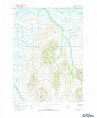
1954 Map of Bethel C-5
USGS Topo · Published 1983About this map
The Kasigluk River and its intricate drainage system dominate this mid-century topographic study of the Alaskan interior near Bethel. In an environment defined by water and elevation, the Little Kasigluk River meanders through the central lowlands, flanked by the prominent heights of Shining Dome to the southeast. The mapping reveals a transition from the dense network of tundra lakes and streams like Columbia Creek and the Kushluk River in the west to the more defined relief of the eastern uplands. This 1954 field-annotated survey, based on photogrammetric methods from the mid-1950s, documents a wilderness landscape devoid of established roads or trails. The hydrological pattern of the Akulikutak River in the southwest further illustrates the complex waterway network that served as the primary means of movement through this region before modern infrastructure.
Find a feature on this map
6 named features on this map. Tap any name to fly to it.
Don’t see what you’re looking for? This feature index may not catch every label — zoom into the map to look around manually.
Map Details
Editions of this 1954 Bethel C-5 Map
Other maps of this area

1950 · Bethel
USGS Topo · 1:250,000

1954 · Bethel B-6
USGS Topo · 1:63,360

1954 · Bethel D-4
USGS Topo · 1:63,360

1954 · Bethel C-6
USGS Topo · 1:63,360

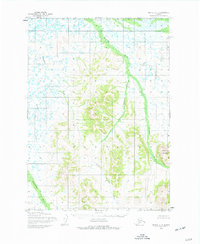
1954 · Bethel C-5
USGS Topo · 1:63,360

1954 · Bethel D-6
USGS Topo · 1:63,360

1954 · Bethel C-4
USGS Topo · 1:63,360

1954 · Bethel D-5
USGS Topo · 1:63,360

1954 · Bethel B-4
USGS Topo · 1:63,360

1954 · Bethel B-5
USGS Topo · 1:63,360