Old Maps of Shishmaref, Alaska for Metal Detecting
Plan your next treasure hunt with 6 historic maps of Shishmaref. Find old homesites, ghost towns, trails, and gathering spots that may be lost to time — perfect for identifying promising metal detecting locations.
- Locate forgotten sites: Uncover places like long-lost settlements, abandoned rail lines, or gathering spots.
- Plan better hunts: Use map overlays combined with LiDAR or satellite views to narrow in on historically rich areas.
- Made for detectorists: Thousands of hobbyists use these maps to discover relics, coins, and hidden history.
Use these historic maps to boost your research and find new opportunities beneath the surface of Shishmaref.
Shishmaref, AK maps
(6)- 1950 Map of Shishmaref, 1956 Print
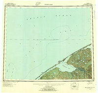 1950 Shishmaref1956 Print · USGSThe Seward Peninsula shoreline at the dawn of the fifties reveals a landscape of barrier islands and isolated tundra outposts. Researchers can trace seasonal routes like the Winter Trail and locate the historic Shishmaref village on Sarichef Island.5 unique versions available
 - 1950 Map of Shishmaref A-3, 1957 Print
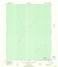
 1950 Shishmaref A-31957 Print · USGSThe Chukchi Sea coastline near the Shishmaref Inlet is captured here in the mid-twentieth century. Researchers can trace the seasonal Winter Trail and locate early aviation landmarks like the Landing Area on Sarichef Island.2 unique versions available
 - 1950 Map of Shishmaref B-3, 1957 Print
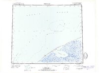
 1950 Shishmaref B-31957 Print · USGSSarichef Island and the village of Shishmaref sit along the Chukchi Sea in the 1950s. Trace the mid-century footprint of this Arctic outpost through its Landing Strip, Light, and the Winter Trail leading along Shishmaref Inlet.2 unique versions available
 - 1951 Map of Shishmaref
 1951 Shishmaref1951 Print · USGSThe Seward Peninsula and Sarichef Island are captured here during the early fifties, showing the coastal subsistence landscape of the Alaskan Arctic. Researchers can locate remote outposts like Sinrazat and Kividlow, or trace the path of the Winter Trail as it skirts the Shishmaref Inlet.
 - 2014 Map of Shishmaref B-3 SE, 2014 Print
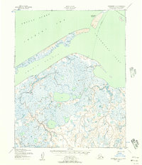
 2014 Shishmaref B-3 SE2014 Print · USGSShishmaref and Sarichef Island are captured in the early twenty-first century as they sit between the open sea and the inlet. Researchers can trace the layout of Shishmaref along Main Street and locate the critical Shishmaref Airport.
 - 2014 Map of Shishmaref A-3 NE, 2014 Print
 2014 Shishmaref A-3 NE2014 Print · USGSThe Seward Peninsula coastline appears as a delicate thread of barrier islands and inlets in this 2014 survey. Geographers and coastal researchers can trace the modern shoreline of Sarichef Island and the positioning of the Shishmaref Airport.
End of results
Showing maps 1-6 of 6
Frequently asked questions
- What are the different types of historical maps available for Shishmaref?
- What is the oldest map of Shishmaref?
- Where can I purchase historical maps of Shishmaref for my home or office?
- Where can I download high-res historical maps of Shishmaref?
- Are there historical topographic maps available for Shishmaref?
- Is there historical aerial imagery available for Shishmaref?
- Where are historical maps of Shishmaref sourced from?