2010s Maps of Togiak, Alaska
Explore 5 historic maps of Togiak from the 2010s. These maps offer a rare glimpse into what life looked like during the 2010s — showing old roads, neighborhoods, homes, and landmarks that have changed or disappeared over time.
Whether you're researching your family's past, planning a metal detecting trip, or studying how Togiak's landscape evolved across the 2010s, these high-resolution maps are a powerful tool for exploring the history of this region.
- Focus on a specific era: All maps on this page are from the 2010s, giving you a focused view of this time period.
- See what’s changed: Compare century-old streets, trails, and buildings to today's modern landscape using overlays and satellite layers.
- Research with precision: Use these maps for genealogy, historical research, land use analysis, or educational projects.
- View, download, or print: Maps are fully viewable online in high resolution, and can be downloaded or printed for your own records.
Start exploring Togiak's history through authentic maps from the 2010s. This is your window into the past.
Togiak, AK maps
(5)- 2018 Map of Hagemeister Island D-3 SE, 2018 Print
 2018 Hagemeister Island D-3 SE2018 Print · USGSThe northern tip of Hagemeister Island and the waters of Togiak Bay are captured in this 2010s coastal survey. Researchers can trace the shoreline of Rocky Point and study the elevation contours of the island's interior.
 - 2018 Map of Hagemeister Island D-2 NW, 2018 Print
 2018 Hagemeister Island D-2 NW2018 Print · USGSThe coastal wilds near the Pacific Ocean are documented here in the late twenty-teens, showing the area's natural drainage and shoreline. Researchers can trace the path of the Quigmy River as it reaches the sea across this remote terrain.
 - 2018 Map of Hagemeister Island D-1 NW, 2018 Print
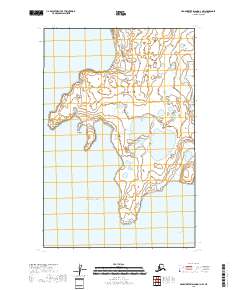 2018 Hagemeister Island D-1 NW2018 Print · USGSThe coastal village of Togiak and its surrounding wetlands are captured here in the late 2010s. Researchers can trace the rugged shoreline from Anchor Point down to Rocky Point and explore the remote reaches of Ungadikthluk Bay.
 - 2018 Map of Hagemeister Island D-3 SW, 2018 Print
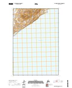
 2018 Hagemeister Island D-3 SW2018 Print · USGSCoastal Alaska's maritime landscape is charted in the late 2010s, focusing on the waters surrounding Hagemeister Island. Researchers can trace the shoreline of Tongue Point and the navigational passage through Hagemeister Strait into the Pacific Ocean.
 - 2018 Map of Hagemeister Island D-3 NE, 2018 Print
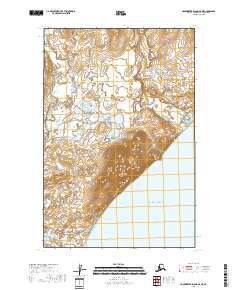 2018 Hagemeister Island D-3 NE2018 Print · USGSThe northern reaches of the Alaska coast are captured here in the late twenty-first century, showing where the tundra meets the sea. Researchers can trace the courses of the Matogluk River and Quigmy River as they flow around the prominent heights of Aeolus Mtn.
End of results
Showing maps 1-5 of 5
Frequently asked questions
- What are the different types of historical maps available for Togiak?
- What is the oldest map of Togiak?
- Where can I purchase historical maps of Togiak for my home or office?
- Where can I download high-res historical maps of Togiak?
- Are there historical topographic maps available for Togiak?
- Is there historical aerial imagery available for Togiak?
- Where are historical maps of Togiak sourced from?