Old Maps of Togiak, Alaska for Hiking & Exploration
Hike through history with 20 historic maps of Togiak. Explore old trails, ghost towns, and forgotten backroads — perfect for outdoor adventurers and local explorers.
- Rediscover forgotten places: Map out old mining camps, roads, and footpaths that no longer exist on modern maps.
- Layer with modern tools: Combine with LiDAR or satellite views to plan hikes through historical terrain.
- Made for exploration: Popular among hikers, overlanders, and local history lovers.
Use these maps to find adventure and explore the hidden past of Togiak.
Togiak, AK maps
(20)- 1947 Map of Hagemeister Island D-2, 1975 Print
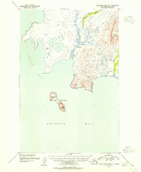
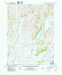
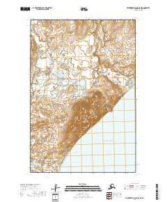
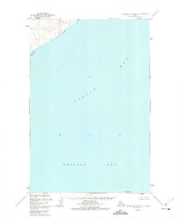 1947 Hagemeister Island D-21975 Print · USGSThe northern reaches of Bristol Bay appear here in the late 1940s, providing a detailed record of the Alaskan coast before modern development. Researchers can trace the mouth of the Quigmy R and locate the solitary landmark of High Island among the soundings of Togiak Bay.2 unique versions available
 - 1948 Map of Hagemeister Island D-3, 1957 Print
 1948 Hagemeister Island D-31957 Print · USGSThe Alaska coastline at Togiak Bay appears here in the late 1940s, showcasing a wild maritime landscape before modern development. Researchers can trace the rugged shoreline from Tongue Point to Aeolus Mtn and across the Hagemeister Strait.2 unique versions available
 - 1950 Map of Hagemeister Island D-1, 1974 Print
 1950 Hagemeister Island D-11974 Print · USGSCoastal Alaska in the mid-twentieth century reveals a landscape of isolated outposts and protected wildlife waters. Researchers can trace the remote settlement at Ungalikthluk and the solitary Cabin near the shores of Bristol Bay.2 unique versions available
 - 1951 Map of Goodnews, 1953 Print
 1951 Goodnews1953 Print · USGSSouthwest Alaska’s coastal bays and mountain lakes are captured here just after the war, showing the area's shifting settlement patterns. Trace the coastline from Kwinhagak to Goodnews, or locate interior landmarks like the Placer Mine and Nuyakuk Lake.6 unique versions available
 - 1951 Map of Hagemeister Island, 1953 Print
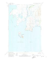
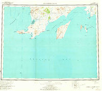
 1951 Hagemeister Island1953 Print · USGSSouthwestern Alaska's coastal frontier is detailed in this mid-century reconnaissance, showing the territory before modern infrastructure. Researchers can trace the Winter Trail and locate coastal landmarks like Platinum, Hagemeister Island, and the Walrus Islands.2 unique versions available
 - 1952 Map of Hagemeister Island D-1, 1955 Print
 1952 Hagemeister Island D-11955 Print · USGSCoastal Bristol Bay in the early fifties shows a landscape of tidal rivers and remote outposts. Researchers can trace the geography of the Ungalikthluk settlement or locate a lone Cabin near the shores of Nunavachak Lake and the rocky heights of Summit Island.
 - 1953 Map of Hagemeister Island D-2, 1955 Print
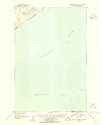 1953 Hagemeister Island D-21955 Print · USGSCoastal Alaska in the early fifties is defined by the open waters of Togiak Bay and Bristol Bay. Maritime researchers can trace the shoreline near the mouth of the Quigmy R and locate the isolated position of High Island.
 - 1954 Map of Goodnews A-4, 1968 Print
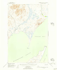
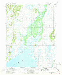 1954 Goodnews A-41968 Print · USGSTogiak Bay and its surrounding river deltas are captured here in the early fifties, showing a landscape defined by water and isolation. Researchers can trace the coastal settlement at Togiak, the Landing Field, and remote landmarks like Eklik 932.2 unique versions available
 - 1957 Map of Hagemeister Island, 1966 Print
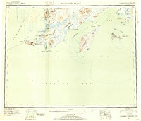
 1957 Hagemeister Island1966 Print · USGSCoastal Alaska's mining and maritime landscape comes alive in the mid-1950s, highlighting the remote settlements and rugged Bristol Bay shoreline. Researchers can trace the industrial footprint at Goodnews Mining Camp or locate coastal features like Cape Newenham and Kinegnak.3 unique versions available
 - 1979 Map of Goodnews Bay A-5
 1979 Goodnews Bay A-51979 Print · USGSCoastal Alaska in the late seventies is captured here, showing a landscape of rivers and tidal flats with no established roads. Researchers can trace the Togiak Corporate Boundary and the courses of the Matogak River and Quigmy River.2 unique versions available
 - 1979 Map of Goodnews Bay
 1979 Goodnews Bay1979 Print · USGSCoastal villages and massive mountain ranges define the southwestern Alaska wilderness during the late seventies. Researchers can trace remote routes like the Winter Trail and locate isolated outposts at Platinum and Goodnews Bay near Cape Newenham.2 unique versions available
 - 2018 Map of Hagemeister Island D-3 SE, 2018 Print
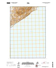
 2018 Hagemeister Island D-3 SE2018 Print · USGSThe northern tip of Hagemeister Island and the waters of Togiak Bay are captured in this 2010s coastal survey. Researchers can trace the shoreline of Rocky Point and study the elevation contours of the island's interior.
 - 2018 Map of Hagemeister Island D-2 NW, 2018 Print
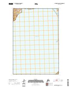
 2018 Hagemeister Island D-2 NW2018 Print · USGSThe coastal wilds near the Pacific Ocean are documented here in the late twenty-teens, showing the area's natural drainage and shoreline. Researchers can trace the path of the Quigmy River as it reaches the sea across this remote terrain.
 - 2018 Map of Hagemeister Island D-1 NW, 2018 Print
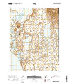
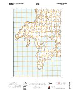 2018 Hagemeister Island D-1 NW2018 Print · USGSThe coastal village of Togiak and its surrounding wetlands are captured here in the late 2010s. Researchers can trace the rugged shoreline from Anchor Point down to Rocky Point and explore the remote reaches of Ungadikthluk Bay.
 - 2018 Map of Hagemeister Island D-3 SW, 2018 Print
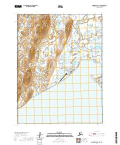
 2018 Hagemeister Island D-3 SW2018 Print · USGSCoastal Alaska's maritime landscape is charted in the late 2010s, focusing on the waters surrounding Hagemeister Island. Researchers can trace the shoreline of Tongue Point and the navigational passage through Hagemeister Strait into the Pacific Ocean.
 - 2018 Map of Hagemeister Island D-3 NE, 2018 Print
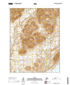
 2018 Hagemeister Island D-3 NE2018 Print · USGSThe northern reaches of the Alaska coast are captured here in the late twenty-first century, showing where the tundra meets the sea. Researchers can trace the courses of the Matogluk River and Quigmy River as they flow around the prominent heights of Aeolus Mtn.
 - 2020 Map of Hagemeister Island D-2 SE, 2020 Print
 2020 Hagemeister Island D-2 SE2020 Print · USGSCoastal Alaska at the opening of the 2020s reveals a maritime landscape defined by the intersection of world oceans. Researchers can trace the survey boundaries of T16S R67W as they meet the waters of Bristol Bay and the Pacific Ocean.
 - 2020 Map of Goodnews Bay A-4 SE, 2020 Print
 2020 Goodnews Bay A-4 SE2020 Print · USGSNear the shores of Bristol Bay, the community of Twin Hills is documented in this recent survey. Researchers can trace the local infrastructure including Airport Road, the Twin Hills Airport, and the meandering Negukthlik River.
 - 2020 Map of Goodnews Bay A-5 SE, 2020 Print
 2020 Goodnews Bay A-5 SE2020 Print · USGSThe Dillingham region of southwestern Alaska is captured here in 2020, showing the remote coastal tundra and river systems. Researchers can trace the winding paths of the Quigmy River and Kurtluk River as they flow toward the waters of Togiak Bay.
 - 2020 Map of Goodnews Bay A-4 SW, 2020 Print
 2020 Goodnews Bay A-4 SW2020 Print · USGSIn the Dillingham Census Area, this 2020 survey captures the coastal community of Togiak where the river meets the bay. Researchers can trace local infrastructure from the Togiak Airport to the Togiak Cem and the University of Alaska Fairbanks - Togiak Center.
End of results
Showing maps 1-20 of 20
Frequently asked questions
- What are the different types of historical maps available for Togiak?
- What is the oldest map of Togiak?
- Where can I purchase historical maps of Togiak for my home or office?
- Where can I download high-res historical maps of Togiak?
- Are there historical topographic maps available for Togiak?
- Is there historical aerial imagery available for Togiak?
- Where are historical maps of Togiak sourced from?