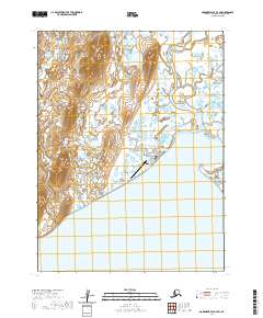
2020 Map of Goodnews Bay A-4 SW
USGS Topo · Published 2020About this map
Togiak sits at the northern edge of Togiak Bay in the Dillingham Census Area, serving as a vital hub for this coastal region. The settlement is organized around a modest grid of streets including Bay Street (1st Street) and First Avenue, with education and transportation services anchored by the University of Alaska Fairbanks - Togiak Center and the Togiak Airport.
Find a feature on this map
15 named features on this map. Tap any name to fly to it.
Don’t see what you’re looking for? This feature index may not catch every label — zoom into the map to look around manually.
Map Details
Editions of this 2020 Goodnews Bay A-4 SW Map
This is the sole edition of this map. No revisions or reprints were ever made.
Other maps of this area

1947 · Hagemeister Island D-2
USGS Topo · 1:63,360

1950 · Hagemeister Island D-1
USGS Topo · 1:63,360

1951 · Goodnews
USGS Topo · 1:250,000

1951 · Hagemeister Island
USGS Topo · 1:250,000

1952 · Hagemeister Island D-1
USGS Topo · 1:63,360

1953 · Hagemeister Island D-2
USGS Topo · 1:63,360

1954 · Goodnews A-4
USGS Topo · 1:63,360

1957 · Hagemeister Island
USGS Topo · 1:250,000

1979 · Goodnews Bay A-5
USGS Topo · 1:63,360

1979 · Goodnews Bay
USGS Topo · 1:250,000