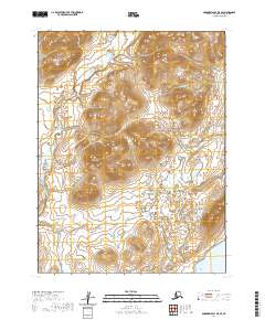
2020 Map of Goodnews Bay A-5 SE
USGS Topo · Published 2020About this map
Togiak terrain dominates this coastal region of southwestern Alaska, where the landscape transitions from the high, relief-heavy interior to the shoreline. The drainage system is defined by the Quigmy River and the Kurtluk River, which cut through the tundra toward the southern coast. This area within the Dillingham Census Area is primarily characterized by its remote hydrology and significant wetland networks, as documented by the U.S. Geological Survey using 2009 SPOT imagery and updated elevation data. The map reaches its southern extent at the waters of Togiak Bay, providing a clear record of the coastal geography and the inland river channels as they appeared in 2020.
Find a feature on this map
8 named features on this map. Tap any name to fly to it.
Don’t see what you’re looking for? This feature index may not catch every label — zoom into the map to look around manually.
Map Details
Editions of this 2020 Goodnews Bay A-5 SE Map
This is the sole edition of this map. No revisions or reprints were ever made.
Other maps of this area

1947 · Hagemeister Island D-2
USGS Topo · 1:63,360

1948 · Hagemeister Island D-3
USGS Topo · 1:63,360

1951 · Goodnews
USGS Topo · 1:250,000

1951 · Hagemeister Island
USGS Topo · 1:250,000

1953 · Hagemeister Island D-2
USGS Topo · 1:63,360

1954 · Goodnews A-4
USGS Topo · 1:63,360

1957 · Hagemeister Island
USGS Topo · 1:250,000

1979 · Goodnews Bay A-5
USGS Topo · 1:63,360

1979 · Goodnews Bay
USGS Topo · 1:250,000
2018 · Hagemeister Island D-2 NW
USGS Topo · 1:25,000