
2018 Map of Hagemeister Island D-3 SE
USGS Topo · Published 2018About this map
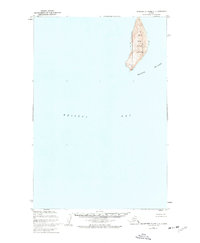
Hagemeister Island dominates the southern reaches of this survey, standing as a prominent landmass within the Pacific Ocean waters off the Alaskan coast. The landscape is characterized by its isolation and maritime orientation, specifically where the island's northern edge meets the open water. To the northeast, the coastal profile is defined by Rocky Point, a distinct geographic landmark that marks the transition into the broader waters of Togiak Bay. This 2018 study documents the coastal geography within the Togiak administrative boundary, showing the precise topographic contours and shoreline of the island before it stretches south beyond the quadrangle boundary. The map illustrates a remote coastal environment defined more by its natural landmarks and maritime boundaries than by human infrastructure or permanent settlements.
Find a feature on this map
8 named features on this map. Tap any name to fly to it.
Don’t see what you’re looking for? This feature index may not catch every label — zoom into the map to look around manually.
Map Details
Editions of this 2018 Hagemeister Island D-3 SE Map
This is the sole edition of this map. No revisions or reprints were ever made.
Other maps of this area

1947 · Hagemeister Island D-2
USGS Topo · 1:63,360

1948 · Hagemeister Island D-3
USGS Topo · 1:63,360

1948 · Hagemeister Island C-3
USGS Topo · 1:63,360
1948 · Hagemeister Island C-2
USGS Topo · 1:63,360

1951 · Hagemeister Island
USGS Topo · 1:250,000

1952 · Hagemeister Island C-3
USGS Topo · 1:63,360

1952 · Hagemeister Island C-2
USGS Topo · 1:63,360

1953 · Hagemeister Island D-2
USGS Topo · 1:63,360

1957 · Hagemeister Island
USGS Topo · 1:250,000
2018 · Hagemeister Island D-3 NW
USGS Topo · 1:25,000