2000s (21st Century) Maps of Unalaska, Alaska
Explore 8 historic maps of Unalaska from the 2000s (21st Century). These maps offer a rare glimpse into what life looked like during the 2000s — showing old roads, neighborhoods, homes, and landmarks that have changed or disappeared over time.
Whether you're researching your family's past, planning a metal detecting trip, or studying how Unalaska's landscape evolved across the 2000s, these high-resolution maps are a powerful tool for exploring the history of this region.
- Focus on a specific era: All maps on this page are from the 2000s, giving you a focused view of this time period.
- See what’s changed: Compare century-old streets, trails, and buildings to today's modern landscape using overlays and satellite layers.
- Research with precision: Use these maps for genealogy, historical research, land use analysis, or educational projects.
- View, download, or print: Maps are fully viewable online in high resolution, and can be downloaded or printed for your own records.
Start exploring Unalaska's history through authentic maps from the 2000s. This is your window into the past.
Unalaska, AK maps
(8)- 2020 Map of Unalaska D-2 SW, 2020 Print
 2020 Unalaska D-2 SW2020 Print · USGSThe Aleutian coastline near the edge of the Unalaska region is documented here in the early twenty-first century. Researchers can trace the rugged shoreline of Cape Cheerful and the underwater coordinates of the Chelan Bank in the Bering Sea.
 - 2020 Map of Unalaska D-2 SE, 2020 Print
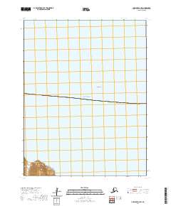
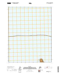 2020 Unalaska D-2 SE2020 Print · USGSUnalaska Island and the northern Bering Sea are documented here in the early twenty-first century, showing the remote Aleutian coastline. Maritime historians and researchers can trace the coastal contours of Cape Kalekta and locate the offshore pillar of Priest Rock.
 - 2021 Map of Unalaska C-2 SE, 2021 Print
 2021 Unalaska C-2 SE2021 Print · USGSUnalaska Island in the early twenty-first century reveals a landscape of deep fjords and steep coastal ridges. Researchers can trace the narrow passage of Overland Drive or locate landmarks like Bishops Cap and Mt Newhall.
 - 2021 Map of Unalaska C-2 SW, 2021 Print
 2021 Unalaska C-2 SW2021 Print · USGSUnalaska and the northern Fox Islands appear here in recent detail, showing the rugged coastline and maritime infrastructure of the Aleutians. Genealogists and historians can locate the Unalaska City Cem, the Unalaska Courthouse, and roads leading to Captains Bay.
 - 2021 Map of Unalaska C-3 SE, 2021 Print
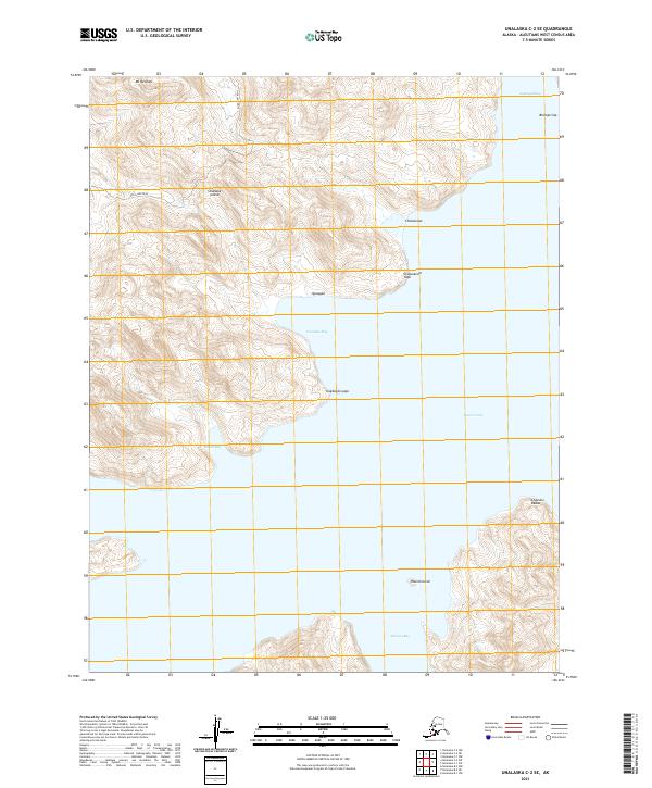
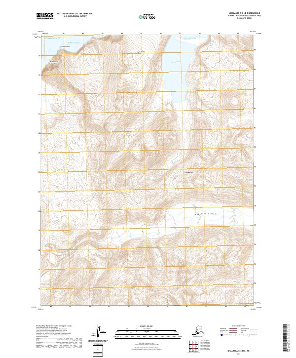
 2021 Unalaska C-3 SE2021 Print · USGSThe Aleutian wilderness is charted in this recent topographic study of the islands. Researchers can trace the steep drainage of the Nateekin River and Shaishnikof River as they flow past landmarks like Cathedral Point.
 - 2021 Map of Unalaska C-3 NE, 2021 Print
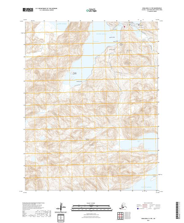
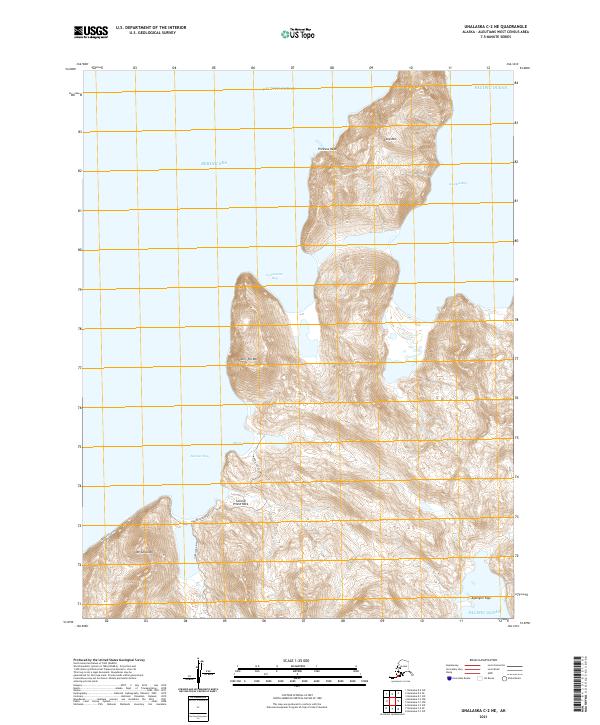
 2021 Unalaska C-3 NE2021 Print · USGSUnalaska Island in the early twenty-first century remains a landscape of dramatic coastal peaks and deep glacial drainages. Researchers can trace the rugged shoreline from Cape Wislow to McLees Lake and locate landmarks like Irishmans Hat.
 - 2021 Map of Unalaska C-2 NW, 2021 Print
 2021 Unalaska C-2 NW2021 Print · USGSThe Aleutian landscape of Unalaska and Dutch Harbor comes into focus in this recent survey of the Bering Sea coast. Trace maritime and aviation history from Amaknak Island to landmarks like the Holy Ascension Cathedral Church Cem and Unalaska Airport.
 - 2021 Map of Unalaska C-2 NE, 2021 Print
 2021 Unalaska C-2 NE2021 Print · USGSUnalaska Island's coastal terrain is charted here in the early twenty-first century, showing the meeting of the Bering Sea and Pacific Ocean. Researchers can trace land access along Morris Cove Road to landmarks like Split Top Mtn and Second Priest Rock.
End of results
Showing maps 1-8 of 8
Top neighborhoods of Unalaska
Frequently asked questions
- What are the different types of historical maps available for Unalaska?
- What is the oldest map of Unalaska?
- Where can I purchase historical maps of Unalaska for my home or office?
- Where can I download high-res historical maps of Unalaska?
- Are there historical topographic maps available for Unalaska?
- Is there historical aerial imagery available for Unalaska?
- Where are historical maps of Unalaska sourced from?