Old Maps of Ungalikthluk, Alaska for Metal Detecting
Plan your next treasure hunt with 5 historic maps of Ungalikthluk. Find old homesites, ghost towns, trails, and gathering spots that may be lost to time — perfect for identifying promising metal detecting locations.
- Locate forgotten sites: Uncover places like long-lost settlements, abandoned rail lines, or gathering spots.
- Plan better hunts: Use map overlays combined with LiDAR or satellite views to narrow in on historically rich areas.
- Made for detectorists: Thousands of hobbyists use these maps to discover relics, coins, and hidden history.
Use these historic maps to boost your research and find new opportunities beneath the surface of Ungalikthluk.
Ungalikthluk, AK maps
(5)- 1950 Map of Hagemeister Island D-1, 1974 Print
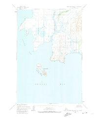 1950 Hagemeister Island D-11974 Print · USGSCoastal Alaska in the mid-twentieth century reveals a landscape of isolated outposts and protected wildlife waters. Researchers can trace the remote settlement at Ungalikthluk and the solitary Cabin near the shores of Bristol Bay.2 unique versions available
 - 1951 Map of Hagemeister Island, 1953 Print
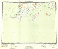 1951 Hagemeister Island1953 Print · USGSSouthwestern Alaska's coastal frontier is detailed in this mid-century reconnaissance, showing the territory before modern infrastructure. Researchers can trace the Winter Trail and locate coastal landmarks like Platinum, Hagemeister Island, and the Walrus Islands.2 unique versions available
 - 1952 Map of Hagemeister Island D-1, 1955 Print
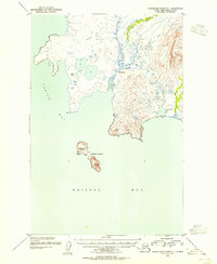 1952 Hagemeister Island D-11955 Print · USGSCoastal Bristol Bay in the early fifties shows a landscape of tidal rivers and remote outposts. Researchers can trace the geography of the Ungalikthluk settlement or locate a lone Cabin near the shores of Nunavachak Lake and the rocky heights of Summit Island.
 - 1957 Map of Hagemeister Island, 1966 Print
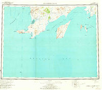 1957 Hagemeister Island1966 Print · USGSCoastal Alaska's mining and maritime landscape comes alive in the mid-1950s, highlighting the remote settlements and rugged Bristol Bay shoreline. Researchers can trace the industrial footprint at Goodnews Mining Camp or locate coastal features like Cape Newenham and Kinegnak.3 unique versions available
 - 2020 Map of Hagemeister Island D-1 NE, 2020 Print
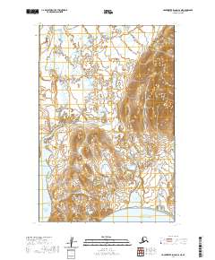 2020 Hagemeister Island D-1 NE2020 Print · USGSCoastal Alaska near Dillingham is shown in this modern era as a landscape of interconnected river systems and tidal bays. Researchers can trace the path of the Ungalikthluk River past the settlement of Ungalikthluk toward the waters of Nunavachak Bay.
End of results
Showing maps 1-5 of 5
Top cities near Ungalikthluk
Frequently asked questions
- What are the different types of historical maps available for Ungalikthluk?
- What is the oldest map of Ungalikthluk?
- Where can I purchase historical maps of Ungalikthluk for my home or office?
- Where can I download high-res historical maps of Ungalikthluk?
- Are there historical topographic maps available for Ungalikthluk?
- Is there historical aerial imagery available for Ungalikthluk?
- Where are historical maps of Ungalikthluk sourced from?