1900s (20th Century) Maps of Nazlini, Chinle Agency
Explore 9 historic maps of Nazlini from the 1900s (20th Century). These maps offer a rare glimpse into what life looked like during the 1900s — showing old roads, neighborhoods, homes, and landmarks that have changed or disappeared over time.
Whether you're researching your family's past, planning a metal detecting trip, or studying how Nazlini's landscape evolved across the 1900s, these high-resolution maps are a powerful tool for exploring the history of this region.
- Focus on a specific era: All maps on this page are from the 1900s, giving you a focused view of this time period.
- See what’s changed: Compare century-old streets, trails, and buildings to today's modern landscape using overlays and satellite layers.
- Research with precision: Use these maps for genealogy, historical research, land use analysis, or educational projects.
- View, download, or print: Maps are fully viewable online in high resolution, and can be downloaded or printed for your own records.
Start exploring Nazlini's history through authentic maps from the 1900s. This is your window into the past.
Nazlini, Chinle Agency maps
(9)- 1954 Map of Gallup, 1973 Print
 1954 Gallup1973 Print · USGSNative American tribal lands and the railroad corridor of the Southwest appear here at the midpoint of the century. Trace historic sites and remote settlements from Window Rock to the Fort Wingate Army Depot and Bibo.2 unique versions available
 - 1955 Map of Zith-Tusayan Butte 2 NW, 1957 Print
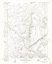 1955 Zith-Tusayan Butte 2 NW1957 Print · USGSThe Navajo Nation in Apache County is captured here in the mid-1950s, centered on the high desert terrain of the Defiance Plateau. Researchers can trace early infrastructure around the Nazlini Trading Post or locate ancient sites marked simply as Ruins along the Nazlini Wash.
 - 1955 Map of Nazlini, 1959 Print
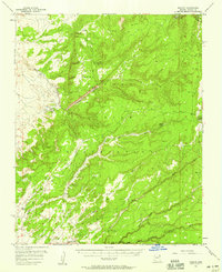 1955 Nazlini1959 Print · USGSNazlini and the high plateaus of the Navajo Nation are captured here in the mid-1950s. Genealogists and historians can trace old trails and seasonal watercourses like Lone Tule Wash, or locate remote landmarks such as Fluted Rock and Segetoa Spring.2 unique versions available
 - 1958 Map of Gallup
 1958 Gallup1958 Print · USGSThe high desert of Western New Mexico and Eastern Arizona is captured here in the late fifties, dominated by the Navajo and Zuni homelands. Researchers can trace the path of US 66 through Gallup or locate historic industry at the Navajo Coal Mine and Gibson Coal Mine.
 - 1959 Map of Gallup
 1959 Gallup1959 Print · USGSThe high desert corridor of northwestern New Mexico and eastern Arizona comes alive in the late fifties, following the path of Route 66 and the rail lines. Trace established landmarks like Zuni Pueblo, the Fort Wingate Military Reservation, and the Coolidge Post Office.
 - 1962 Map of Gallup
 1962 Gallup1962 Print · USGSThe high plateau and mountains surrounding Gallup in the early sixties reveal a landscape defined by tribal lands, coal mining, and the rail corridor. Researchers can locate remote trading posts, the Gibson Coal Mine, and the historic Window Rock capital.
 - 1967 Map of Gallup
 1967 Gallup1967 Print · USGSThe high desert of New Mexico and Arizona comes into focus in the mid-1960s, centered on the railroad and ranching hub of Gallup. Genealogists and historians can trace routes through Zuni Pueblo, identify old rail stops like Houck, or locate the Aqua Fria Post Office.
 - 1983 Map of Nazlini
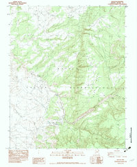 1983 Nazlini1983 Print · USGSThe community of Nazlini in the early 1980s is documented here as a center of tribal life on the Navajo Indian Reservation. Genealogists and historians can locate the Chapter House, the local Boarding Sch, and several ancient Ruins along the banks of Nazlini Creek.
 - 1984 Map of Ganado
 1984 Ganado1984 Print · USGSThe Navajo Nation in the mid-eighties reveals a landscape of high mesas and vital community hubs across Apache County. Trace the development of Fort Defiance and Window Rock, or locate historic landmarks like Hubbell Trading Post and Kinlichee Boarding School.2 unique versions available
End of results
Showing maps 1-9 of 9
Top cities near Nazlini
- Shiprock Agency historical maps
- Chinle Agency historical maps
- Fort Defiance Agency historical maps
- Ganado historical maps
- Burnside historical maps
Frequently asked questions
- What are the different types of historical maps available for Nazlini?
- What is the oldest map of Nazlini?
- Where can I purchase historical maps of Nazlini for my home or office?
- Where can I download high-res historical maps of Nazlini?
- Are there historical topographic maps available for Nazlini?
- Is there historical aerial imagery available for Nazlini?
- Where are historical maps of Nazlini sourced from?