1950s Maps of Douglas, Arizona
Explore 6 historic maps of Douglas from the 1950s. These maps offer a rare glimpse into what life looked like during the 1950s — showing old roads, neighborhoods, homes, and landmarks that have changed or disappeared over time.
Whether you're researching your family's past, planning a metal detecting trip, or studying how Douglas's landscape evolved across the 1950s, these high-resolution maps are a powerful tool for exploring the history of this region.
- Focus on a specific era: All maps on this page are from the 1950s, giving you a focused view of this time period.
- See what’s changed: Compare century-old streets, trails, and buildings to today's modern landscape using overlays and satellite layers.
- Research with precision: Use these maps for genealogy, historical research, land use analysis, or educational projects.
- View, download, or print: Maps are fully viewable online in high resolution, and can be downloaded or printed for your own records.
Start exploring Douglas's history through authentic maps from the 1950s. This is your window into the past.
Douglas, AZ maps
(6)- 1955 Map of Douglas
 1955 Douglas1955 Print · USGSThe Arizona and New Mexico borderlands come into focus in the mid-1950s, highlighting the mining and ranching hubs of the Desert Southwest. Genealogists and historians can trace the foundations of Bisbee, the operations at Hachita Mine, and rural landmarks like the Double Adobe School.2 unique versions available
 - 1958 Map of College Peaks, 1959 Print
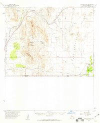 1958 College Peaks1959 Print · USGSSoutheast Arizona's high desert borderlands are captured here in the late fifties, showing a landscape defined by cattle ranching and rugged mountain passes. Genealogists and historians can trace family-named water sources like Steel Woods Windmill and landmarks along the historic Geronimo Trail.3 unique versions available
 - 1958 Map of Douglas, 1959 Print
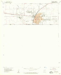 1958 Douglas1959 Print · USGSThe Arizona-Mexico border comes alive in the 1950s, showing a bustling desert city shaped by smelting and transcontinental rail. Researchers can trace the industrial footprint of the Copper Queen Smelter and locate family sites at Calvary Cemetery or the High School.4 unique versions available
 - 1958 Map of Douglas, 1959 Print
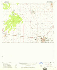 1958 Douglas1959 Print · USGSThe Arizona-Mexico border landscape comes alive in this late 1950s survey of the Sulphur Springs Valley during a peak era for the copper industry. Genealogists and historians can trace the foundations of Pirtleville, the massive Copper Queen Smelter, and family sites like Stewart Ranch.2 unique versions available
 - 1958 Map of Douglas NE, 1959 Print
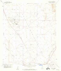 1958 Douglas NE1959 Print · USGSCochise County ranching and aviation come into focus in the late fifties as the regional economy centers on the border. Genealogists and historians can trace family properties like Stewart Ranch and Watson Ranch or the infrastructure of the Southern Pacific railroad.2 unique versions available
 - 1959 Map of Douglas, 1968 Print
 1959 Douglas1968 Print · USGSSoutheast Arizona and southwest New Mexico meet at the border in the late fifties, showcasing a high-desert landscape defined by industrial copper mining and ranching. Genealogists and historians can trace the foundations of Bisbee, locate the Lavender Pit, and follow the Southern Pacific line through Douglas.4 unique versions available
End of results
Showing maps 1-6 of 6
Top cities near Douglas
Frequently asked questions
- What are the different types of historical maps available for Douglas?
- What is the oldest map of Douglas?
- Where can I purchase historical maps of Douglas for my home or office?
- Where can I download high-res historical maps of Douglas?
- Are there historical topographic maps available for Douglas?
- Is there historical aerial imagery available for Douglas?
- Where are historical maps of Douglas sourced from?