Old Maps of Estrella, Arizona for Genealogy
Trace your family roots with 13 historic maps of Estrella. These high-res maps reveal old neighborhoods, homesites, landmarks, and streets — helping you uncover where your ancestors lived and how the area evolved over time.
- Explore historic neighborhoods: Identify where your relatives may have lived in the 1800s or 1900s.
- Compare maps over time: Trace the changes in streets, buildings, and landmarks for multi-generational research.
- Perfect for genealogy & ancestry research: Used by family historians and researchers to map out lineage and migration.
These maps are an incredible resource for exploring your personal connection to Estrella's past.
Estrella, AZ maps
(13)- 1951 Map of Mobile
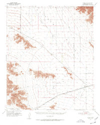 1951 Mobile1951 Print · USGSRainbow Valley and the surrounding desert peaks are captured here in the early 1950s, showing a landscape shaped by rail and stage routes. You can trace the historic Butterfield Stage Line and locate small rail sidings like Mobile and Estrella.3 unique versions available
 - 1954 Map of Phoenix, 1964 Print
 1954 Phoenix1964 Print · USGSMid-century Arizona is captured here as the Phoenix metropolitan area begins its rapid expansion into the surrounding desert. Genealogists and historians can trace the development of agricultural hubs like Buckeye and Tolleson, or locate remote landmarks like the Vulture Mine and Nottbusch Cem.5 unique versions available
 - 1957 Map of Phoenix
 1957 Phoenix1957 Print · USGSGreater Phoenix and the central Arizona desert during the mid-fifties reveal a landscape of growing suburbs and active desert mines. Researchers can trace the legacy of local landmarks like Wickenburg Prison, the Vulture Mine, and the Tonopah Post Office.
 - 1958 Map of Phoenix
 1958 Phoenix1958 Print · USGSThe Phoenix Valley enters a period of postwar expansion, where desert irrigation meets massive military aviation footprints. Trace the development of Phoenix and Glendale alongside the legendary Vulture Mine and the auxiliary runways of Luke Air Force Base.
 - 1960 Map of Phoenix
 1960 Phoenix1960 Print · USGSCentral Arizona in the mid-fifties reveals a landscape of rapid suburban growth alongside enduring desert mining and ranching. Genealogists and historians can trace rail-side settlements like Vicksburg Junction and Waddell, or locate the Vulture Mine and early sites like Agua Fria School.
 - 1969 Map of Phoenix, 1970 Print
 1969 Phoenix1970 Print · USGSCentral Arizona is seen at a technological turning point in the late sixties, using Apollo 9 space photography to map the desert landscape. Researchers can trace the growth of Sun City, locate old workings at Vulture Mine, and follow the Gila River past Buckeye.2 unique versions available
 - 1971 Map of Phoenix
 1971 Phoenix1971 Print · USGSCentral Arizona at the start of the seventies shows a desert metropolis expanding toward the Sun Valley retirement boom. Trace the growth of Sun City and Glendale, or locate remote historic sites like the Vulture Gold Mine and Nottbusch Cemetery.
 - 1973 Map of Butterfield Pass, 1976 Print
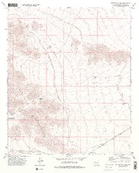 1973 Butterfield Pass1976 Print · USGSThe Maricopa Mountains in the early 1970s reveal a landscape defined by historic transit and desert survival. Trace the path of the Butterfield Stage Route through Butterfield Pass and locate rail stops at Shawmut and Estrella.2 unique versions available
 - 1981 Map of Phoenix South
 1981 Phoenix South1981 Print · USGSThe desert south of Phoenix in the early eighties shows a unique mix of tribal lands, military outposts, and agricultural growth. Genealogists and historians can trace settlements like Ak Chin and Valencia or locate the Buckeye Copper Mine and Luke Aux Field No 6.2 unique versions available
 - 2011 Map of Butterfield Pass, 2011 Print
 2011 Butterfield Pass2011 Print · USGSCovers Estrella, including Maricopa County, United States, and other nearby areas
 - 2014 Map of Butterfield Pass, 2014 Print
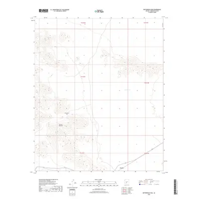
 2014 Butterfield Pass2014 Print · USGSCovers Estrella, including Maricopa County, United States, and other nearby areas
 - 2018 Map of Butterfield Pass, 2018 Print
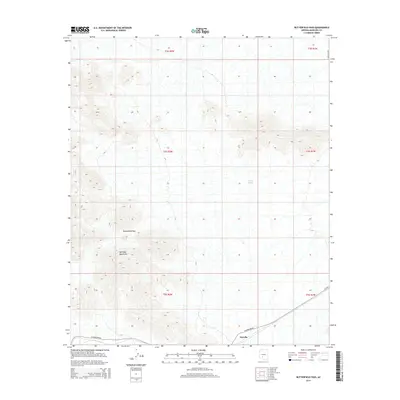
 2018 Butterfield Pass2018 Print · USGSCovers Estrella, including Maricopa County, United States, and other nearby areas
 - 2021 Map of Butterfield Pass, 2021 Print
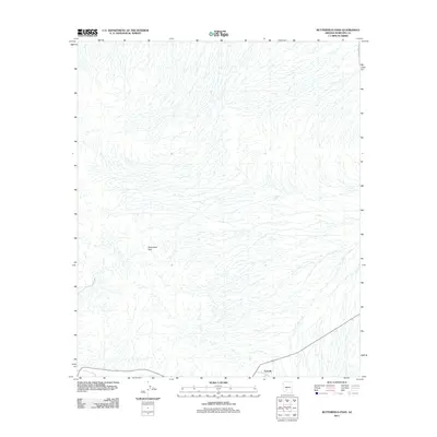
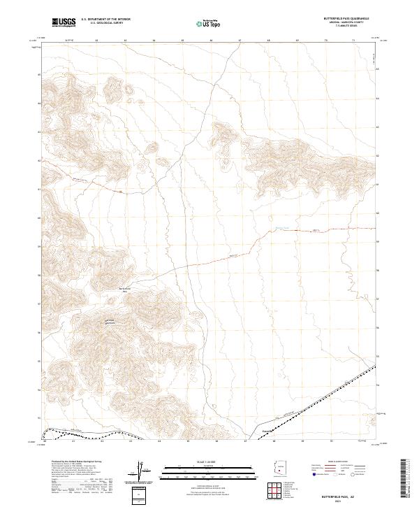 2021 Butterfield Pass2021 Print · USGSThe Maricopa Mountains define this part of the Sonoran desert during the early twenty-first century. Researchers can trace the path through Butterfield Pass, locate the settlement of Estrella, and follow remote routes like Margies Cove Trl.
End of results
Showing maps 1-13 of 13
Top cities near Estrella
Frequently asked questions
- What are the different types of historical maps available for Estrella?
- What is the oldest map of Estrella?
- Where can I purchase historical maps of Estrella for my home or office?
- Where can I download high-res historical maps of Estrella?
- Are there historical topographic maps available for Estrella?
- Is there historical aerial imagery available for Estrella?
- Where are historical maps of Estrella sourced from?