1960s Maps of Paradise Valley, Arizona
Explore 6 historic maps of Paradise Valley from the 1960s. These maps offer a rare glimpse into what life looked like during the 1960s — showing old roads, neighborhoods, homes, and landmarks that have changed or disappeared over time.
Whether you're researching your family's past, planning a metal detecting trip, or studying how Paradise Valley's landscape evolved across the 1960s, these high-resolution maps are a powerful tool for exploring the history of this region.
- Focus on a specific era: All maps on this page are from the 1960s, giving you a focused view of this time period.
- See what’s changed: Compare century-old streets, trails, and buildings to today's modern landscape using overlays and satellite layers.
- Research with precision: Use these maps for genealogy, historical research, land use analysis, or educational projects.
- View, download, or print: Maps are fully viewable online in high resolution, and can be downloaded or printed for your own records.
Start exploring Paradise Valley's history through authentic maps from the 1960s. This is your window into the past.
Paradise Valley, AZ maps
(6)- 1960 Map of Mesa
 1960 Mesa1960 Print · USGSThe Salt River Valley and Superstition wilderness are captured here during a era of rapid post-war growth. Researchers can trace the mid-century footprints of Williams AF Base and Arizona State College or locate the deep-rock shafts of the Old Dominion Mine and Magma Mine.
 - 1960 Map of Phoenix
 1960 Phoenix1960 Print · USGSCentral Arizona in the mid-fifties reveals a landscape of rapid suburban growth alongside enduring desert mining and ranching. Genealogists and historians can trace rail-side settlements like Vicksburg Junction and Waddell, or locate the Vulture Mine and early sites like Agua Fria School.
 - 1964 Map of Mesa
 1964 Mesa1964 Print · USGSCentral Arizona in the mid-1960s reveals a landscape defined by rapid desert urbanization and a massive copper mining industry. Genealogists and historians can trace the growth of Phoenix or explore the mining camps and operations at Miami Mine and Magma Mine.
 - 1965 Map of Paradise Valley, 1966 Print
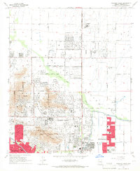 1965 Paradise Valley1966 Print · USGSParadise Valley and Scottsdale were rapidly evolving desert communities in the mid-1960s. Genealogists and local historians can trace the early suburban footprint through landmarks like Thunderbird Academy, Camelback Cem, and the Judson Sch.4 unique versions available
 - 1965 Map of Sunnyslope, 1967 Print
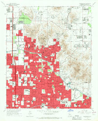 1965 Sunnyslope1967 Print · USGSPhoenix and the Sunnyslope area are shown in the mid-sixties as suburban neighborhoods rapidly expanded toward the desert mountains. Trace local history at the Chris-Town Mall, the Arizona Canal, and numerous schools like Sunnyslope High Sch.4 unique versions available
 - 1969 Map of Phoenix, 1970 Print
 1969 Phoenix1970 Print · USGSCentral Arizona is seen at a technological turning point in the late sixties, using Apollo 9 space photography to map the desert landscape. Researchers can trace the growth of Sun City, locate old workings at Vulture Mine, and follow the Gila River past Buckeye.2 unique versions available
End of results
Showing maps 1-6 of 6
Top cities near Paradise Valley
- Phoenix historical maps
- Mesa historical maps
- Chandler historical maps
- Glendale historical maps
- Scottsdale historical maps
- Gilbert historical maps
See more
Top neighborhoods of Paradise Valley
- Paradise Valley historical maps
- Clearview Hills historical maps
- Camelback Estates IV historical maps
- Cinco Soles historical maps
Frequently asked questions
- What are the different types of historical maps available for Paradise Valley?
- What is the oldest map of Paradise Valley?
- Where can I purchase historical maps of Paradise Valley for my home or office?
- Where can I download high-res historical maps of Paradise Valley?
- Are there historical topographic maps available for Paradise Valley?
- Is there historical aerial imagery available for Paradise Valley?
- Where are historical maps of Paradise Valley sourced from?