1950s Maps of Kaibab, Arizona
Explore 19 historic maps of Kaibab from the 1950s. These maps offer a rare glimpse into what life looked like during the 1950s — showing old roads, neighborhoods, homes, and landmarks that have changed or disappeared over time.
Whether you're researching your family's past, planning a metal detecting trip, or studying how Kaibab's landscape evolved across the 1950s, these high-resolution maps are a powerful tool for exploring the history of this region.
- Focus on a specific era: All maps on this page are from the 1950s, giving you a focused view of this time period.
- See what’s changed: Compare century-old streets, trails, and buildings to today's modern landscape using overlays and satellite layers.
- Research with precision: Use these maps for genealogy, historical research, land use analysis, or educational projects.
- View, download, or print: Maps are fully viewable online in high resolution, and can be downloaded or printed for your own records.
Start exploring Kaibab's history through authentic maps from the 1950s. This is your window into the past.
Kaibab, AZ maps
(19)- 1953 Map of Cedar City, 1966 Print
 1953 Cedar City1966 Print · USGSSouthwestern Utah's high plateaus and desert basins are mapped here during the mid-fifties, showing the region before the modern interstate system. Researchers can trace historic mining at Silver Reef, follow the Union Pacific line, and locate early settlements like Kanarraville and Toquerville.3 unique versions available
 - 1953 Map of Grand Canyon, 1967 Print
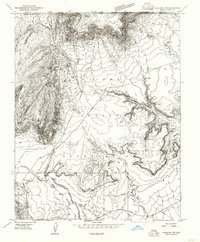
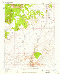
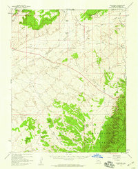
 1953 Grand Canyon1967 Print · USGSArizona's northern frontier is captured here in the mid-twentieth century, from the high plateaus to the desert basins. Trace early routes like Arizona 67, explore the isolated Moccasin settlement, or locate early landmarks such as Mount Trumbull.3 unique versions available
 - 1954 Map of Kanab SW, 1956 Print
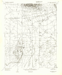
 1954 Kanab SW1956 Print · USGSThe Utah-Arizona borderlands in the mid-1950s reveal a landscape of isolated springs and deep drainages. Researchers can trace the rugged terrain of Yellowjacket Canyon and locate remote water sources like Sand Spring and Harris Springs.
 - 1954 Map of Fredonia NW, 1956 Print
 1954 Fredonia NW1956 Print · USGSThe Kaibab Indian Reservation along the Arizona-Utah border is captured here in the mid-fifties, showing a landscape of remote ranching outposts. Researchers can trace the infrastructure of the desert west through the settlement at Moccasin, the Twomile Corrals, and vital water sources like Pine Spring.
 - 1954 Map of Kanab SE, 1956 Print
 1954 Kanab SE1956 Print · USGSThe Utah-Arizona borderlands come into focus during the mid-fifties, centered on the settlement of Kanab and the northern edge of the Kaibab Indian Reservation. Researchers can locate a Cem, the local Landing Strip, and ancient Cliff Dwellings tucked into the surrounding canyons.
 - 1954 Map of Shinarump NW, 1956 Print
 1954 Shinarump NW1956 Print · USGSArizona's Coconino County meets the Utah line in the mid-1950s, revealing a landscape of high plateaus and remote cattle operations. Researchers can trace the layout of Buttons Ranch, locate an Abandoned Airstrip, and follow the path of the Winter Road.
 - 1954 Map of Short Creek SE, 1956 Print
 1954 Short Creek SE1956 Print · USGSMohave County’s Arizona Strip was a landscape of remote ranching and tribal lands during the mid-fifties. Researchers can trace the early infrastructure of the Kaibab Indian Reservation and locate water sources like Moonshine Spring and Rouch Well.
 - 1954 Map of Fredonia SW, 1956 Print
 1954 Fredonia SW1956 Print · USGSThe Arizona Strip in the mid-fifties remains a world of remote springs and reservation land. You can trace the path of the Mt Trumbull Road past Scotts Hole or explore the early boundaries of Pipe Spring National Monument.
 - 1954 Map of Fredonia NE, 1958 Print
 1954 Fredonia NE1958 Print · USGSThe Arizona-Utah borderlands come alive in the mid-fifties, showing the intersection of tribal lands and desert ranching. Genealogists and historians can trace the settlement of Fredonia, early aviation via the Abandoned Airstrip, and vital water sources like Sixmile Spring.
 - 1954 Map of Fredonia, 1959 Print
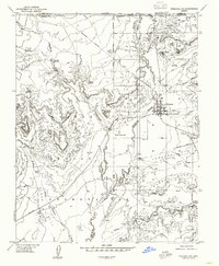
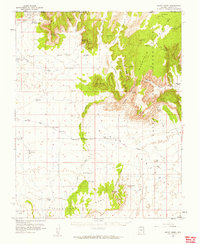
 1954 Fredonia1959 Print · USGSIn the mid-1950s, the Arizona Strip near the Utah border centered on the town of Fredonia and the sprawling Kaibab Indian Reservation. Researchers can locate vital water sources like Bitter Seeps or trace the desert floor past landmarks such as Steamboat Rock and the Pipe Spring National Monument.3 unique versions available
 - 1954 Map of Short Creek, 1959 Print
 1954 Short Creek1959 Print · USGSArizona’s high desert borderlands are mapped here in the mid-1950s, showing the early layouts of remote Mormon and tribal settlements. Genealogists and historians can locate early family-named sites like Esplins Corral, Moccasin, and the Cemetery at Short Creek.2 unique versions available
 - 1956 Map of Springdale SE
 1956 Springdale SE1956 Print · USGSThe high desert border between Utah and Arizona was surveyed in the early fifties, capturing a landscape defined by vital water sources. Researchers can trace the placement of Pine Spring, Elephant Cove, and the northern boundary of the Kaibab Indian Reservation.
 - 1956 Map of Short Creek NE
 1956 Short Creek NE1956 Print · USGSThe Arizona-Utah borderlands within the Kaibab Indian Reservation appear here in the mid-fifties. Researchers can trace the water infrastructure of the era through sites like Bee Cistern and the settlement at Moccasin below the Vermilion Cliffs.
 - 1957 Map of Grand Canyon
 1957 Grand Canyon1957 Print · USGSNorthern Arizona in the mid-fifties presents a sparsely settled expanse of high plateaus and ranching outposts surrounding the great canyon. Genealogists and historians can trace family land at Diamond Butte Ranch, locate the Moccasin settlement, or study the magnesium works at Black Diamond Mine.
 - 1957 Map of Shinarump SW, 1958 Print
 1957 Shinarump SW1958 Print · USGSCoconino County was a frontier of cattle ranching and open-range navigation during the mid-fifties. You can trace the path of Ryan Road past cattle reservoirs and prominent local landmarks like Cedar Knoll and White Sage Flat.
 - 1957 Map of Shinarump, 1959 Print
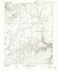
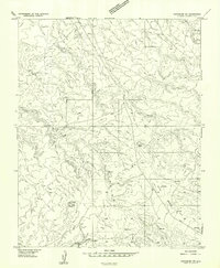
 1957 Shinarump1959 Print · USGSNorthern Arizona's high ranching country comes to life in this mid-century survey of the Coconino plateau. Researchers can trace remote homesteads like Buttons Ranch and Chatterly Ranch or locate the old Landing Strip and Ryan settlement.2 unique versions available
 - 1957 Map of Kanab, 1960 Print
 1957 Kanab1960 Print · USGSSouthern Utah during the mid-fifties shows a landscape of deep canyons and high desert mesas on the edge of the Arizona border. Genealogists and historians can trace the early layout of Kanab and Mt Carmel, alongside remote sites like a Cliff Dwelling and the Foot Ranch.2 unique versions available
 - 1958 Map of Grand Canyon
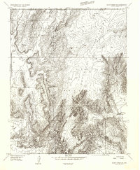
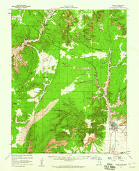
 1958 Grand Canyon1958 Print · USGSNorthern Arizona in the late fifties was a landscape of remote cattle ranches and timber operations spanning from the Virgin Mountains to the Kaibab Forest. Researchers can locate family outposts like Bundy Ranch, trace the Temple Trail, or find the Parashant Lumber Mill.
 - 1958 Map of Cedar City
 1958 Cedar City1958 Print · USGSSouthwestern Utah in the late fifties was a land of mineral extraction and monumental landscapes. Genealogists and historians can trace pioneer-era settlements like Grafton and Parowan alongside industrial sites such as the Silver Reef Mine.2 unique versions available
End of results
Showing maps 1-19 of 19
Top cities near Kaibab
Top neighborhoods of Kaibab
Frequently asked questions
- What are the different types of historical maps available for Kaibab?
- What is the oldest map of Kaibab?
- Where can I purchase historical maps of Kaibab for my home or office?
- Where can I download high-res historical maps of Kaibab?
- Are there historical topographic maps available for Kaibab?
- Is there historical aerial imagery available for Kaibab?
- Where are historical maps of Kaibab sourced from?