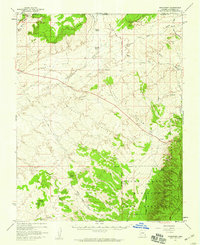
1957 Map of Shinarump
USGS Topo · Published 1959About this map
Buttons Ranch and Chatterly Ranch anchor the northern landscape of this 1950s survey, marking a period of active ranching along the Gila and Salt River Meridian. The terrain is defined by the dramatic ascent of the Shinarump Cliffs and the deep incisions of Wildcat Canyon and Canyon De L'Eau. To the south, the boundary of the Kaibab National Forest meets the Game Preserve Boundary, preserving a rugged environment where Cedar Knoll and Little Cedar Knoll stand as prominent landmarks. This map captures the region's mid-century utility, evidenced by the Landing Strip near the western edge and a network of unimproved tracks like Winter Road and Ryan Road. The transition from the high mesas toward the northern rim of the Grand Canyon is visible through the drainage patterns of Johnson Wash and Seaman Wash.
Find a feature on this map
32 named features on this map. Tap any name to fly to it.
Don’t see what you’re looking for? This feature index may not catch every label — zoom into the map to look around manually.
Map Details
Editions of this 1957 Shinarump Map
2 editions found
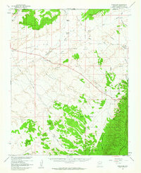
Other maps of this area

1886 · Kanab
USGS Topo · 1:250,000

1886 · Kaibab
USGS Topo · 1:250,000

1936 · Jacobs Lake
USGS Topo · 1:48,000

1940 · Jacob Lake
USGS Topo · 1:62,500

1953 · Jacobs Lake
USGS Topo · 1:62,500

1953 · Cedar City
USGS Topo · 1:250,000

1953 · Grand Canyon
USGS Topo · 1:250,000

1954 · Buckskin Gulch SW
USGS Topo · 1:24,000

1954 · Johnson SE
USGS Topo · 1:24,000

1954 · Kanab SE
USGS Topo · 1:24,000