
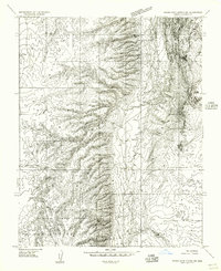
1954 Map of Buckskin Gulch SW
USGS Topo · Published 1954About this map
The Utah-Arizona borderland in Kane County appears here during a period of active ranching and cattle grazing across the high desert. Two primary homesteads, the Hoda Ranch and School Section Ranch, serve as the only human outposts in a landscape defined by seasonal watercourses like Petrified Hollow Wash and Telegraph Wash. The reliance on local hydrology is evident in the numerous Stock Ponds scattered throughout the territory to support livestock.
Find a feature on this map
11 named features on this map. Tap any name to fly to it.
Don’t see what you’re looking for? This feature index may not catch every label — zoom into the map to look around manually.
Map Details
Editions of this 1954 Buckskin Gulch SW Map
This is the sole edition of this map. No revisions or reprints were ever made.
Other maps of this area

1886 · Kanab
USGS Topo · 1:250,000

1886 · Kaibab
USGS Topo · 1:250,000

1953 · Cedar City
USGS Topo · 1:250,000

1953 · Grand Canyon
USGS Topo · 1:250,000

1954 · Buckskin Gulch NW
USGS Topo · 1:24,000

1954 · Buckskin Gulch NE
USGS Topo · 1:24,000

1954 · Buckskin Gulch SE
USGS Topo · 1:24,000

1954 · Johnson SE
USGS Topo · 1:24,000
1954 · House Rock Spring NE
USGS Topo · 1:24,000

1954 · Johnson NE
USGS Topo · 1:24,000