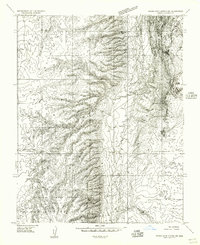
1954 Map of House Rock Spring NE
USGS Topo · Published 1956About this map
The dramatic escarpment of the Vermilion Cliffs dominates this 1950s survey, marking a stark geological boundary between the high Paria Plateau and the lower basin to the west. This mid-century landscape is defined by the logistics of ranching and early motor travel, evidenced by the Old Arizona Road and the specialized Winter Road navigating the contours of the plateau. Within the boundaries of the Grand Canyon National Game Preserve and Kaibab National Forest, water management is the primary marker of human activity. Rare water sources like Coyote Spring and a designated Stock Pond along Coyote Wash illustrate the critical infrastructure required for livestock in this arid environment before modern development reached the more remote corners of Coconino County.
Find a feature on this map
14 named features on this map. Tap any name to fly to it.
Don’t see what you’re looking for? This feature index may not catch every label — zoom into the map to look around manually.
Map Details
Editions of this 1954 House Rock Spring NE Map
This is the sole edition of this map. No revisions or reprints were ever made.
Other maps of this area

1886 · Kanab
USGS Topo · 1:250,000

1886 · Escalante
USGS Topo · 1:250,000

1886 · Echo Cliffs
USGS Topo · 1:250,000

1886 · Kaibab
USGS Topo · 1:250,000

1891 · Echo Cliffs
USGS Topo · 1:250,000

1953 · Cedar City
USGS Topo · 1:250,000

1953 · Grand Canyon
USGS Topo · 1:250,000

1954 · Buckskin Gulch SE
USGS Topo · 1:24,000

1954 · Buckskin Gulch SW
USGS Topo · 1:24,000

1954 · Paria Plateau NW
USGS Topo · 1:24,000