Old Maps of Lake Havasu City, Arizona for Hiking & Exploration
Hike through history with 50 historic maps of Lake Havasu City. Explore old trails, ghost towns, and forgotten backroads — perfect for outdoor adventurers and local explorers.
- Rediscover forgotten places: Map out old mining camps, roads, and footpaths that no longer exist on modern maps.
- Layer with modern tools: Combine with LiDAR or satellite views to plan hikes through historical terrain.
- Made for exploration: Popular among hikers, overlanders, and local history lovers.
Use these maps to find adventure and explore the hidden past of Lake Havasu City.
Lake Havasu City, AZ maps
(50)- 1903 Map of Needles, 1960 Print
 1903 Needles1960 Print · USGSThe Colorado River borderlands in the early 1900s centered on the critical rail crossing at Needles. Genealogists and historians can trace early railroad sidings like Khatoum and Beal or the old Parker Road through the Chemehuevi Valley.
 - 1904 Map of Needles Special
 1904 Needles Special1904 Print · USGSThe Lower Colorado River region at the start of the twentieth century was a vital corridor for western rail expansion and river navigation. Genealogists and historians can trace the rail sidings of the Atchison Topeka and Santa Fe RR and early settlements like Mellen, Franconia, and Needles.7 unique versions available
 - 1911 Map of Parker
 1911 Parker1911 Print · USGSThe Arizona-California borderlands are captured here in the early twentieth century as the river and rail networks began to transform the desert. Researchers can trace the development of the Colorado River Indian Reservation, the rail hub at Parker, and early mining sites like the Billy Mack Mine.3 unique versions available
 - 1927 Map of Buck Mountains, 1966 Print
 1927 Buck Mountains1966 Print · USGSMohave County was a land of early highways and remote mining claims during the late 1920s. Trace the path of the National Old Trails Highway and locate mineral operations like the Palo Verde Mine and Arizona-Yucca Mine.
 - 1929 Map of Buck Mountains
 1929 Buck Mountains1929 Print · USGSMohave County’s desert mining and transit networks are documented here during the late twenties. Genealogists and historians can trace routes along the National Old Trails Highway or locate the Palo Verde Mine and Arizona-Yucca Mine.2 unique versions available
 - 1943 Map of Giers Basin
 1943 Giers Basin1943 Print · USGSThe Colorado River borderlands come into focus during the early years of the war, when this area served as a military maneuver zone. Researchers can locate desert water sources like Mohave Spring and Screwbean Spring or trace the early footprint of Parker Dam.
 - 1943 Map of Topock
 1943 Topock1943 Print · USGSThe Arizona-California borderlands are captured here during World War II, just as the landscape was being reshaped by the waters of the Colorado. Researchers can trace the original rail line through Topock and locate desert sidings like Franconia and Powell along the Sacramento Wash.
 - 1943 Map of Whipple Mts.
 1943 Whipple Mts.1943 Print · USGSThe Colorado River borderlands come into focus during the early years of the Second World War. Researchers can trace historic river access points and desert water sources like Liverpool Landing, Pittsburg Flat, and Whipple Well.
 - 1950 Map of Topock, 1957 Print
 1950 Topock1957 Print · USGSThe Colorado River borderlands in the early postwar era show a desert landscape being reshaped by infrastructure and conservation. Genealogists and historians can trace the rail corridor through Franconia and locate remote mining sites like the Gold Dome Mine or the Jackpot Mine.3 unique versions available
 - 1950 Map of Whipple Mts, 1958 Print
 1950 Whipple Mts1958 Print · USGSThe Colorado River and Whipple Mountains define this mid-century desert borderland between California and Arizona. Researchers can trace remote mining history and early lakefront settlements through landmarks like Needles Boat Landing, Roulette Mine, and Chambers Well.3 unique versions available
 - 1951 Map of Topock
 1951 Topock1951 Print · USGSThe Colorado River valley and Mohave Mountains are captured here in the early fifties, showing a landscape defined by desert mining and river life. Trace the path of the National Old Trails Road and locate remote sites like Jackpot Mine or Jops Landing.2 unique versions available
 - 1952 Map of Whipple Mts
 1952 Whipple Mts1952 Print · USGSThe Lower Colorado River borderlands are captured here in the early fifties as desert mining gave way to new shoreline developments. You can trace the locations of numerous historic prospects like the Roulette Mine and Islander Mine, alongside early river landings such as Needles Boat Landing.
 - 1954 Map of Needles
 1954 Needles1954 Print · USGSThe Mojave Desert at the height of the mid-century era shows a landscape defined by the Atchison Topeka and Santa Fe railroad and the legendary U S Highway 66. Genealogists and historians can trace rail stops like Goffs, mining sites such as the Bonanza King Mine, and the early borders of the Chemehuevi Indian Reservation.
 - 1956 Map of Needles
 1956 Needles1956 Print · USGSThe Mojave Desert and Colorado River come alive in the mid-fifties, showing the intersection of vital rail lines and massive water projects. Trace the Atchison Topeka and Santa Fe line through Amboy or locate remote sites like the Copper World Mine and Rio Vista Guest Ranch.7 unique versions available
 - 1959 Map of Parker Dam, 1960 Print
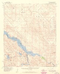 1959 Parker Dam1960 Print · USGSThe Lower Colorado River is captured here in the late fifties as a hub of massive water infrastructure and remote desert mining. Trace the complex engineering of Parker Dam, locate the historic Kohen Ranch, or find early mining sites like the Manitowoc Mine.3 unique versions available
 - 1959 Map of Standard Wash, 1960 Print
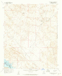 1959 Standard Wash1960 Print · USGSThe Mohave County desert meets the Colorado River in the late 1950s, documenting a landscape of mining and boundary lines. Metal detectorists and historians can locate the Manitowoc Mine, El Campo Mine, and the Chemehuevi Indian Res Bdy.3 unique versions available
 - 1970 Map of Havasu Lake, 1973 Print
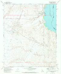 1970 Havasu Lake1973 Print · USGSThe Chemehuevi Indian Reservation meets the shoreline of Lake Havasu in the early 1970s. Researchers can locate the early layout of the Havasu Lake settlement, including Needles Ldg and various Jeep Trails heading into the Chemehuevi Valley.3 unique versions available
 - 1970 Map of Lake Havasu City South, 1973 Print
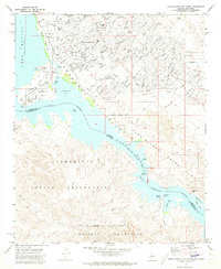 1970 Lake Havasu City South1973 Print · USGSArizona's desert landscape meets the rising waters of the Colorado River during the early 1970s expansion of Lake Havasu City. Genealogists and local historians can trace the early suburban footprint near Thompson Bay and locate landmarks like the Roulette Mine and Lake Havasu City Airport.3 unique versions available
 - 1970 Map of Crossman Peak, 1973 Print
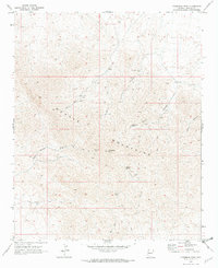 1970 Crossman Peak1973 Print · USGSThe Mohave Mountains are shown during a period of active mineral prospecting in the early seventies, accessible only by a web of primitive tracks. Researchers can trace the locations of the Sunrise Mine, Pittsburg Mine, and remote water sources like Cottonwood Spring.4 unique versions available
 - 1970 Map of Castle Rock, 1973 Print
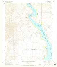 1970 Castle Rock1973 Print · USGSThe Colorado River and its transformation into Lake Havasu define this desert landscape during the early 1970s. Trace the intersection of tribal land and federal refuge while locating Picture Rock Petroglyphs, Jops Harbor, and the Chemehuevi Landing Field.2 unique versions available
 - 1970 Map of Lake Havasu City North, 1973 Print
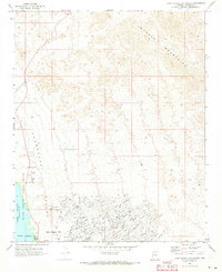 1970 Lake Havasu City North1973 Print · USGSLake Havasu City is shown in its primary stage of expansion during the early seventies, with its distinctive street grid pushing into the desert. You can trace the development of neighborhood tracts like Havasupai or locate early landmarks such as the Wing Mine and the Radio Facility.4 unique versions available
 - 1981 Map of Needles, 1987 Print
 1981 Needles1987 Print · USGSThe High Desert and Colorado River valley are seen here in the early 1980s through the unique lens of satellite imagery. Trace the isolated outposts of the AT & SF railroad at Goffs and Essex, or explore the sprawling shores of Lake Havasu.
 - 1985 Map of Parker
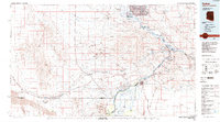 1985 Parker1985 Print · USGSThe Colorado River valley in the mid-eighties was a hub of desert transit, mining, and water management. Researchers can trace the path of the Atchison Topeka and Santa Fe railroad through Vidal Junction and locate numerous historic diggings like the Gold Hill Mine or Billy Mack Mine.2 unique versions available
 - 1985 Map of Needles
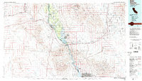 1985 Needles1985 Print · USGSThe Colorado River borderlands in the mid-1980s show a region shaped by major infrastructure and desert transit. Genealogists and historians can trace the path of U S 66 and the Atchison Topeka and Santa Fe through settlements like Needles, Goffs, and Topock.
 - 1994 Map of Lake Havasu City South, 1997 Print
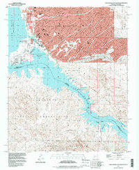 1994 Lake Havasu City South1997 Print · USGSLake Havasu City enters a period of modern expansion in the mid-nineties, centering on the relocated London Bridge and the developing waterfront. Genealogists and researchers can trace the city's growth alongside older desert landmarks like the Roulette Mine and the Lake Havasu City Airport (Abandoned).
Showing maps 1-25 of 50
Top cities near Lake Havasu City
Frequently asked questions
- What are the different types of historical maps available for Lake Havasu City?
- What is the oldest map of Lake Havasu City?
- Where can I purchase historical maps of Lake Havasu City for my home or office?
- Where can I download high-res historical maps of Lake Havasu City?
- Are there historical topographic maps available for Lake Havasu City?
- Is there historical aerial imagery available for Lake Havasu City?
- Where are historical maps of Lake Havasu City sourced from?