Old Maps of Lake Havasu City, Arizona
Explore 25 old maps of Lake Havasu City, spanning from 1903 to today. These high-resolution historic maps reveal how streets, neighborhoods, landmarks, and natural features evolved over time — perfect for genealogy, metal detecting, research, and local history exploration.
What you can do with these maps:
- See how Lake Havasu City changed over time: Compare historical maps to modern-day views to trace roads, homesites, rail lines & more.
- View detailed metadata: Each map includes creators, publishers, year, scale, and archive source.
- Overlay maps with satellite & LiDAR: Visualize the past alongside modern tools to explore terrain & human change.
- Trusted historical sources: Maps sourced from the USGS, Library of Congress, and other archives.
- Access maps your way: View online, download high-res files, or order prints for personal or research use.
Start exploring old maps of Lake Havasu City to uncover forgotten places, hidden landmarks, and the deep history beneath your feet.
Lake Havasu City, AZ maps
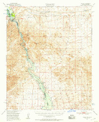
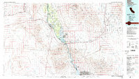
(25)- 1903 Map of Needles, 1960 Print
 1903 Needles1960 Print · USGSCovers Lake Havasu City, including Needles, Desert Hills, and other nearby areas
 - 1904 Map of Needles Special
 1904 Needles Special1904 Print · USGSCovers Lake Havasu City, including Needles, Desert Hills, and other nearby areas7 unique versions available
 - 1911 Map of Parker
 1911 Parker1911 Print · USGSCovers Lake Havasu City, including Parker, Parker, and other nearby areas3 unique versions available
 - 1927 Map of Buck Mountains, 1966 Print
 1927 Buck Mountains1966 Print · USGSCovers Lake Havasu City, including Mohave County, United States, and other nearby areas
 - 1929 Map of Buck Mountains
 1929 Buck Mountains1929 Print · USGSCovers Lake Havasu City, including Mohave County, United States, and other nearby areas2 unique versions available
 - 1943 Map of Giers Basin
 1943 Giers Basin1943 Print · USGSCovers Lake Havasu City, including Parker Strip, Black Meadow Landing, and other nearby areas
 - 1943 Map of Topock
 1943 Topock1943 Print · USGSCovers Lake Havasu City, including Desert Hills, Topock, and other nearby areas
 - 1943 Map of Whipple Mts.
 1943 Whipple Mts.1943 Print · USGSCovers Lake Havasu City, including Copper Canyone, Havasu Lake, and other nearby areas
 - 1950 Map of Topock, 1957 Print
 1950 Topock1957 Print · USGSCovers Lake Havasu City, including Desert Hills, Topock, and other nearby areas3 unique versions available
 - 1950 Map of Whipple Mts, 1958 Print
 1950 Whipple Mts1958 Print · USGSCovers Lake Havasu City, including Copper Canyone, Havasu Lake, and other nearby areas3 unique versions available
 - 1951 Map of Topock
 1951 Topock1951 Print · USGSCovers Lake Havasu City, including Desert Hills, Topock, and other nearby areas2 unique versions available
 - 1952 Map of Whipple Mts
 1952 Whipple Mts1952 Print · USGSCovers Lake Havasu City, including Copper Canyone, Havasu Lake, and other nearby areas
 - 1954 Map of Needles
 1954 Needles1954 Print · USGSCovers Lake Havasu City, including Twentynine Palms, Needles, and other nearby areas
 - 1956 Map of Needles
 1956 Needles1956 Print · USGSCovers Lake Havasu City, including Twentynine Palms, Needles, and other nearby areas7 unique versions available
 - 1959 Map of Parker Dam, 1960 Print
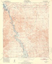
 1959 Parker Dam1960 Print · USGSCovers Lake Havasu City, including Parker Strip, Black Meadow Landing, and other nearby areas3 unique versions available
 - 1959 Map of Standard Wash, 1960 Print
 1959 Standard Wash1960 Print · USGSCovers Lake Havasu City, including San Bernardino County, Mohave County, and other nearby areas3 unique versions available
 - 1970 Map of Havasu Lake, 1973 Print
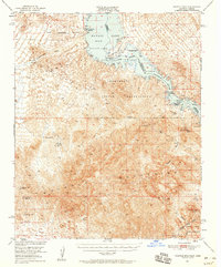
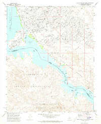
 1970 Havasu Lake1973 Print · USGSCovers Lake Havasu City, including Havasu Lake, San Bernardino County, and other nearby areas3 unique versions available
 - 1970 Map of Lake Havasu City South, 1973 Print
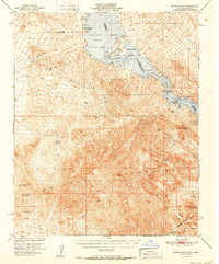
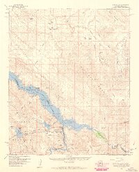
 1970 Lake Havasu City South1973 Print · USGSCovers Lake Havasu City, including Copper Canyone, Havasu Palms, and other nearby areas3 unique versions available
 - 1970 Map of Crossman Peak, 1973 Print
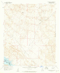
 1970 Crossman Peak1973 Print · USGSCovers Lake Havasu City, including Mohave County, United States, and other nearby areas4 unique versions available
 - 1970 Map of Castle Rock, 1973 Print
 1970 Castle Rock1973 Print · USGSCovers Lake Havasu City, including San Bernardino County, Mohave County, and other nearby areas2 unique versions available
 - 1970 Map of Lake Havasu City North, 1973 Print
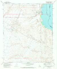
 1970 Lake Havasu City North1973 Print · USGSCovers Lake Havasu City, including Desert Hills, Mohave County, and other nearby areas4 unique versions available
 - 1981 Map of Needles, 1987 Print
 1981 Needles1987 Print · USGSCovers Lake Havasu City, including Twentynine Palms, Needles, and other nearby areas
 - 1985 Map of Parker
 1985 Parker1985 Print · USGSCovers Lake Havasu City, including Parker, Parker, and other nearby areas2 unique versions available
 - 1985 Map of Needles
 1985 Needles1985 Print · USGSCovers Lake Havasu City, including Needles, Desert Hills, and other nearby areas
 - 1994 Map of Lake Havasu City South, 1997 Print
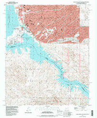 1994 Lake Havasu City South1997 Print · USGSCovers Lake Havasu City, including Copper Canyone, Havasu Palms, and other nearby areas
End of results
Showing maps 1-25 of 25
Top cities near Lake Havasu City
Frequently asked questions
- What are the different types of historical maps available for Lake Havasu City?
- What is the oldest map of Lake Havasu City?
- Where can I purchase historical maps of Lake Havasu City for my home or office?
- Where can I download high-res historical maps of Lake Havasu City?
- Are there historical topographic maps available for Lake Havasu City?
- Is there historical aerial imagery available for Lake Havasu City?
- Where are historical maps of Lake Havasu City sourced from?