Old Maps of Littlefield, Arizona for Academic Research
Study the evolution of Littlefield with 13 high-resolution historic maps. Whether you're teaching, researching, or modeling changes in land use, these maps provide essential visual documentation of urban, environmental, and geographic change.
- Analyze long-term change: Track patterns in development, transportation, and natural features.
- Ideal for environmental or urban studies: Support academic projects with primary historical map data.
- Use in the classroom or lab: Educators and researchers rely on these maps to bring historical context to life.
These maps are a powerful tool for teaching, research, and visualizing how Littlefield has changed over the decades.
Littlefield, AZ maps
(13)- 1886 Map of Mt. Trumbull
 1886 Mt. Trumbull1886 Print · USGSMohave County in the late nineteenth century was a territory of extreme verticality and scarce water. Historians can trace early routes through the Arizona Strip via vital water stops like Pierce Ferry, Witches Pool, and Pakoon Spring.
 - 1892 Map of Mt. Trumbull
 1892 Mt. Trumbull1892 Print · USGSNorthwestern Arizona in the late nineteenth century was a frontier of isolated springs and massive plateaus. You can trace early routes across the Colorado River at Pierce Ferry and locate vital water at Pakoon Spring or Witch Pool.6 unique versions available
 - 1953 Map of Grand Canyon, 1967 Print
 1953 Grand Canyon1967 Print · USGSArizona's northern frontier is captured here in the mid-twentieth century, from the high plateaus to the desert basins. Trace early routes like Arizona 67, explore the isolated Moccasin settlement, or locate early landmarks such as Mount Trumbull.3 unique versions available
 - 1954 Map of Littlefield, 1959 Print
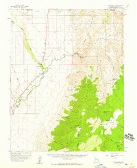 1954 Littlefield1959 Print · USGSNorthwestern Arizona's desert river valley is captured here in the mid-fifties, showing the vital watering holes and ranching outposts along the Virgin River. Local historians can locate the Littlefield and Beaver Dam settlements, the local Cem, and remote landmarks like Mormon Well.2 unique versions available
 - 1957 Map of Grand Canyon
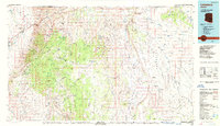
 1957 Grand Canyon1957 Print · USGSNorthern Arizona in the mid-fifties presents a sparsely settled expanse of high plateaus and ranching outposts surrounding the great canyon. Genealogists and historians can trace family land at Diamond Butte Ranch, locate the Moccasin settlement, or study the magnesium works at Black Diamond Mine.
 - 1958 Map of Grand Canyon
 1958 Grand Canyon1958 Print · USGSNorthern Arizona in the late fifties was a landscape of remote cattle ranches and timber operations spanning from the Virgin Mountains to the Kaibab Forest. Researchers can locate family outposts like Bundy Ranch, trace the Temple Trail, or find the Parashant Lumber Mill.
 - 1960 Map of Grand Canyon
 1960 Grand Canyon1960 Print · USGSThe Arizona strip and the Colorado River corridor appear in the 1950s as a vast network of isolated plateaus and remote outposts. Researchers can trace historic ranching and tribal lands including Supai, the Kaibab Indian Reservation, and the Mt Trumbull Post Office.
 - 1985 Map of Littlefield
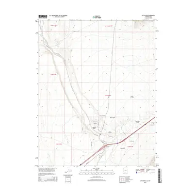
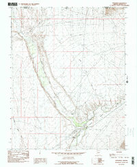 1985 Littlefield1985 Print · USGSThe Virgin River corridor in the 1980s comes to life on this map, documenting the desert settlements of Littlefield and Beaver Dam. Genealogists and researchers can trace local water infrastructure like the Virgin Ditch and natural landmarks including Castle Cliff.2 unique versions available
 - 1987 Map of Littlefield, 1988 Print
 1987 Littlefield1988 Print · USGSNorthwestern Arizona’s high desert comes into focus in the late eighties, showing the remote ranching and mining country along the Utah border. Researchers can trace the path of the Virgin River and locate vital water sites like Wolf Hole Lake, Mormon Well, and the Hidden Mines.2 unique versions available
 - 2011 Map of Littlefield, 2011 Print
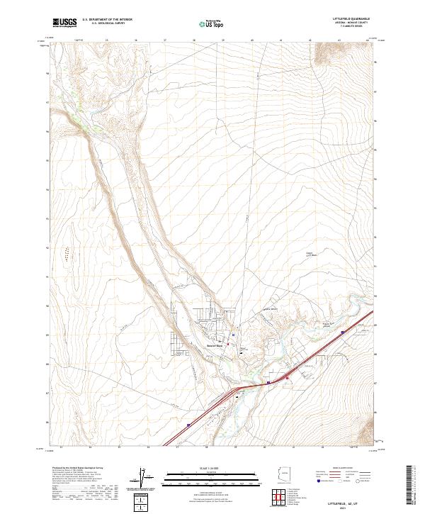
 2011 Littlefield2011 Print · USGSCovers Littlefield, including Desert Springs, Beaver Dam, and other nearby areas2 unique versions available
 - 2014 Map of Littlefield, 2014 Print
 2014 Littlefield2014 Print · USGSCovers Littlefield, including Desert Springs, Beaver Dam, and other nearby areas
 - 2018 Map of Littlefield, 2018 Print
 2018 Littlefield2018 Print · USGSCovers Littlefield, including Desert Springs, Beaver Dam, and other nearby areas
 - 2021 Map of Littlefield, 2021 Print
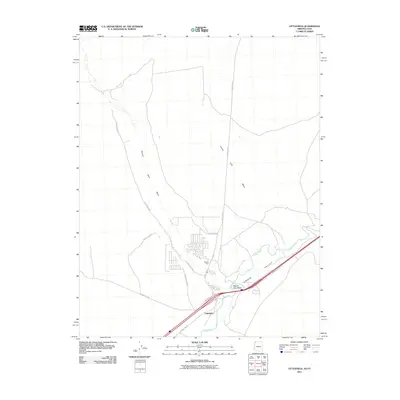
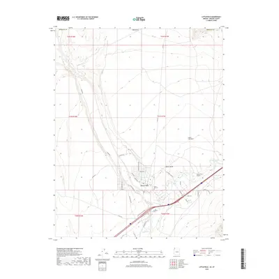
 2021 Littlefield2021 Print · USGSThe Virgin River valley in Mohave County is captured here in the early twenty-first century as a desert oasis shaped by ancient trails and modern transit. Genealogy researchers can locate the Beaver Dam Cem and Littlefield Cem near the river's edge.
End of results
Showing maps 1-13 of 13
Top cities near Littlefield
Frequently asked questions
- What are the different types of historical maps available for Littlefield?
- What is the oldest map of Littlefield?
- Where can I purchase historical maps of Littlefield for my home or office?
- Where can I download high-res historical maps of Littlefield?
- Are there historical topographic maps available for Littlefield?
- Is there historical aerial imagery available for Littlefield?
- Where are historical maps of Littlefield sourced from?