2020s Maps of Kayenta, Arizona
Explore 2 historic maps of Kayenta from the 2020s. These maps offer a rare glimpse into what life looked like during the 2020s — showing old roads, neighborhoods, homes, and landmarks that have changed or disappeared over time.
Whether you're researching your family's past, planning a metal detecting trip, or studying how Kayenta's landscape evolved across the 2020s, these high-resolution maps are a powerful tool for exploring the history of this region.
- Focus on a specific era: All maps on this page are from the 2020s, giving you a focused view of this time period.
- See what’s changed: Compare century-old streets, trails, and buildings to today's modern landscape using overlays and satellite layers.
- Research with precision: Use these maps for genealogy, historical research, land use analysis, or educational projects.
- View, download, or print: Maps are fully viewable online in high resolution, and can be downloaded or printed for your own records.
Start exploring Kayenta's history through authentic maps from the 2020s. This is your window into the past.
Kayenta, AZ maps
(2)- 2021 Map of Kayenta East, 2021 Print
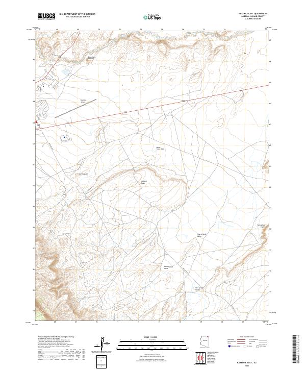 2021 Kayenta East2021 Print · USGSNavajo County's high desert landscape is documented here in the early twenty-first century, showing the intersection of major routes and traditional landmarks. Trace the terrain from Kayenta Airport to features like Black Rock Standing and Church Rock Valley.
 - 2021 Map of Kayenta West, 2021 Print
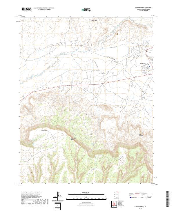 2021 Kayenta West2021 Print · USGSKayenta and the surrounding Navajo Nation lands are shown here as they appeared in the early 2020s. Genealogists and desert historians can trace the local road network and vital water sources like Little Shonto Spring and Laguna Creek beneath the heights of Tyende Mesa.
End of results
Showing maps 1-2 of 2
Top cities near Kayenta
Frequently asked questions
- What are the different types of historical maps available for Kayenta?
- What is the oldest map of Kayenta?
- Where can I purchase historical maps of Kayenta for my home or office?
- Where can I download high-res historical maps of Kayenta?
- Are there historical topographic maps available for Kayenta?
- Is there historical aerial imagery available for Kayenta?
- Where are historical maps of Kayenta sourced from?