1990s Maps of Gu Achi District, Arizona
Explore 22 historic maps of Gu Achi District from the 1990s. These maps offer a rare glimpse into what life looked like during the 1990s — showing old roads, neighborhoods, homes, and landmarks that have changed or disappeared over time.
Whether you're researching your family's past, planning a metal detecting trip, or studying how Gu Achi District's landscape evolved across the 1990s, these high-resolution maps are a powerful tool for exploring the history of this region.
- Focus on a specific era: All maps on this page are from the 1990s, giving you a focused view of this time period.
- See what’s changed: Compare century-old streets, trails, and buildings to today's modern landscape using overlays and satellite layers.
- Research with precision: Use these maps for genealogy, historical research, land use analysis, or educational projects.
- View, download, or print: Maps are fully viewable online in high resolution, and can be downloaded or printed for your own records.
Start exploring Gu Achi District's history through authentic maps from the 1990s. This is your window into the past.
Gu Achi District, AZ maps
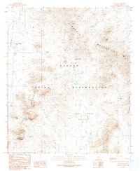
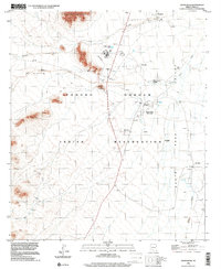
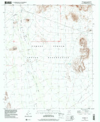
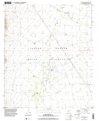
(22)- 1990 Map of Window Mountain
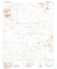 1990 Window Mountain1990 Print · USGSThe Papago Indian Reservation in Pima County is captured here in the late twentieth century, showing a desert landscape of deep valleys and isolated peaks. Researchers can identify cultural locations like Oit Ihuk (Site) and geographical landmarks like Window Mountain and its Natural Arch.
 - 1990 Map of Santa Rosa
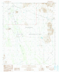
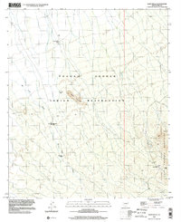
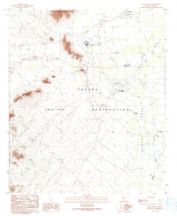 1990 Santa Rosa1990 Print · USGSThe Tohono O'odham landscape of the late twentieth century is preserved here, centered on the Papago Indian Reservation. Researchers can trace tribal infrastructure and cultural landmarks like the Childrens Shrine, Santa Rosa Trading Post, and Ak Chin.
 - 1990 Map of Gurli Put Vo
 1990 Gurli Put Vo1990 Print · USGSThe Pima County desert landscape in the late 1980s reveals a quiet network of wells and mining prospects within the Papago Indian Reservation. Researchers can trace local history through the Quijotoa Trading Post, the Cem, and sites like Gurli Put Vo.
 - 1990 Map of Maish Vaya
 1990 Maish Vaya1990 Print · USGSThe Papago Indian Reservation and its desert ranges are captured in the late twentieth century, showing a remote landscape of mining and O'odham settlements. Trace 4WD trails to Stoa Vaya, Maish Vaya, and mining sites like the Black Prince Mine.
 - 1990 Map of Vainom Kug
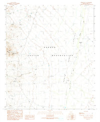
 1990 Vainom Kug1990 Print · USGSThe Sonoran desert landscape of the Papago Indian Reservation is captured here in the late twentieth century. Genealogists and desert researchers can trace remote sites like Vainom Kug, the Old Quijotoa Well (Dry), and the archaeological Kui Tatk (Site).
 - 1990 Map of Ventana
 1990 Ventana1990 Print · USGSThe Papago Indian Reservation in southern Arizona is depicted here in the late twentieth century, centered on the settlement of Ventana. Researchers can locate mining sites like the Isabella Mine and distinctive cultural landmarks such as Ventana Cave and a local Cemetery.
 - 1990 Map of Vaya Chin, 1991 Print
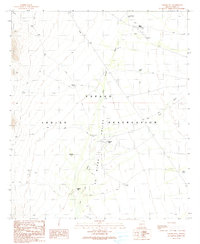
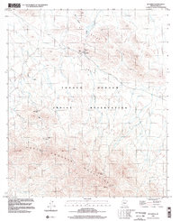
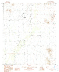 1990 Vaya Chin1991 Print · USGSThe Papago Indian Reservation in the early nineties reveals a landscape of desert survival and meticulous water management. Researchers can trace the layout of Vaya Chin, find the local Cem, and locate ranching infrastructure like the Corral and numerous Check Dams.
 - 1990 Map of Hickiwan, 1991 Print
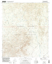
 1990 Hickiwan1991 Print · USGSThe settlement of Hickiwan is captured here during the late twentieth century, showing the life and landscape of the Papago Indian Reservation. Researchers can trace the desert water systems and mineral exploration at Mine Shafts Adit Prospect or along the Hickiwan Wash.
 - 1994 Map of Silver Bell Mountains
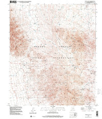
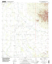
 1994 Silver Bell Mountains1994 Print · USGSSouthern Arizona in the mid-nineties shows a land of transition between desert wilderness, tribal lands, and the growing Tucson suburbs. Genealogists and historians can trace settlements like San Luis and Ko Vaya, or follow the industrial legacy of the Silver Bell Mine.2 unique versions available
 - 1996 Map of Window Mountain, 2001 Print
 1996 Window Mountain2001 Print · USGSThe high desert of the Tohono O'odham nation is recorded here during the late twentieth century. Researchers can locate archaeological points like Oit Ihuk (Site) and geological landmarks such as Window Mountain and its Natural Arch.
 - 1996 Map of Santa Rosa, 2001 Print
 1996 Santa Rosa2001 Print · USGSThe Tohono O'odham Reservation in the mid-1990s reveals a desert landscape organized around the Santa Rosa Wash and the Sheridan Mountains. Genealogists and historians can trace community landmarks like the Santa Rosa School, the Childrens Shrine, and the Santa Rosa Trading Post.
 - 1996 Map of Vaya Chin, 2001 Print
 1996 Vaya Chin2001 Print · USGSIn the late nineties, the Tohono O'odham Indian Reservation maintained a quiet ranching presence in the Arizona desert. Genealogists and researchers can trace local landmarks like Vaya Chin, the nearby Cem, and isolated desert outposts such as Window Mountain Well.
 - 1996 Map of Gurli Put Vo, 2001 Print
 1996 Gurli Put Vo2001 Print · USGSThe Tohono O'odham desert landscape is captured here in the late twentieth century, showing the remote reaches of Pima County. Researchers can trace the site of Gurli Put Vo, historical mining at the Prospect V-O Mine, and the Quijotoa Trading Post.
 - 1996 Map of Maish Vaya, 2001 Print
 1996 Maish Vaya2001 Print · USGSThe Tohono O'odham Indian Reservation and the mineral-rich mountains of Pima County are shown here as they appeared in the late nineties. Genealogists and historians can locate remote settlements like Stoa Vaya and trace mining sites from Brownell Peak to Quijotoa.
 - 1996 Map of Hickiwan, 2001 Print
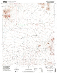
 1996 Hickiwan2001 Print · USGSSet within the Tohono O'odham reservation in the late twentieth century, this map documents a desert landscape where the community of Hickiwan meets the Crooked Mountains. Researchers can trace local landmarks such as the Cemetery, old Mine Shafts, and early survey markers like GLO Sta No 11.
 - 1996 Map of Sil Nakya, 2002 Print
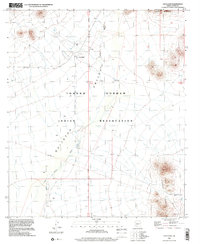
 1996 Sil Nakya2002 Print · USGSThe Tohono O'odham nation at the end of the twentieth century shows a landscape defined by desert wells and mountain passes. Trace the footprint of the St Agatha Mission, find the Sil Nakya cemetery, and locate water sources like Frog Well.
 - 1996 Map of Sand Wells, 2002 Print
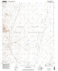
 1996 Sand Wells2002 Print · USGSThe Tohono O'odham Indian Reservation in the late twentieth century is a landscape of desert water management and mountain peaks. Researchers can trace remote desert features like Sand Wells, Standing Bar Tank, and the mineral Prospects in the North Comobabi Mountains.
 - 1996 Map of Comobabi, 2002 Print
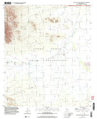
 1996 Comobabi2002 Print · USGSThe Tohono O'odham Reservation in the mid-1990s reveals a landscape of desert peaks and O'odham settlements. Trace family roots and land use near Ko Vaya, the Emperor and Duchess Mine, and the village of Comobabi.
 - 1996 Map of Vainom Kug, 2002 Print
 1996 Vainom Kug2002 Print · USGSThe Tohono O'odham Reservation in the late nineties is a landscape shaped by desert washes and vital water infrastructure. Researchers can trace remote settlements like Vainom Kug and Kaihon Kug, alongside scattered landmarks such as Old Quijotoa Well and Francis Tank.
 - 1996 Map of Santa Rosa Mountains SW, 2003 Print
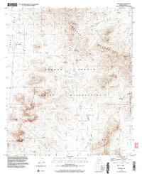
 1996 Santa Rosa Mountains SW2003 Print · USGSThe Tohono O'odham lands of Pima County are captured here in the mid-1990s, where desert washes converge beneath high mountain peaks. Genealogists and researchers can locate the Makgum Havoka (Site) or trace mining activity near Gu Achi Peak and GLO Station 19.
 - 1996 Map of Ventana, 2003 Print
 1996 Ventana2003 Print · USGSThe Tohono O'odham interior of Pima County is captured here in the mid-1990s, showcasing a landscape of desert mining and isolated settlements. Researchers can locate the Isabella Mine, trace the Anegam Wash, and identify the Cem near Ventana.
 - 1996 Map of Santa Rosa Mountains SE, 2003 Print
 1996 Santa Rosa Mountains SE2003 Print · USGSThe Tohono O'odham Nation and the Sonoran desert basins are captured here during the 1990s as modern imagery updated older topographic surveys. Genealogists and desert researchers can trace the locations of Hoi Oidak (Site) and Pipyak (Site) along the banks of Sil Nakya Wash.
End of results
Showing maps 1-22 of 22
Top cities near Gu Achi District
Top neighborhoods of Gu Achi District
- San Luis historical maps
- Ko Vaya historical maps
- Palo Verde Stand historical maps
- Santa Rosa historical maps
- Maish Vaya historical maps
- Narcho Santos historical maps
See more
Frequently asked questions
- What are the different types of historical maps available for Gu Achi District?
- What is the oldest map of Gu Achi District?
- Where can I purchase historical maps of Gu Achi District for my home or office?
- Where can I download high-res historical maps of Gu Achi District?
- Are there historical topographic maps available for Gu Achi District?
- Is there historical aerial imagery available for Gu Achi District?
- Where are historical maps of Gu Achi District sourced from?