1960s Maps of Gu Vo District, Arizona
Explore 8 historic maps of Gu Vo District from the 1960s. These maps offer a rare glimpse into what life looked like during the 1960s — showing old roads, neighborhoods, homes, and landmarks that have changed or disappeared over time.
Whether you're researching your family's past, planning a metal detecting trip, or studying how Gu Vo District's landscape evolved across the 1960s, these high-resolution maps are a powerful tool for exploring the history of this region.
- Focus on a specific era: All maps on this page are from the 1960s, giving you a focused view of this time period.
- See what’s changed: Compare century-old streets, trails, and buildings to today's modern landscape using overlays and satellite layers.
- Research with precision: Use these maps for genealogy, historical research, land use analysis, or educational projects.
- View, download, or print: Maps are fully viewable online in high resolution, and can be downloaded or printed for your own records.
Start exploring Gu Vo District's history through authentic maps from the 1960s. This is your window into the past.
Gu Vo District, AZ maps
(8)- 1962 Map of Ajo
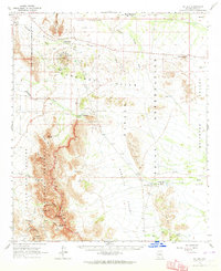
 1962 Ajo1962 Print · USGSSouthern Arizona in the early sixties was a landscape of deep-desert mining, military airfields, and tribal lands. Researchers can trace the Cornelia Mine near Ajo, remote outposts like Trays Trading Post, and the path of the Devils Highway.
 - 1963 Map of Ajo
 1963 Ajo1963 Print · USGSSouthwestern Arizona in the early sixties reveals a landscape of desert ranches and remote mining outposts. Trace the historic Southern Pacific line or locate isolated landmarks like O'Neils Grave and Tracy's Trading Post.
 - 1963 Map of Kom Vo, 1964 Print
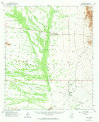
 1963 Kom Vo1964 Print · USGSThe southern border of the Papago Indian Reservation is captured in the early 1960s, showing a land shaped by isolated wells and ancient paths. Genealogists and historians can trace the residents of Kom Vo and Vamori, or locate specific sites like Petroglyphs and Papago Farms.2 unique versions available
 - 1963 Map of Mt. Ajo, 1964 Print
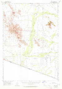
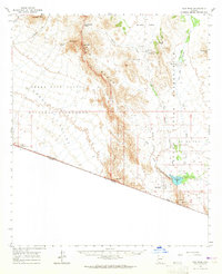
 1963 Mt. Ajo1964 Print · USGSSouthern Arizona in the early sixties reveals a landscape of tribal villages and desert monuments shaped by the Ajo Range. Genealogists and historians can locate remote settlements like Schuchuli and Gu Vo, or trace landmarks like the Surprise Mine and Kerwo Day Sch.2 unique versions available
 - 1963 Map of Pisinimo, 1964 Print
 1963 Pisinimo1964 Print · USGSThe Papago Indian Reservation in the early sixties is captured here as a landscape of desert washes and remote O'odham villages. Genealogists and historians can trace traditional settlements and vital water sources like Pisinimo, Wahak Hotrontk, and Schuk Cowlik.2 unique versions available
 - 1963 Map of Lukeville, 1964 Print
 1963 Lukeville1964 Print · USGSThe Arizona-Mexico borderlands come into focus in this early 1960s survey, detailing the desert infrastructure of the Papago Indian Reservation. Researchers can locate remote sites like the Milton Mine, San Rafael Ruins, and the border crossing at Lukeville.2 unique versions available
 - 1963 Map of Diaz Peak, 1965 Print
 1963 Diaz Peak1965 Print · USGSSouthern Arizona’s borderlands and the tribal lands of the O'odham people are captured in the 1960s. Trace the remote desert outposts and water sources of the era, from the village of Ali Chuk and Menagers Lake to the rugged heights of Diaz Peak.2 unique versions available
 - 1967 Map of Ajo
 1967 Ajo1967 Print · USGSSouthern Arizona in the mid-1960s is depicted here as a landscape of military aviation and deep-desert ranching. Trace the historical mining operations at Vekol Mine or follow the Southern Pacific rail line through Gila Bend and Dateland.
End of results
Showing maps 1-8 of 8
Top neighborhoods of Gu Vo District
- Pia Oik historical maps
- Sweetwater historical maps
- Gu Vo historical maps
- Kuakatch historical maps
- Ali Ak Chin historical maps
- Shaotkam historical maps
See more
Frequently asked questions
- What are the different types of historical maps available for Gu Vo District?
- What is the oldest map of Gu Vo District?
- Where can I purchase historical maps of Gu Vo District for my home or office?
- Where can I download high-res historical maps of Gu Vo District?
- Are there historical topographic maps available for Gu Vo District?
- Is there historical aerial imagery available for Gu Vo District?
- Where are historical maps of Gu Vo District sourced from?