1990s Maps of Gu Vo District, Arizona
Explore 19 historic maps of Gu Vo District from the 1990s. These maps offer a rare glimpse into what life looked like during the 1990s — showing old roads, neighborhoods, homes, and landmarks that have changed or disappeared over time.
Whether you're researching your family's past, planning a metal detecting trip, or studying how Gu Vo District's landscape evolved across the 1990s, these high-resolution maps are a powerful tool for exploring the history of this region.
- Focus on a specific era: All maps on this page are from the 1990s, giving you a focused view of this time period.
- See what’s changed: Compare century-old streets, trails, and buildings to today's modern landscape using overlays and satellite layers.
- Research with precision: Use these maps for genealogy, historical research, land use analysis, or educational projects.
- View, download, or print: Maps are fully viewable online in high resolution, and can be downloaded or printed for your own records.
Start exploring Gu Vo District's history through authentic maps from the 1990s. This is your window into the past.
Gu Vo District, AZ maps
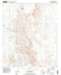
(19)- 1990 Map of Mount Ajo
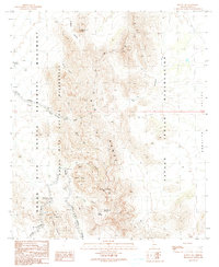 1990 Mount Ajo1990 Print · USGSThe Ajo Range and its desert surroundings are detailed in this 1990 survey of the Arizona-Mexico borderlands. Trace high-elevation features like Mount Ajo and Montezuma Head alongside vital water points such as Diablo Tank and Barajita Well.
 - 1990 Map of West of Wahak Hotrontk
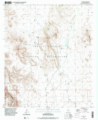
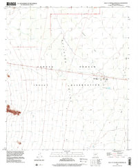
 1990 West of Wahak Hotrontk1990 Print · USGSThe Pima County desert in the 1990s reveals a landscape of communal infrastructure within the Papago Indian Reservation. Local history researchers can trace the water systems of the Quijotoa Valley through landmarks like the San Simon High Sch, Corral, and Check Dams.
 - 1990 Map of West of Pisinimo
 1990 West of Pisinimo1990 Print · USGSIn the Sonoran Desert during the late 1980s, this survey captures the arid expanse of the Quijotoa Valley. Researchers can trace the layout of Schuk Cowlik and locate several Check Dams built to control seasonal water flow.
 - 1990 Map of Hotason Vo
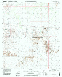
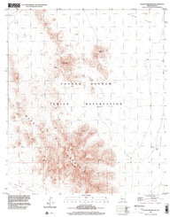
 1990 Hotason Vo1990 Print · USGSIn the Sonoran Desert of the 1990s, this area of the Papago Indian Reservation centers on the local settlements of Hotason Vo and Chagit Vo. Researchers can trace old mining efforts at Little Chief Mine or locate the small cemetery and Check Dams that mark the local landscape.
 - 1990 Map of Gu Vo
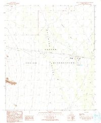
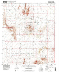
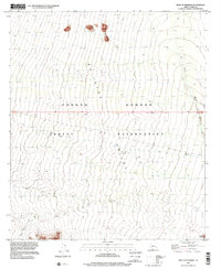
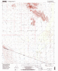
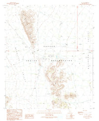 1990 Gu Vo1990 Print · USGSTraditional Tohono O'odham lands are documented here during the late twentieth century, centered on the community at Gu Vo. Genealogists and researchers can trace local landmarks like the Cemetery, Kerwo Well, and the small settlement of Pia south of the hills.
 - 1990 Map of Gunsight
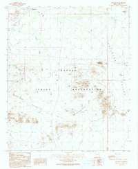
 1990 Gunsight1990 Print · USGSThe Pima County desert landscape in the 1990s reveals a complex intersection of tribal lands and protected wilderness. Researchers can trace historic mining operations like the Surprise Mine, locate the Gunsight Cemetery, and map old water sources like Lewis Well.
 - 1994 Map of Lukeville
 1994 Lukeville1994 Print · USGSThe Arizona-Sonora borderlands come into focus in the mid-nineties, centering on the crossing between Lukeville and Sonoyta. Local historians can trace the scattered settlements of the Tohono O'odham Nation, including Ali Ak Chin and Tatk Kam Vo, alongside the peaks of the Ajo Range.
 - 1996 Map of Gu Vo, 2000 Print
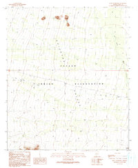
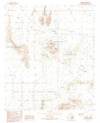
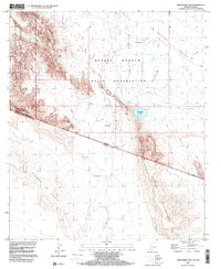
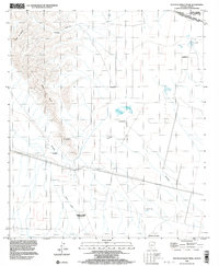
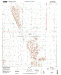 1996 Gu Vo2000 Print · USGSThe Tohono O'odham nation in the mid-nineties is documented here, centered on the Gu Vo Hills and surrounding desert valleys. Local historians can trace the layout of the Gu Vo settlement, locate a Cemetery, and follow the seasonal Gu Vo Wash.
 - 1996 Map of Gunsight, 2000 Print
 1996 Gunsight2000 Print · USGSThe Tohono O'odham nation and the Organ Pipe Cactus wilderness meet here in the late twentieth century. Genealogists and historians can trace mining sites like the Surprise Mine and the community at Schuchuli near the Gunsight Cemetery.
 - 1996 Map of Menagers Lake, 2000 Print
 1996 Menagers Lake2000 Print · USGSThe Arizona-Mexico borderlands come into focus in the mid-nineties, showing the intersection of tribal lands and national monuments. Researchers can trace the desert terrain from Ali Ak Chin to the shores of Menagers Lake and the peaks of Sierra La Nariz.
 - 1996 Map of Pia Oik, 2000 Print
 1996 Pia Oik2000 Print · USGSThe Sonoran desert landscape of Pima County is captured here in the mid-1990s, centering on the tribal lands of the Tohono O'odham Indian Reservation. Genealogists and historians can locate the settlement of Pia Oik and trace former residents at Sweetwater or Siovi Shuatak.
 - 1996 Map of Diaz Peak, 2000 Print
 1996 Diaz Peak2000 Print · USGSThe Ajo Range forms a dramatic desert skyline in the mid-1990s as it marks the border of the Tohono O'odham Indian Reservation. Trace the high-desert terrain through Sweetwater Pass, Siovi Shuatak Pass, and along the Ajo Mountain One Way Drive.
 - 1996 Map of Hotason Vo, 2000 Print
 1996 Hotason Vo2000 Print · USGSWithin the Tohono O'odham Indian Reservation during the late nineties, this map documents a traditional desert landscape centered on community and resource extraction. Trace old mining operations at Little Chief Mine and find the small settlements of Hotason Vo and Chagit Vo.
 - 1996 Map of Mount Ajo, 2000 Print
 1996 Mount Ajo2000 Print · USGSThe high Sonoran Desert of Pima County is captured here in the late twentieth century, showing the boundary between protected monument land and tribal territory. Researchers can locate remote landmarks like Montezumas Head, Bull Pasture Spring, and the high peaks of the Ajo Range.
 - 1996 Map of West of Pisinimo, 2001 Print
 1996 West of Pisinimo2001 Print · USGSThe Tohono O'odham nation at the close of the twentieth century is documented here through the shifting sands of the Quijotoa Valley. Local historians can trace the paths of the San Simon Wash and Gu Vo Wash across the reservation floor.
 - 1996 Map of West of Wahak Hotrontk, 2001 Print
 1996 West of Wahak Hotrontk2001 Print · USGSPima County’s desert landscape within the Tohono O'odham Nation is shown here in the mid-1990s. Researchers can locate remote desert infrastructure such as the San Simon High Sch and water management features like Hickiwan Wash and a local Ditch.
 - 1996 Map of Chupan Mountain, 2002 Print
 1996 Chupan Mountain2002 Print · USGSIn the desert basins of Pima County during the late nineties, the tribal landscape remained centered on its towering peaks and vital water sources. Researchers can trace remote desert routes to Vasquez Well, Stone Tank, and the high summits of Chupan Mountain.
 - 1996 Map of Bailey Peak, 2003 Print
 1996 Bailey Peak2003 Print · USGSThe Arizona-Sonora borderlands come into focus in the mid-nineties, showing the intersection of the Tohono O'odham Indian Reservation and Mexico. Trace the international boundary as it cuts between Bailey Peak and the southern C. El Conejo.
 - 1996 Map of South of Bailey Peak, 2003 Print
 1996 South of Bailey Peak2003 Print · USGSThe Arizona borderlands meet Sonora in the mid-nineties, showing where tribal lands and international boundaries intersect. Researchers can trace remote desert outposts like La Nariz and Cuauhtémoc alongside landmarks like Sierra El Conejo and L. Sucita.
End of results
Showing maps 1-19 of 19
Top neighborhoods of Gu Vo District
- Pia Oik historical maps
- Sweetwater historical maps
- Gu Vo historical maps
- Kuakatch historical maps
- Ali Ak Chin historical maps
- Shaotkam historical maps
See more
Frequently asked questions
- What are the different types of historical maps available for Gu Vo District?
- What is the oldest map of Gu Vo District?
- Where can I purchase historical maps of Gu Vo District for my home or office?
- Where can I download high-res historical maps of Gu Vo District?
- Are there historical topographic maps available for Gu Vo District?
- Is there historical aerial imagery available for Gu Vo District?
- Where are historical maps of Gu Vo District sourced from?