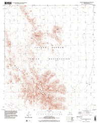
1996 Map of Chupan Mountain
USGS Topo · Published 2002About this map
The Tohono O'odham Indian Reservation landscape is defined by the significant rise of the Mesquite Mountains and the central prominence of Chupan Mountain. This desert terrain shows a distinct pattern of isolated water sources essential for survival in the arid environment, such as Vasquez Well and Stone Tank. These landmarks provided critical stopping points along the unimproved roads and pack trails that cross the desert floor between the high peaks.
Find a feature on this map
11 named features on this map. Tap any name to fly to it.
Don’t see what you’re looking for? This feature index may not catch every label — zoom into the map to look around manually.
Map Details
Editions of this 1996 Chupan Mountain Map
This is the sole edition of this map. No revisions or reprints were ever made.
Other maps of this area

1953 · Ajo
USGS Topo · 1:250,000

1954 · Sonoyta
USGS Topo · 1:250,000

1957 · Ajo
USGS Topo · 1:250,000

1958 · Ajo
USGS Topo · 1:250,000

1962 · Ajo
USGS Topo · 1:250,000

1963 · Ajo
USGS Topo · 1:250,000

1963 · Kom Vo
USGS Topo · 1:62,500

1963 · Mt. Ajo
USGS Topo · 1:62,500

1963 · Pisinimo
USGS Topo · 1:62,500

1963 · Lukeville
USGS Topo · 1:250,000