1980s Maps of Gu Vo District, Arizona
Explore 8 historic maps of Gu Vo District from the 1980s. These maps offer a rare glimpse into what life looked like during the 1980s — showing old roads, neighborhoods, homes, and landmarks that have changed or disappeared over time.
Whether you're researching your family's past, planning a metal detecting trip, or studying how Gu Vo District's landscape evolved across the 1980s, these high-resolution maps are a powerful tool for exploring the history of this region.
- Focus on a specific era: All maps on this page are from the 1980s, giving you a focused view of this time period.
- See what’s changed: Compare century-old streets, trails, and buildings to today's modern landscape using overlays and satellite layers.
- Research with precision: Use these maps for genealogy, historical research, land use analysis, or educational projects.
- View, download, or print: Maps are fully viewable online in high resolution, and can be downloaded or printed for your own records.
Start exploring Gu Vo District's history through authentic maps from the 1980s. This is your window into the past.
Gu Vo District, AZ maps
(8)- 1980 Map of Ajo, 1996 Print
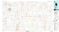 1980 Ajo1996 Print · USGSIn the Sonoran Desert during the early 1980s, mining operations and tribal lands shaped the landscape of Pima County. Researchers can trace the development of Ajo and Why, locate desert outposts like San Simon Well, and identify old workings at the Bluebird Mine.
 - 1982 Map of Ajo
 1982 Ajo1982 Print · USGSThe Arizona-Sonora borderlands come into focus in the early eighties, showcasing a landscape of desert mining towns and expansive tribal lands. Trace the Southern Pacific rail line through Gila Bend or explore the remote settlements of Ajo and Lukeville.
 - 1988 Map of Diaz Peak
 1988 Diaz Peak1988 Print · USGSThe high desert of Pima County comes to life in the late 1980s as conservation lands meet tribal territories. Trace the dramatic topography of the Ajo Range and find remote landmarks like Diaz Spire, Sweetwater Pass, and the Papago Indian Reservation boundary.
 - 1988 Map of South of Bailey Peak
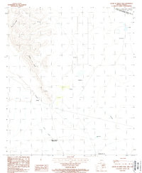 1988 South of Bailey Peak1988 Print · USGSThe Arizona-Sonora borderlands come into focus in the late 1980s, documenting the rugged mountains and cross-border settlements of Pima County. Genealogists and researchers can trace the reach of the Papago Indian Reservation and locate local landmarks like Rancho Lilón and Sonoita.
 - 1988 Map of Bailey Peak
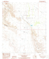
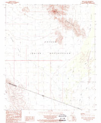 1988 Bailey Peak1988 Print · USGSThe Arizona-Sonora borderlands come into focus in the late 1980s, centered on the Papago Indian Reservation. Trace the high desert terrain from Bailey Peak across The Great Plain to the international boundary at El Conejo.
 - 1988 Map of Pia Oik
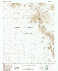
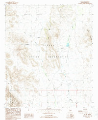 1988 Pia Oik1988 Print · USGSArizona's Sonoran desert landscape comes into focus in the 1980s, revealing the intersection of reservation lands and national monuments. Researchers can trace the footprints of Sweetwater and Siovi Shuatak or locate Adams Well near the base of the Gu Vo Hills.
 - 1988 Map of Chupan Mountain
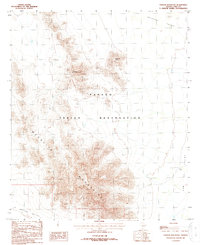 1988 Chupan Mountain1988 Print · USGSSouthern Pima County appears in the late eighties as a landscape of dramatic mountain ranges and desert valleys. Researchers can trace land patterns in the Papago Indian Reservation and locate water sources like Vasquez Well and Mamtotk Peak.
 - 1988 Map of Menagers Lake
 1988 Menagers Lake1988 Print · USGSThe Arizona-Mexico border country is detailed in the late eighties, documenting the remote desert outposts of the Tohono O'odham Nation. Trace the network of check dams and seasonal washes near Ali Chuk, Ali Ak Chin, and the waters of Menagers Lake.
End of results
Showing maps 1-8 of 8
Top neighborhoods of Gu Vo District
- Pia Oik historical maps
- Sweetwater historical maps
- Gu Vo historical maps
- Kuakatch historical maps
- Ali Ak Chin historical maps
- Shaotkam historical maps
See more
Frequently asked questions
- What are the different types of historical maps available for Gu Vo District?
- What is the oldest map of Gu Vo District?
- Where can I purchase historical maps of Gu Vo District for my home or office?
- Where can I download high-res historical maps of Gu Vo District?
- Are there historical topographic maps available for Gu Vo District?
- Is there historical aerial imagery available for Gu Vo District?
- Where are historical maps of Gu Vo District sourced from?