2020s Maps of Gu Vo District, Arizona
Explore 12 historic maps of Gu Vo District from the 2020s. These maps offer a rare glimpse into what life looked like during the 2020s — showing old roads, neighborhoods, homes, and landmarks that have changed or disappeared over time.
Whether you're researching your family's past, planning a metal detecting trip, or studying how Gu Vo District's landscape evolved across the 2020s, these high-resolution maps are a powerful tool for exploring the history of this region.
- Focus on a specific era: All maps on this page are from the 2020s, giving you a focused view of this time period.
- See what’s changed: Compare century-old streets, trails, and buildings to today's modern landscape using overlays and satellite layers.
- Research with precision: Use these maps for genealogy, historical research, land use analysis, or educational projects.
- View, download, or print: Maps are fully viewable online in high resolution, and can be downloaded or printed for your own records.
Start exploring Gu Vo District's history through authentic maps from the 2020s. This is your window into the past.
Gu Vo District, AZ maps
(12)- 2021 Map of South of Bailey Peak, 2021 Print
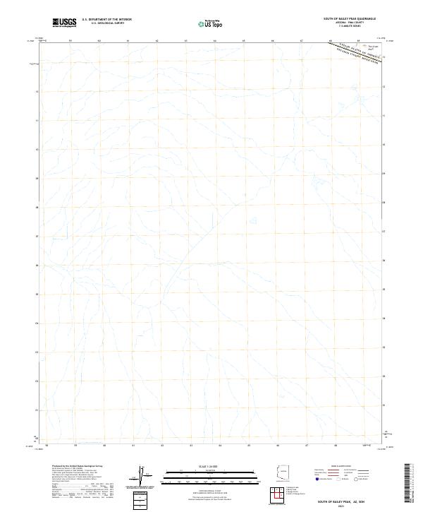 2021 South of Bailey Peak2021 Print · USGSThe international boundary in southern Pima County is captured here during the 2020s, showing the intersection of political borders and desert geography. Historians can trace the line between United States of America and Mexico as it crosses the expanse of The Great Plain.
 - 2021 Map of Chupan Mountain, 2021 Print
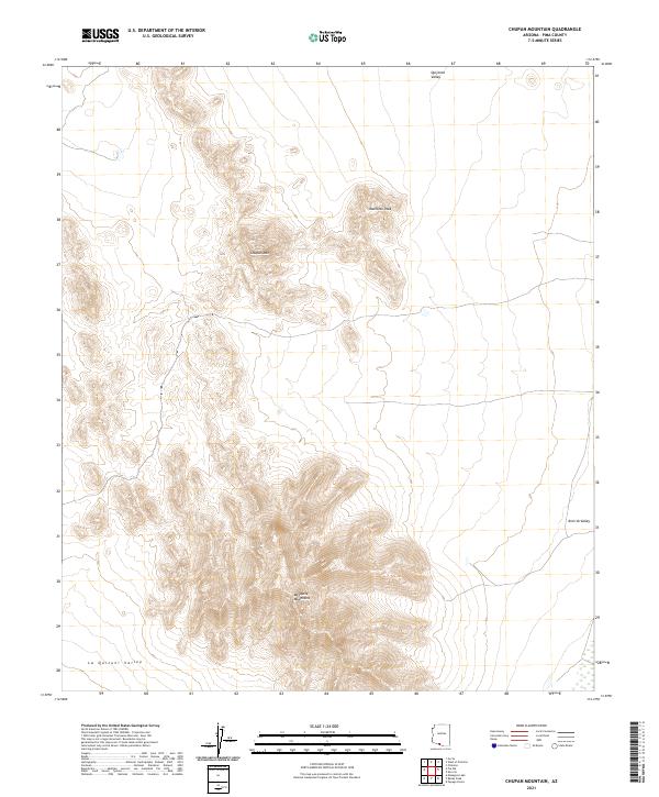 2021 Chupan Mountain2021 Print · USGSSouthern Arizona desert terrain comes into sharp focus during this recent survey of Pima County. Researchers can trace the elevation profiles of Chupan Mtn and Mamtotk Peak as they descend into the La Quituni Valley.
 - 2021 Map of Bailey Peak, 2021 Print
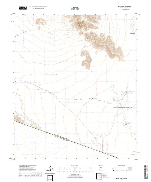 2021 Bailey Peak2021 Print · USGSThe Arizona borderlands at the start of the 2020s are captured here, showing the remote desert terrain where the U.S. meets Mexico. Researchers can trace the drainage of the Chukut Kuk Wash near Shaotkam or study the topography of Bailey Peak and the Mesquite Mountains.
 - 2021 Map of Diaz Peak, 2021 Print
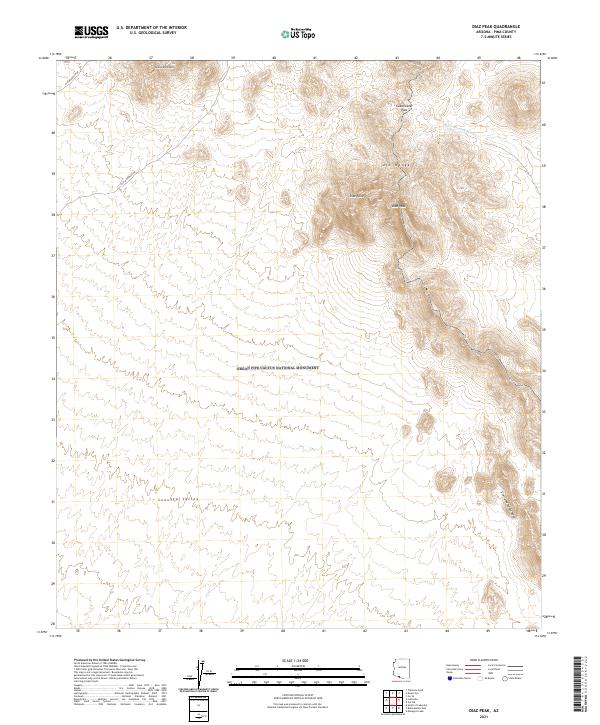 2021 Diaz Peak2021 Print · USGSThe Sonoran Desert landscape within Organ Pipe Cactus National Monument is shown here in the early twenty-first century. Researchers can trace the high ridgelines of the Ajo Range and locate landmarks like Diaz Peak and Sweetwater Pass.
 - 2021 Map of West of Wahak Hotrontk, 2021 Print
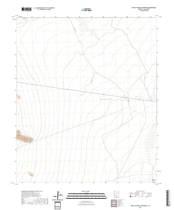 2021 West of Wahak Hotrontk2021 Print · USGSThe Sonoran desert landscape of Pima County appears in high detail in this modern topographic study. Researchers can trace the path of Indian Rte 17 as it crosses the Quijotoa Valley near the seasonal Hickiwan Wash.
 - 2021 Map of Pia Oik, 2021 Print
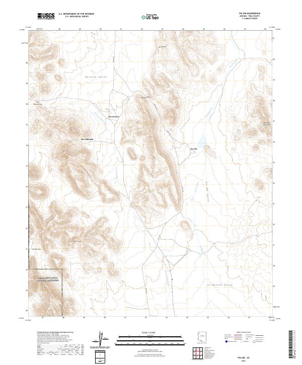 2021 Pia Oik2021 Print · USGSSouthern Arizona’s high desert valleys and mountain ranges appear here in detail just before the 2020s. Researchers can trace the routes through Pia Oik Pass and Ali Wua Pass or locate the settlements at Pia Oik and Sweetwater.
 - 2021 Map of Gunsight, 2021 Print
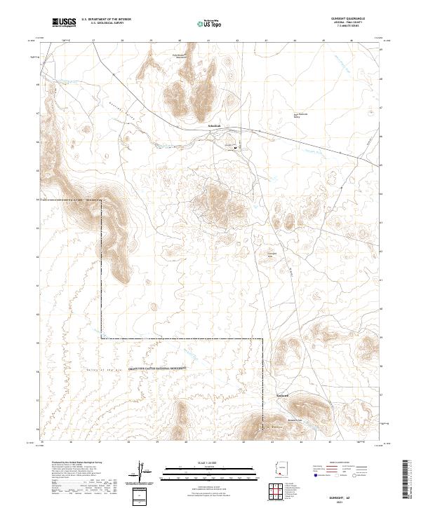 2021 Gunsight2021 Print · USGSModern Pima County desert life meets protected wilderness in this recent survey of the Arizona borderlands. Trace local landmarks like Schuchuli, the Gunsight Cem, and the northern boundaries of Organ Pipe Cactus National Monument.
 - 2021 Map of Menagers Lake, 2021 Print
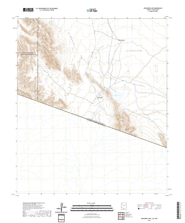 2021 Menagers Lake2021 Print · USGSThe Arizona-Mexico border landscape is documented here in the early twenty-first century. Genealogists and researchers can trace the roads and settlements of Ali Chuk and Ali Ak Chin near Menagers Lake and the Ajo Range.
 - 2021 Map of Gu Vo, 2021 Print
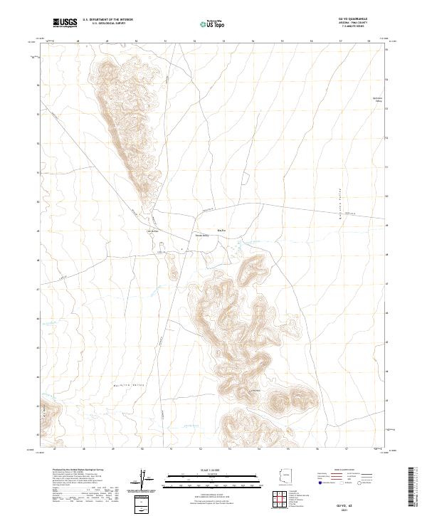 2021 Gu Vo2021 Print · USGSThe settlement of Gu Vo and its surrounding desert valleys are documented here in the early twenty-first century. Researchers can trace the modern road network including Indian Rte 1 and N Well Rd as they pass through the Gu Vo Hills and Ajo Range.
 - 2021 Map of Mount Ajo, 2021 Print
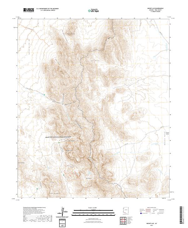 2021 Mount Ajo2021 Print · USGSOrgan Pipe Cactus National Monument is shown here in its modern topographic detail, preserving a landscape of dramatic desert peaks and canyons. Researchers can trace remote desert routes and landmarks like Montezuma Head, the Arch Window, and Bull Pasture Spring.
 - 2021 Map of Hotason Vo, 2021 Print
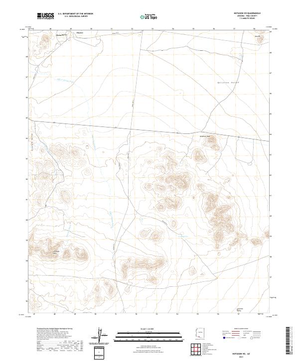 2021 Hotason Vo2021 Print · USGSThe Pima County desert as it appeared in the early 2020s shows a landscape of resilient communities and vast seasonal washes. Genealogists and researchers can trace the roads connecting Hotason Vo, Charco, and the high point of Ninemile Peak.
 - 2021 Map of West of Pisinimo, 2021 Print
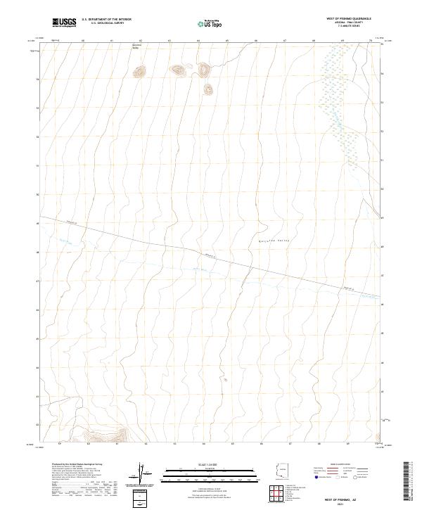 2021 West of Pisinimo2021 Print · USGSThe Pima County desert landscape comes into focus in this recent survey of the Sonoran interior. You can trace the path of Indian Rte 28 as it traverses the Quijotoa Valley and crosses the seasonal drainage of Gu Vo Wash.
End of results
Showing maps 1-12 of 12
Top neighborhoods of Gu Vo District
- Pia Oik historical maps
- Sweetwater historical maps
- Gu Vo historical maps
- Kuakatch historical maps
- Ali Ak Chin historical maps
- Shaotkam historical maps
See more
Frequently asked questions
- What are the different types of historical maps available for Gu Vo District?
- What is the oldest map of Gu Vo District?
- Where can I purchase historical maps of Gu Vo District for my home or office?
- Where can I download high-res historical maps of Gu Vo District?
- Are there historical topographic maps available for Gu Vo District?
- Is there historical aerial imagery available for Gu Vo District?
- Where are historical maps of Gu Vo District sourced from?