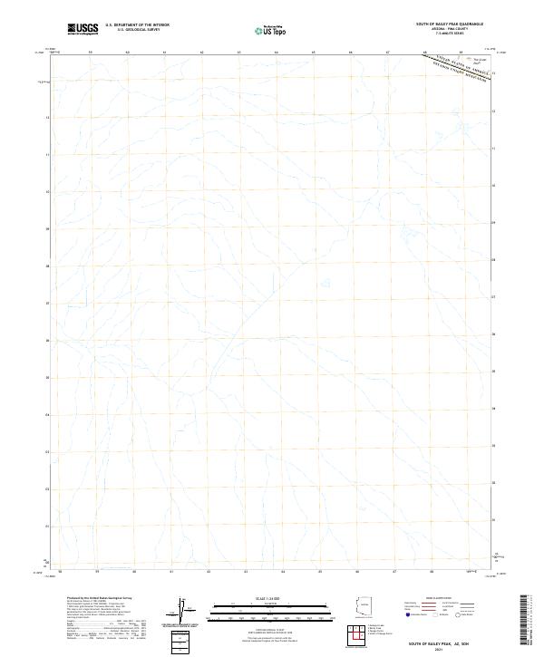
2021 Map of South of Bailey Peak
USGS Topo · Published 2021About this map
United States of America Estados Unidos Mexicanos defines the northern edge of this international borderland in southern Arizona. The landscape is characterized by the wide, arid expanse of The Great Plain, where ephemeral drainage patterns weave across the desert floor. This 2021 survey illustrates a sparse, unpopulated terrain south of Bailey Peak, documenting the precise location of the international boundary line and the network of dry washes that define the local hydrography in Pima County. It serves as a modern record of the natural topography along the edge of the Sonoran region before it transitions into Mexico.
Find a feature on this map
2 named features on this map. Tap any name to fly to it.
Don’t see what you’re looking for? This feature index may not catch every label — zoom into the map to look around manually.
Map Details
Editions of this 2021 South of Bailey Peak Map
This is the sole edition of this map. No revisions or reprints were ever made.
Other maps of this area

1954 · Sonoyta
USGS Topo · 1:250,000

1963 · Kom Vo
USGS Topo · 1:62,500

1963 · Lukeville
USGS Topo · 1:250,000

1963 · Diaz Peak
USGS Topo · 1:62,500
1988 · South of Bailey Peak
USGS Topo · 1:24,000
1988 · South of Papago Farms
USGS Topo · 1:24,000
1988 · Bailey Peak
USGS Topo · 1:24,000
1988 · Papago Farms
USGS Topo · 1:24,000
1988 · Menagers Lake
USGS Topo · 1:24,000
1994 · Lukeville
USGS Topo · 1:100,000