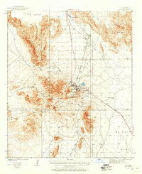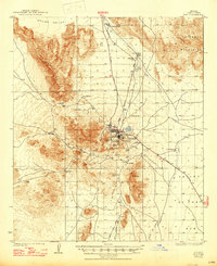
1980 Map of Ajo
USGS Topo · Published 1996About this map
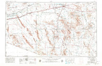
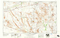
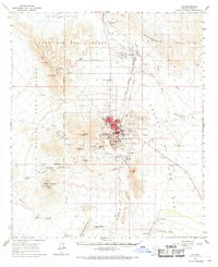
Ajo and the adjacent settlement of Gibson anchor this arid landscape within the Papago Indian Reservation (Tohono O'odham Nation). The map illustrates a region defined by its mineral wealth and strategic military presence, with extensive Mine Dumps and workings such as the Bluebird Mine and Copper Mtn Mine surrounding the main towns. To the west, the Barry M Goldwater Air Force Range and Cabeza Prieta National Wildlife Refuge border the mountain ranges, while the Organ Pipe Cactus National Monument dominates the southwestern quadrant.
Find a feature on this map
110 named features on this map. Tap any name to fly to it.
Don’t see what you’re looking for? This feature index may not catch every label — zoom into the map to look around manually.
Map Details
Editions of this 1980 Ajo Map
This is the sole edition of this map. No revisions or reprints were ever made.
Historical Maps of Ajo Through Time
11 maps found