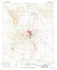
1963 Map of Ajo
USGS Topo · Published 1969About this map
The massive New Cornelia Mine and its extensive infrastructure dominate the center of this Pima County landscape, reflecting the heavy industrial footprint of mid-century copper extraction. The community of Ajo is detailed alongside its satellite neighborhoods of Gibson and Mexican Town, served by the Tucson Cornelia and Gila Bend railroad and the Tucson Cornelia and Gila Bend Road. Large engineering features like the North Dam Tailings Pond and East Dam Tailings Pond flank the open pit, while the town's social life is marked by the Ajo Country Club and a Boy Scout Campground. Beyond the industrial core, the map reveals a desert landscape of cattle tanks and remote outposts, including The Adobe and the John the Baptist (Site) in the mountains to the south. To the west, the Luke Air Force Range and Cabeza Prieta Game Range establish sprawling administrative boundaries across the arid terrain.
Find a feature on this map
72 named features on this map. Tap any name to fly to it.
Don’t see what you’re looking for? This feature index may not catch every label — zoom into the map to look around manually.
Map Details
Editions of this 1963 Ajo Map
2 editions found
Other maps of this area

1932 · Ajo
USGS Topo · 1:62,500

1934 · Ajo
USGS Topo · 1:62,500

1953 · Ajo
USGS Topo · 1:250,000

1957 · Ajo
USGS Topo · 1:250,000

1958 · Ajo
USGS Topo · 1:250,000

1958 · Midway
USGS Topo · 1:62,500

1958 · Hat Mountain
USGS Topo · 1:62,500

1962 · Ajo
USGS Topo · 1:250,000

1963 · Ajo
USGS Topo · 1:250,000

1963 · Ajo
USGS Topo · 1:62,500