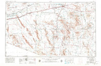
1953 Map of Ajo
USGS Topo · Published 1980About this map
The copper-mining center of Ajo and its massive New Cornelia Mine anchor this mid-century portrait of the Sonoran Desert. The landscape is defined by the sharp transition from the irrigated corridor of the Gila River and the Southern Pacific railroad in the north to the protected wildlands of the south. Vast tracts of the Papago Indian Reservation cover the eastern half, including traditional settlements such as Wahak Hotrontk (San Simon Indian Village) and Vaya Chin. The southwestern portion highlights the scale of government land management during the Cold War, showing the Luke Air Force Range and Cabeza Prieta Game Range abutting the international border. From the isolated Vekol Mine in the east to the Mohawk Valley in the west, this map details a region of seasonal washes and remote wells like Baragan Well and Stanwix Windmill.
Find a feature on this map
159 named features on this map. Tap any name to fly to it.
Don’t see what you’re looking for? This feature index may not catch every label — zoom into the map to look around manually.
Map Details
Editions of this 1953 Ajo Map
2 editions found

Other maps of this area

1913 · Maricopa
USGS Topo · 1:62,500

1914 · Gila Butte
USGS Topo · 1:62,500

1915 · Maricopa
USGS Topo · 1:62,500

1917 · Gila Butte
USGS Topo · 1:62,500

1922 · Casa Grande
USGS Topo · 1:62,500

1924 · Casa Grande
USGS Topo · 1:62,500

1926 · Wellton
USGS Topo · 1:62,500

1926 · Mohawk
USGS Topo · 1:62,500

1927 · Aguila Mountains
USGS Topo · 1:48,000

1927 · Kim
USGS Topo · 1:62,500