Old Maps of Norton, Arizona for Academic Research
Study the evolution of Norton with 17 high-resolution historic maps. Whether you're teaching, researching, or modeling changes in land use, these maps provide essential visual documentation of urban, environmental, and geographic change.
- Analyze long-term change: Track patterns in development, transportation, and natural features.
- Ideal for environmental or urban studies: Support academic projects with primary historical map data.
- Use in the classroom or lab: Educators and researchers rely on these maps to bring historical context to life.
These maps are a powerful tool for teaching, research, and visualizing how Norton has changed over the decades.
Norton, AZ maps
(17)- 1928 Map of Norton, 1947 Print
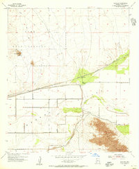
 1928 Norton1947 Print · USGSThe Yuma County desert in the late twenties was a landscape of remote rail stops and vital water holes along the Gila River. Researchers can trace the early path of the Southern Pacific railroad past the Norton settlement, Growler, and Terry Ranch.
 - 1929 Map of Norton
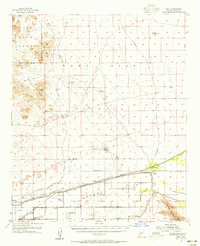
 1929 Norton1929 Print · USGSYuma County during the late 1920s shows a desert landscape shaped by the Southern Pacific railroad and the Gila River. Researchers can trace early ranching and utility sites like Terry Ranch and the Electric Gas and Water Co.2 unique versions available
 - 1953 Map of Ajo, 1971 Print
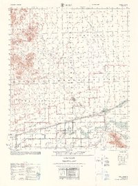
 1953 Ajo1971 Print · USGSThe Arizona desert at mid-century reveals a landscape of massive copper mines, tribal reservations, and military testing grounds. Genealogists and historians can trace rail stopovers like Dateland and Mohawk or locate remote sites like the Reward Mine and Gu Achi (Santa Rosa).2 unique versions available
 - 1955 Map of Growler, 1956 Print
 1955 Growler1956 Print · USGSIn the mid-fifties, the arid Yuma County landscape was a critical corridor for rail and water infrastructure. Researchers can trace the Southern Pacific line and the Mohawk Canal past Norton (Site) and the Mohawk Mts.3 unique versions available
 - 1955 Map of Roll, 1956 Print
 1955 Roll1956 Print · USGSYuma County during the mid-fifties reveals an arid landscape being transformed by the Mohawk Canal and the Southern Pacific railroad. Genealogists and historians can trace the foundations of desert life at Roll, Norton, and the Mohawk Valley Sch.3 unique versions available
 - 1957 Map of Ajo
 1957 Ajo1957 Print · USGSSouthern Arizona in the fifties reveals a landscape of massive copper mines, remote desert wells, and tribal reservations. Genealogists and historians can trace old cattle outposts like Whitewing Ranch, the Tracy's Trading Post, and the copper works at Ajo.
 - 1958 Map of Ajo
 1958 Ajo1958 Print · USGSThe high desert of Pima and Yuma Counties during the late fifties shows a landscape of remote copper mines and military flight paths. Researchers can trace the Southern Pacific Railroad through Gila Bend and find heritage sites like O'Neills Grave or the Christmas Gift Mine.2 unique versions available
 - 1962 Map of Ajo
 1962 Ajo1962 Print · USGSSouthern Arizona in the early sixties was a landscape of deep-desert mining, military airfields, and tribal lands. Researchers can trace the Cornelia Mine near Ajo, remote outposts like Trays Trading Post, and the path of the Devils Highway.
 - 1963 Map of Ajo
 1963 Ajo1963 Print · USGSSouthwestern Arizona in the early sixties reveals a landscape of desert ranches and remote mining outposts. Trace the historic Southern Pacific line or locate isolated landmarks like O'Neils Grave and Tracy's Trading Post.
 - 1967 Map of Ajo
 1967 Ajo1967 Print · USGSSouthern Arizona in the mid-1960s is depicted here as a landscape of military aviation and deep-desert ranching. Trace the historical mining operations at Vekol Mine or follow the Southern Pacific rail line through Gila Bend and Dateland.
 - 1968 Map of Roll
 1968 Roll1968 Print · USGSYuma County during the late sixties shows a desert landscape divided between military testing grounds and the ranching life of the valley. Genealogists and historians can trace local landmarks like Terry Ranch, Mohawk Valley Sch, and the Southern Pacific railroad line.
 - 1980 Map of Dateland, 1996 Print
 1980 Dateland1996 Print · USGSThe Yuma County desert during the late twentieth century is defined by the vital transit corridor along the Gila River. Researchers can trace the Southern Pacific rail line through remote stops like Sentinel and Aztec or locate the Sheep Mine in the rugged backcountry.
 - 1982 Map of Ajo
 1982 Ajo1982 Print · USGSThe Arizona-Sonora borderlands come into focus in the early eighties, showcasing a landscape of desert mining towns and expansive tribal lands. Trace the Southern Pacific rail line through Gila Bend or explore the remote settlements of Ajo and Lukeville.
 - 2011 Map of Growler, 2011 Print
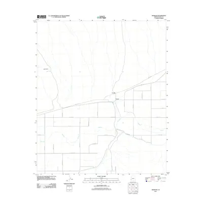 2011 Growler2011 Print · USGSCovers Norton, including Growler, Yuma County, and other nearby areas
 - 2014 Map of Growler, 2014 Print
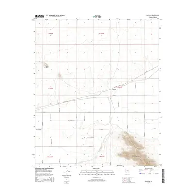 2014 Growler2014 Print · USGSCovers Norton, including Growler, Yuma County, and other nearby areas
 - 2018 Map of Growler, 2018 Print
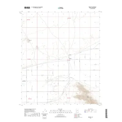 2018 Growler2018 Print · USGSCovers Norton, including Growler, Yuma County, and other nearby areas
 - 2021 Map of Growler, 2021 Print
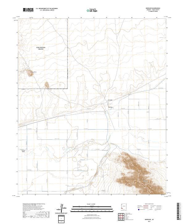 2021 Growler2021 Print · USGSThe Gila River winds through the Mohawk Valley in this 2021 survey of Yuma County, Arizona. Genealogists and researchers can trace local road networks serving the settlements of Growler and Norton or locate landmarks like Signal Butte and the Mohawk Mountains.
End of results
Showing maps 1-17 of 17
Top cities near Norton
Frequently asked questions
- What are the different types of historical maps available for Norton?
- What is the oldest map of Norton?
- Where can I purchase historical maps of Norton for my home or office?
- Where can I download high-res historical maps of Norton?
- Are there historical topographic maps available for Norton?
- Is there historical aerial imagery available for Norton?
- Where are historical maps of Norton sourced from?