Old Maps of Arkansas County, Arkansas for Hiking & Exploration
Hike through history with 204 historic maps of Arkansas County. Explore old trails, ghost towns, and forgotten backroads — perfect for outdoor adventurers and local explorers.
- Rediscover forgotten places: Map out old mining camps, roads, and footpaths that no longer exist on modern maps.
- Layer with modern tools: Combine with LiDAR or satellite views to plan hikes through historical terrain.
- Made for exploration: Popular among hikers, overlanders, and local history lovers.
Use these maps to find adventure and explore the hidden past of Arkansas County.
Arkansas County, AR maps
(204)- 1935 Map of Varner, 1938 Print
 1935 Varner1938 Print · USGSLower Arkansas River life in the mid-thirties is defined by its winding riverbanks and the expansion of the state penal system. Genealogists can locate family-named landmarks and old rural congregations like Mt Calvary Ch & Cem, Kimbrough, and the Cummins Ferry.3 unique versions available
 - 1935 Map of Red Fork, 1943 Print
 1935 Red Fork1943 Print · USGSDesha County's riverfront and rail lines are captured here in the mid-1930s, showing a landscape shaped by the Arkansas River. Researchers can trace the Missouri Pacific corridor through Dumas or locate the Indian Mound near Red Fork.3 unique versions available
 - 1935 Map of Clarendon, 1943 Print
 1935 Clarendon1943 Print · USGSThe river and rail networks of Monroe and Arkansas counties are frozen in time during the mid-1930s. Genealogists and historians can trace family locations through numerous rural landmarks like Mt Zion Ch & Cem, the Ramsey Mill Site, and Harris Ferry.
 - 1935 Map of Gillett, 1945 Print
 1935 Gillett1945 Print · USGSThe river plains around Gillett were defined by the shifting Arkansas River and the arrival of the railroad in the 1930s. Genealogists can locate family landmarks like Luther Cem, Hostetter Sch, and the remote One Horse Store.2 unique versions available
 - 1937 Map of Stuttgart
 1937 Stuttgart1937 Print · USGSThe Grand Prairie region of Arkansas is captured here in the mid-1930s, showing the early infrastructure of the rice-growing heartland. Genealogists can trace family roots through numerous country schools and landmarks like Rice Junction, Slovac, and the Gum Pond Cem.3 unique versions available
 - 1939 Map of Indian Bay, 1941 Print
 1939 Indian Bay1941 Print · USGSThe Arkansas delta near the confluence of the White River and Arkansas River is shown here just before the Second World War. Genealogists and local historians can trace numerous rural schoolhouses and churches, including Pin Oak Sch, Hill Chapel, and the St John Church and Cemetery.2 unique versions available
 - 1939 Map of Henrico, 1941 Print
 1939 Henrico1941 Print · USGSThe river bottomlands of the Arkansas delta are mapped here in the late 1930s as flood control efforts reshaped the basin. Genealogists can trace early landmarks like Fairview Ch & Sch, Henrico Cem, and the small settlement at Lagrue Springs.2 unique versions available
 - 1939 Map of Big Island, 1945 Print
 1939 Big Island1945 Print · USGSThe confluence of the White, Arkansas, and Mississippi Rivers is captured here in the late 1930s, showing a land defined by shifting channels and strategic landings. Researchers can trace the river economy through Campbell Ferry and Pleasant Green Ch & Cem near Rosedale.3 unique versions available
 - 1939 Map of Stuttgart, 1947 Print
 1939 Stuttgart1947 Print · USGSThe Grand Prairie region of Arkansas is captured here in the late 1930s, showing the agricultural heartland around the rail hub of Stuttgart. Genealogists and historians can trace defunct rural school districts like Fairmount Sch and Hamilton Sch or the early rail alignments of the St Louis Southwestern Ry.
 - 1941 Map of De Witt, 1942 Print
 1941 De Witt1942 Print · USGSArkansas County’s rice-growing prairie is shown in detail during the early 1940s, revealing a landscape transformed by intensive irrigation and rail transport. Genealogists and local historians can trace family roots through numerous rural landmarks like Wofford Chapel, Prairieville Sch, and the St Louis Southwestern rail line.
 - 1941 Map of Goldman, 1944 Print
 1941 Goldman1944 Print · USGSThe Arkansas delta landscape comes alive in this early 1940s record of a river-bound territory. Researchers can trace family history through dozens of rural landmarks, including Flynn Ch & Cem, Goldman School, and the scattered settlements of Ricusskey and Humphrey.2 unique versions available
 - 1941 Map of Clarendon, 1946 Print
 1941 Clarendon1946 Print · USGSThe river-driven economy of the Arkansas delta is on full display here in the early 1940s, centered on the confluence of the White and Cache rivers. Genealogists and historians can trace long-standing landmarks like Preston Ferry, the Ramsey Mill Site, and Lookout Store.2 unique versions available
 - 1948 Map of Helena
 1948 Helena1948 Print · USGSEastern Arkansas and the Mississippi Delta are captured here just after the war, showing a landscape defined by its great rivers and rail lines. Genealogists can trace family locations near Bemis Plantation, Helena, and smaller rail stops like Wheatley and Moro.
 - 1950 Map of Helena
 1950 Helena1950 Print · USGSMid-century Phillips County and the surrounding Delta region are shown at a peak of rail and river commerce. Genealogists and historians can trace family locations through numerous rural communities like Old Austin, Cotton Plant, and West Helena, or follow the routes of the Missouri Pacific RR across Grand Prairie.2 unique versions available
 - 1953 Map of Greenwood, 1966 Print
 1953 Greenwood1966 Print · USGSThe Mississippi Delta in the mid-fifties is captured here as a thriving network of river towns, railroads, and oxbow lakes. Researchers can trace the legacy of the Illinois Central Railroad and locate landmarks like the State Penal Farm and Greenville Air Force Base.5 unique versions available
 - 1954 Map of Indian Bay
 1954 Indian Bay1954 Print · USGSThe White River bottomlands of Monroe and Phillips counties come alive in the mid-fifties, showing a landscape defined by oxbow lakes and river management. Genealogists can locate rural landmarks like Clabe Chapel Sch, Smalley Cem, and the riverside community of Indian Bay.
 - 1954 Map of De Witt
 1954 De Witt1954 Print · USGSArkansas County during the early 1950s reveals a productive landscape of rice farms and bayous centered on the town of De Witt. Genealogists and historians can trace many rural landmarks including Wofford Chapel & Cem, the Emanuel Industrial Sch & Ch, and the Prairieville Sch.
 - 1954 Map of Henrico
 1954 Henrico1954 Print · USGSThe White River bottoms and the Laconia Circle in the mid-1950s reveal a landscape shaped by shifting river channels and timber transport. Genealogists can trace family names and local landmarks like Henrico, Malcolm Chapel & Cem, and the Stimson Co Tram.
 - 1955 Map of Helena, 1967 Print
 1955 Helena1967 Print · USGSThe Arkansas Delta and Mississippi floodplains are captured here in the mid-fifties, during a period of expanding flood control and rail commerce. Researchers can trace the extensive Chicago Rock Island and Pacific RR lines and locate sites like the Arkansas State College Experimental Rice Farm or Friars Point.2 unique versions available
 - 1956 Map of Greenwood
 1956 Greenwood1956 Print · USGSThe Mississippi Delta in the mid-fifties is captured here during a period of significant military and agricultural activity. Researchers can trace the rail lines of the Illinois Central RR, find the Greenville Air Force Base, or locate the State Penal Farm.
 - 1957 Map of Clarendon
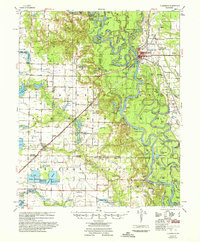 1957 Clarendon1957 Print · USGSThe river and rail landscapes of the Arkansas Delta come alive in this mid-fifties survey of the Clarendon area. Genealogists and local historians can trace family roots at numerous rural landmarks like Mt Pisgah Ch & Cem, Stahley Sch, and the Ramsey Mill Site.
 - 1959 Map of Helena
 1959 Helena1959 Print · USGSThe Arkansas and Mississippi Delta regions are captured here in the late fifties, showing a landscape defined by the Mississippi River and the Grand Prairie. Genealogists and researchers can trace the rail networks of the Illinois Central RR and locate community landmarks like Helena and the White River National Wildlife Refuge.
 - 1960 Map of Helena
 1960 Helena1960 Print · USGSThe Arkansas and Mississippi Delta regions meet along the great river bends during a period of significant agricultural and rail expansion. Genealogists and historians can trace the paths of the Missouri Pacific railroad through Clarendon or locate landings along the Mississippi River and White River.
 - 1964 Map of Cornerstone, 1965 Print
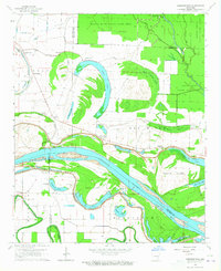 1964 Cornerstone1965 Print · USGSThe river bottoms of Jefferson and Lincoln counties are captured here in the mid-1960s, showing a landscape defined by the Arkansas River and its ancient oxbows. Researchers can locate early rural landmarks like Eudora School and the English Cemetery, alongside small settlements such as Cornerstone and Elmwood.2 unique versions available
 - 1964 Map of Reydell, 1965 Print
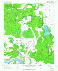 1964 Reydell1965 Print · USGSThe Arkansas Delta near the Jefferson and Lincoln county line is shown here in the mid-sixties, dominated by the wetlands of the Bayou Meto State Game Area. Researchers can trace old family landmarks like Abbey Cem, the Hannaberry Sch, and the riverside settlement of Reydell.2 unique versions available
Showing maps 1-25 of 204
Top cities of Arkansas County
- Stuttgart historical maps
- DeWitt historical maps
- Gillett historical maps
- Almyra historical maps
- Saint Charles historical maps
Frequently asked questions
- What are the different types of historical maps available for Arkansas County?
- What is the oldest map of Arkansas County?
- Where can I purchase historical maps of Arkansas County for my home or office?
- Where can I download high-res historical maps of Arkansas County?
- Are there historical topographic maps available for Arkansas County?
- Is there historical aerial imagery available for Arkansas County?
- Where are historical maps of Arkansas County sourced from?