1900s (20th Century) Maps of Siloam Springs, Arkansas
Explore 11 historic maps of Siloam Springs from the 1900s (20th Century). These maps offer a rare glimpse into what life looked like during the 1900s — showing old roads, neighborhoods, homes, and landmarks that have changed or disappeared over time.
Whether you're researching your family's past, planning a metal detecting trip, or studying how Siloam Springs's landscape evolved across the 1900s, these high-resolution maps are a powerful tool for exploring the history of this region.
- Focus on a specific era: All maps on this page are from the 1900s, giving you a focused view of this time period.
- See what’s changed: Compare century-old streets, trails, and buildings to today's modern landscape using overlays and satellite layers.
- Research with precision: Use these maps for genealogy, historical research, land use analysis, or educational projects.
- View, download, or print: Maps are fully viewable online in high resolution, and can be downloaded or printed for your own records.
Start exploring Siloam Springs's history through authentic maps from the 1900s. This is your window into the past.
Siloam Springs, AR maps
(11)- 1901 Map of Fayetteville
 1901 Fayetteville1901 Print · USGSNorthwest Arkansas is seen here at the start of the twentieth century as railroads and trade began to reshape the Ozark foothills. Researchers can locate the Pea Ridge Battlefield and Elkhorn Tavern, or trace early industrial sites like Osage Mills and Rhea's Mill.4 unique versions available
 - 1903 Map of Siloam Springs, 1904 Print
 1903 Siloam Springs1904 Print · USGSThe border of Arkansas and the Cherokee Nation comes to life in this survey from the turn of the century. Genealogists and historians can trace the early layout of Siloam Springs or locate small landmarks like Shoaps Store and Round Spring Church.
 - 1904 Map of Siloam Springs
 1904 Siloam Springs1904 Print · USGSThe Arkansas and Indian Territory borderlands are captured here at the turn of the century, prior to Oklahoma statehood. Researchers can trace the early layout of Siloam Springs and locate vanished landmarks like Shoaps Store or the Round Spring Church.7 unique versions available
 - 1904 Map of Fayetteville
 1904 Fayetteville1904 Print · USGSNorthwest Arkansas was a land of emerging railroads and Civil War memory at the turn of the century. Genealogists can locate family homesteads near Rhea's Mill, the Pea Ridge Battlefield, and early river crossings like Vanwinkle Ferry.
 - 1954 Map of Tulsa
 1954 Tulsa1954 Print · USGSNortheast Oklahoma and the Ozark border are shown here during a period of massive industrial and infrastructure growth. Researchers can trace the legacy of the Tri-State Mining District and the development of major reservoirs like Grand Lake O' The Cherokees.2 unique versions available
 - 1958 Map of Tulsa, 1968 Print
 1958 Tulsa1968 Print · USGSNortheast Oklahoma and the Ozark borderlands are captured here during a massive era of reservoir construction and highway expansion. Researchers can trace the mid-century footprints of Tulsa, the sprawling Lake O' the Cherokees, and historical sites like Pea Ridge National Military Park.3 unique versions available
 - 1963 Map of Tulsa
 1963 Tulsa1963 Print · USGSThe Oklahoma and Arkansas borderlands are shown here in the early sixties, a time of massive reservoir construction and heavy mining. Genealogists can trace family roots through settlements like Nowata, Pryor, and Jay, or locate historical zinc and lead mines and coal mines.
 - 1970 Map of Gallatin, 1972 Print
 1970 Gallatin1972 Print · USGSBenton County at the start of the seventies shows a landscape where prairie agriculture meets the deep woods of the Ozarks. Genealogists can trace family footprints through sites like Lone Elm Cem, Fairmount Cem, and the Shady Grove Church.3 unique versions available
 - 1972 Map of Watts, 1974 Print
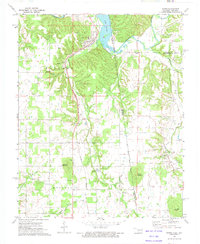 1972 Watts1974 Print · USGSThe Arkansas-Oklahoma borderlands come alive in the early seventies as the rail line connects rural outposts. Trace family roots at Sixkiller Cem or explore the waters of Lake Frances and the ridges of Mission Mountain.2 unique versions available
 - 1972 Map of Siloam Springs, 1974 Print
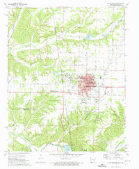 1972 Siloam Springs1974 Print · USGSSiloam Springs and its rural neighbors are caught in a period of steady growth during the early seventies along the state line. Genealogists and historians can trace family plots at Oak Hill Cemetery or Bell Cem, and locate the historic campus of John Brown University.2 unique versions available
 - 1979 Map of Fayetteville, 1980 Print
 1979 Fayetteville1980 Print · USGSNorthwest Arkansas and the tristate corner show a booming corridor of rail-linked towns and highland forests in the late seventies. Researchers can trace historic landmarks like Pea Ridge National Military Park, the Frisco RR, and the University of Arkansas.2 unique versions available
End of results
Showing maps 1-11 of 11
Top cities near Siloam Springs
- Bentonville historical maps
- Centerton historical maps
- Prairie Grove historical maps
- Gravette historical maps
- Gentry historical maps
- Lincoln historical maps
See more
Top neighborhoods of Siloam Springs
Frequently asked questions
- What are the different types of historical maps available for Siloam Springs?
- What is the oldest map of Siloam Springs?
- Where can I purchase historical maps of Siloam Springs for my home or office?
- Where can I download high-res historical maps of Siloam Springs?
- Are there historical topographic maps available for Siloam Springs?
- Is there historical aerial imagery available for Siloam Springs?
- Where are historical maps of Siloam Springs sourced from?