
1970 Map of Gallatin
USGS Topo · Published 1972About this map
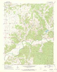
The Illinois River winds through the southern reaches of this landscape, separating the open agricultural lands of the Prairie from the wooded ridges of the Ozark National Forest. Settled clusters like Gallatin and Logan serve as focal points in a region defined by its springs and hollows, including Logan Spring and Gum Springs. The map reveals a community-centered development pattern, documented through family and local landmarks such as the Fairmount Community Hall and the Martin Community Hall. Educational and religious foundations are evident at the Ozark Academy and Shady Grove Church. In the north, the terrain transitions into the Gentry area, while the southern boundary follows the Benton Co Washington Co line, illustrating the intersection of rural townships and managed forest lands during the early 1970s.
Find a feature on this map
41 named features on this map. Tap any name to fly to it.
Don’t see what you’re looking for? This feature index may not catch every label — zoom into the map to look around manually.
Map Details
Editions of this 1970 Gallatin Map
3 editions found
Other maps of this area

1899 · Fayetteville
USGS Topo · 1:125,000

1899 · Siloam Springs
USGS Topo · 1:125,000

1901 · Fayetteville
USGS Topo · 1:125,000

1903 · Siloam Springs
USGS Topo · 1:125,000

1904 · Siloam Springs
USGS Topo · 1:125,000

1904 · Fayetteville
USGS Topo · 1:125,000

1954 · Tulsa
USGS Topo · 1:250,000

1958 · Tulsa
USGS Topo · 1:250,000

1963 · Tulsa
USGS Topo · 1:250,000

1970 · Robinson
USGS Topo · 1:24,000