1900s (20th Century) Maps of Conway County, Arkansas
Explore 44 historic maps of Conway County from the 1900s (20th Century). These maps offer a rare glimpse into what life looked like during the 1900s — showing old roads, neighborhoods, homes, and landmarks that have changed or disappeared over time.
Whether you're researching your family's past, planning a metal detecting trip, or studying how Conway County's landscape evolved across the 1900s, these high-resolution maps are a powerful tool for exploring the history of this region.
- Focus on a specific era: All maps on this page are from the 1900s, giving you a focused view of this time period.
- See what’s changed: Compare century-old streets, trails, and buildings to today's modern landscape using overlays and satellite layers.
- Research with precision: Use these maps for genealogy, historical research, land use analysis, or educational projects.
- View, download, or print: Maps are fully viewable online in high resolution, and can be downloaded or printed for your own records.
Start exploring Conway County's history through authentic maps from the 1900s. This is your window into the past.
Conway County, AR maps
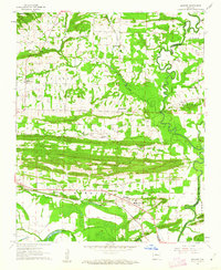
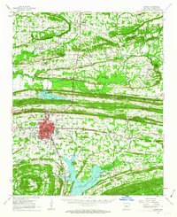
(44)- 1956 Map of Russellville
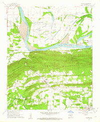
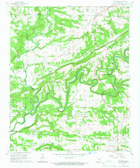
 1956 Russellville1956 Print · USGSThe Arkansas River valley and the surrounding Boston Mountains are captured here in the mid-fifties, showing a landscape of small timber towns and new reservoirs. Genealogists can trace family roots through upland settlements like Pelsor and Witts Springs or locate the campus of Arkansas Polytechnic College.2 unique versions available
 - 1961 Map of Menifee, 1962 Print
 1961 Menifee1962 Print · USGSConway County communities are captured here in the early sixties as they developed along the Missouri Pacific rail line. Genealogists and local historians can locate several rural landmarks including the County Training Sch, Pilgrim Rest Ch, and the waters of Old River Lake.3 unique versions available
 - 1961 Map of Perryville, 1962 Print
 1961 Perryville1962 Print · USGSPerry County and the Arkansas River valley are shown in the early sixties, capturing the area between the river bends and the mountain ridges. Researchers can locate the County Fairground, rural schools like St Elizabeth Sch, and family burial plots including Wolfe Cem and McGhee Cem.3 unique versions available
 - 1961 Map of Morrilton East, 1962 Print
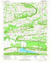
 1961 Morrilton East1962 Print · USGSConway County in the early 1960s shows a landscape transitioning between its deep river-and-rail roots and modern mid-century growth. Genealogists can trace family names through rural landmarks like Gordons Chapel, Scroggin Cem, and the Hickory Hill settlement.3 unique versions available
 - 1961 Map of Morrilton West, 1962 Print
 1961 Morrilton West1962 Print · USGSThe Arkansas River valley at the foot of the Ozarks is captured here in the early sixties, showing the vital river-and-rail corridor near Morrilton. Local historians can trace family ties at Happy Bend Cem and Elmwood Cem or locate industrial sites like the Shale Pit.3 unique versions available
 - 1961 Map of Houston, 1962 Print
 1961 Houston1962 Print · USGSPerry County at the start of the 1960s shows a landscape defined by the winding Arkansas River and the ridges of the Ouachita foothills. Researchers can locate several rural burial sites like Houston Cem and trace the path of the Chicago Rock Island and Pacific railroad through Houston and Bigelow.3 unique versions available
 - 1961 Map of Adona, 1962 Print
 1961 Adona1962 Print · USGSCentrally located in Perry and Conway counties in the early sixties, this region reveals a rural landscape defined by the Petit Jean River. Genealogists and local historians can trace family ties at Hamilton Cem, Liberty Cem, and the small siding of Adona along the rail line.3 unique versions available
 - 1961 Map of Gleason, 1962 Print
 1961 Gleason1962 Print · USGSThe Arkansas River valley comes alive in the early sixties, showing the vital river crossings and mountain ridges of Faulkner and Perry counties. Genealogists and local historians can trace the Toadsuck Ferry, the Missouri Pacific rail line, and rural landmarks like Bethel Ch or Casey Cem.3 unique versions available
 - 1961 Map of Atkins, 1962 Print
 1961 Atkins1962 Print · USGSThe Arkansas River valley comes alive in this early 1960s survey of Pope and Yell counties, showing the transition from delta bottomlands to the heights of Petit Jean Mountain. Genealogists can trace rural roots through landmarks like Bells Chapel Cem, Gold Hill Sch, and the riverside site of Galla Rock.3 unique versions available
 - 1961 Map of Conway, 1963 Print
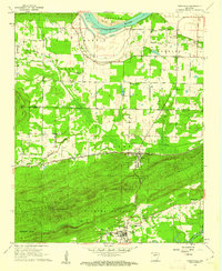
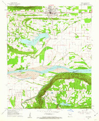
 1961 Conway1963 Print · USGSConway and central Arkansas are captured here during a season of mid-century growth and collegiate expansion. Researchers can locate vanished rural landmarks and early infrastructure like Hendrix College, Beaver Fork Lake, and the Drive-in Theater.
 - 1961 Map of Bee Branch, 1963 Print
 1961 Bee Branch1963 Print · USGSCentral Arkansas settlements and highland ridges are mapped in the early sixties, showing the rural network of the Van Buren and Faulkner county lines. Researchers can find numerous family landmarks such as Quattlebaum Cem, Pinnacle Springs Tabernacle, and the Solomon Grove Sch.2 unique versions available
 - 1961 Map of Greenbrier, 1966 Print
 1961 Greenbrier1966 Print · USGSThe Greenbrier area of Faulkner County is captured here in the early 1960s, showing a landscape of upland ridges and creek valleys. Researchers can trace rural lineages through sites like Bethlehem Ch, Estep Cem, and the community of Wooster.2 unique versions available
 - 1961 Map of Bee Branch, 1966 Print
 1961 Bee Branch1966 Print · USGSBee Branch and the surrounding Ozark foothills are captured here in the early sixties as a network of ridge-top settlements and creek-side farms. Researchers can locate numerous local landmarks including Quattlebaum Cem, Catholic Point, and Southside Schools.2 unique versions available
 - 1961 Map of Damascus, 1966 Print
 1961 Damascus1966 Print · USGSThe borderlands of Van Buren and Faulkner counties are captured here in the early sixties, showing a rural landscape defined by creek valleys and high ridges. Genealogists and local historians can locate community anchors like Solomon Grove School, Martinville Cem, and the historic TREATY BOUNDARY.3 unique versions available
 - 1962 Map of Jerusalem, 1963 Print
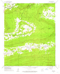
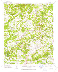
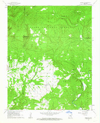 1962 Jerusalem1963 Print · USGSThe rural Arkansas Ozarks come into focus in the early sixties, showing a landscape of mountain settlements and forest ridges. Genealogists can trace family landmarks like Thompson Cem, Mt Zion Ch, and the high-elevation hamlet of Stumptoe.4 unique versions available
 - 1962 Map of Cleveland, 1963 Print
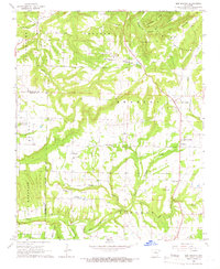
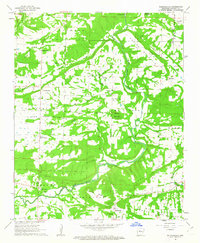
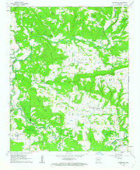
 1962 Cleveland1963 Print · USGSThe hills of Conway County were a land of small farms and remote hollows in the early sixties. Genealogists and historians can trace family ties through numerous rural burial sites and churches like Old Liberty Cemetery, Sunnyside, and Moores Chapel.2 unique versions available
 - 1962 Map of Solgohachia, 1963 Print
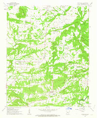
 1962 Solgohachia1963 Print · USGSConway County communities are mapped here in the early sixties, showing a landscape defined by small settlements and mountain ridges. Genealogists and local historians can trace family locations through St Marys Cemetery and rural centers like Lanty or Wonderview.3 unique versions available
 - 1962 Map of Hattieville, 1963 Print
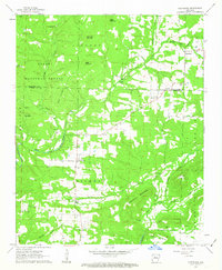
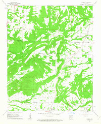
 1962 Hattieville1963 Print · USGSThe hills and bottomlands of Conway County are captured here in the early sixties, showing a landscape shaped by the West Fork Point Remove Creek. Researchers can locate numerous family burial sites and country churches including Wiedower Cem, Plainview Ch, and Old Hickory.2 unique versions available
 - 1962 Map of Springfield, 1963 Print
 1962 Springfield1963 Print · USGSConway County in the early 1960s was a network of high ridges and rural crossroads settlements. Genealogists and historians can trace family roots through landmarks like St Josephs Cem, the Nemo Vista Sch, and the Old Treaty Boundary.2 unique versions available
 - 1962 Map of Formosa, 1963 Print
 1962 Formosa1963 Print · USGSThe Van Buren and Conway County line comes alive in the early sixties, showing a landscape defined by high ridges and rural homesteads. Genealogists can trace family footprints at Woolverton Mountain Cem, Sweet Home Ch, and the community of Formosa.2 unique versions available
 - 1964 Map of Russellville
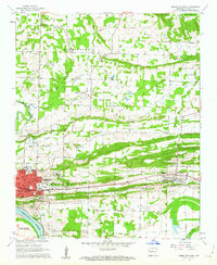
 1964 Russellville1964 Print · USGSMid-century Central Arkansas is defined here by the river-valley towns and the surrounding mountain ranges before the full expansion of the interstate system. Genealogists and historians can trace rail-town development along the Missouri Pacific Railroad and locate landmarks like Arkansas Polytechnic College or Petit Jean State Park.
 - 1972 Map of Casa, 1974 Print
 1972 Casa1974 Print · USGSThe river valley and mountain ridges of central Arkansas are captured here in the early seventies, centered on the railroad town of Casa. Genealogists and historians can trace family locations through Needmore Cem, South View Ch, and the rural crossing at Pontoon.2 unique versions available
 - 1977 Map of Russellville
 1977 Russellville1977 Print · USGSThe Arkansas River Valley and surrounding Ozark Mountains are documented here during a period of significant postwar growth and infrastructure development. Genealogists and researchers can locate family landmarks such as Mount Carmel Cem, St Josephs Church, and several remote Coal Mine sites along the Missouri Pacific RR line.
 - 1983 Map of Conway, 1984 Print
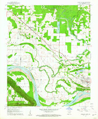
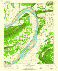
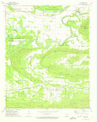
 1983 Conway1984 Print · USGSThe Arkansas River valley in the early eighties shows a landscape of river-bend settlements and expanding wildlife areas. Genealogists and historians can trace the Missouri Pacific RR through old river towns like Toad Suck, Morrilton, and Menifee.
 - 1984 Map of Russellville
 1984 Russellville1984 Print · USGSThe Arkansas River valley in the mid-eighties shows a landscape defined by the rise of Lake Dardanelle and the enduring presence of the Ozark National Forest. Researchers can find historical institutions like Arkansas Tech Univ and Sacred Heart Church or trace the routes of the Missouri Pacific RR.2 unique versions available
Showing maps 1-25 of 44
Top cities of Conway County
Frequently asked questions
- What are the different types of historical maps available for Conway County?
- What is the oldest map of Conway County?
- Where can I purchase historical maps of Conway County for my home or office?
- Where can I download high-res historical maps of Conway County?
- Are there historical topographic maps available for Conway County?
- Is there historical aerial imagery available for Conway County?
- Where are historical maps of Conway County sourced from?