1950s Maps of Cross County, Arkansas
Explore 10 historic maps of Cross County from the 1950s. These maps offer a rare glimpse into what life looked like during the 1950s — showing old roads, neighborhoods, homes, and landmarks that have changed or disappeared over time.
Whether you're researching your family's past, planning a metal detecting trip, or studying how Cross County's landscape evolved across the 1950s, these high-resolution maps are a powerful tool for exploring the history of this region.
- Focus on a specific era: All maps on this page are from the 1950s, giving you a focused view of this time period.
- See what’s changed: Compare century-old streets, trails, and buildings to today's modern landscape using overlays and satellite layers.
- Research with precision: Use these maps for genealogy, historical research, land use analysis, or educational projects.
- View, download, or print: Maps are fully viewable online in high resolution, and can be downloaded or printed for your own records.
Start exploring Cross County's history through authentic maps from the 1950s. This is your window into the past.
Cross County, AR maps
(10)- 1953 Map of Memphis, 1966 Print
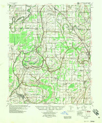
 1953 Memphis1966 Print · USGSEastern Arkansas and the Memphis riverfront are shown here during the mid-century period of regional growth and river management. Local historians can trace the paths of the Chicago Rock Island & Pacific RR through Forrest City or locate river landmarks like President's Island.3 unique versions available
 - 1956 Map of Memphis
 1956 Memphis1956 Print · USGSThe Mississippi Delta and the bluffs of West Tennessee meet in the mid-fifties, showing a landscape defined by massive river systems and rail hubs. Researchers can trace the path of Crowleys Ridge or locate vanished river landings near Centennial Island and Island No 35.
 - 1956 Map of Tilton
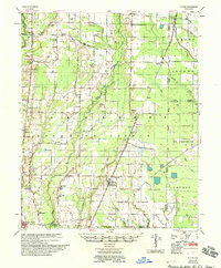
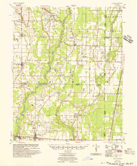 1956 Tilton1956 Print · USGSThe Arkansas Delta comes into focus in the mid-1950s, showing a landscape of drainage canals and rail-line towns. Researchers can trace family roots at Pumpkin Bend, Beedeville, and the crossroads of McCrory.
 - 1956 Map of Whitmore, 1957 Print
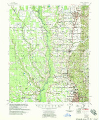
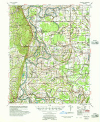 1956 Whitmore1957 Print · USGSThe St. Francis River delta was a landscape of intricate oxbows and rural congregations in the mid-fifties. Genealogists can trace family roots at Shiloh Ch & Cem or Locust Grove Ch & Cem and locate vanished school sites like Reiff Sch.
 - 1956 Map of Princedale, 1957 Print
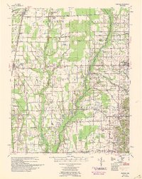
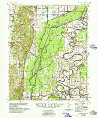 1956 Princedale1957 Print · USGSCross County in the mid-fifties is captured here as a landscape defined by the winding St Francis River and a massive network of drainage ditches. Researchers can locate many family-named landmarks and vanished rural hubs like Bay Village, Burr Place, and the Wildwood Ch & Sch.
 - 1956 Map of Hunter, 1968 Print
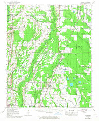 1956 Hunter1968 Print · USGSEastern Arkansas at the mid-century mark reveals a landscape defined by the ST LOUIS SOUTHWESTERN rail line and the CACHE RIVER bottomlands. Researchers can locate numerous family-named landmarks and rural hubs, including Woodmans Cem, Beard Sch, and Whitehall Ch & Cem.
 - 1957 Map of Deckerville, 1958 Print
 1957 Deckerville1958 Print · USGSThe Arkansas delta in the mid-fifties is captured here during its peak era of rail-and-river transport and intensive drainage. Genealogists can trace hundreds of rural family landmarks, including New Bethlehem Ch & Sch, St Peter Sch, and Prosperity Ch Sch & Cem.
 - 1958 Map of Hunter
 1958 Hunter1958 Print · USGSEastern Arkansas at the dawn of the space age reveals a landscape defined by the Cache River and an extensive rail network. Genealogists and historians can trace family roots through numerous rural sites like Odd Fellows Cemetery, Beard School, and Whitehall Church and Cemetery.
 - 1958 Map of Wynne
 1958 Wynne1958 Print · USGSEastern Arkansas in the late fifties shows a landscape of vibrant rail towns and rural parishes between Wynne and Forrest City. Genealogists and historians can trace dozens of landmarks like Slonikers Mill, Cogbill Cem, and Hedge Providence Ch.2 unique versions available
 - 1958 Map of Vanndale
 1958 Vanndale1958 Print · USGSCross and Poinsett Counties are captured in the late fifties, showing a landscape defined by the L'Anguille River and the regional rail lines. Researchers can trace rural genealogy through landmarks like Tilton Sch & Ch, Union Grove Cem, and Slocum Cem.2 unique versions available
End of results
Showing maps 1-10 of 10
Top cities of Cross County
- Wynne historical maps
- Parkin historical maps
- Cherry Valley historical maps
- Hickory Ridge historical maps
Frequently asked questions
- What are the different types of historical maps available for Cross County?
- What is the oldest map of Cross County?
- Where can I purchase historical maps of Cross County for my home or office?
- Where can I download high-res historical maps of Cross County?
- Are there historical topographic maps available for Cross County?
- Is there historical aerial imagery available for Cross County?
- Where are historical maps of Cross County sourced from?