Old Maps of Franklin County, Arkansas for Academic Research
Study the evolution of Franklin County with 174 high-resolution historic maps. Whether you're teaching, researching, or modeling changes in land use, these maps provide essential visual documentation of urban, environmental, and geographic change.
- Analyze long-term change: Track patterns in development, transportation, and natural features.
- Ideal for environmental or urban studies: Support academic projects with primary historical map data.
- Use in the classroom or lab: Educators and researchers rely on these maps to bring historical context to life.
These maps are a powerful tool for teaching, research, and visualizing how Franklin County has changed over the decades.
Franklin County, AR maps
(174)- 1879 Map of Cravens
 1879 Cravens1879 Print · USGSFranklin County in the late 1800s was a landscape of remote settlements and intricate waterways. Genealogists and local historians can trace the early footprints of Lone Elm and Cravens or follow the paths along Maxwell Creek and White Oak Creek.
 - 1887 Map of Magazine Mountain #1
 1887 Magazine Mountain #11887 Print · USGSThe Arkansas River valley in the late 1880s is captured here just as the railroad began reshaping the local economy. Genealogists and researchers can trace early homesteads and rail stops through Paris, Coal Hill, and the river landings at Pattersons Bluff.
 - 1887 Map of Magazine Mountain #2
 1887 Magazine Mountain #21887 Print · USGSThe Arkansas River valley and its late-19th-century rail corridor are meticulously detailed in this survey of Franklin County. Genealogists can locate family names and vanished sites across Staked Prairie or explore old river and rail towns like Webb City and Altus.
 - 1887 Map of Magazine Mountain #3
 1887 Magazine Mountain #31887 Print · USGSLogan County, Arkansas, appears in the late nineteenth century as a series of pioneer settlements and steep ridgelines. Genealogists and historians can trace early footprints at Booneville and Golden City, or locate the specific topography of Huckleberry Mt. and Chismville.
 - 1887 Map of Watalula
 1887 Watalula1887 Print · USGSFranklin, Arkansas, is captured during the late nineteenth century in this rare, unpublished advance sheet. Genealogists and local historians can trace early homesteads near Lone Elm, Cravens, and the winding waters of Maxwell Creek.
 - 1887 Map of Magazine Mountain
 1887 Magazine Mountain1887 Print · USGSNorthwest Arkansas in the 1880s is defined here by the river-and-rail economy along the Arkansas River valley. Genealogists and historians can trace long-forgotten post offices like Burnett Springs and early rail stops such as Coal Hill.
 - 1890 Map of Magazine Mountain
 1890 Magazine Mountain1890 Print · USGSThe Arkansas River Valley is captured here in the late nineteenth century as rail transport begins to eclipse river travel. Genealogists can trace early homesteads and community hubs like Paris, Booneville, and the remote Burnett Springs.6 unique versions available
 - 1890 Map of Fort Smith
 1890 Fort Smith1890 Print · USGSThe Arkansas-Indian Territory border was a landscape of rapid transition in the late nineteenth century. Genealogists and historians can trace early post offices like Jenny Lind P.O. and Oak Bower (Lavaca P.O.) or follow the path of the St. Louis and San Francisco Railroad.7 unique versions available
 - 1898 Map of Winslow #4
 1898 Winslow #41898 Print · USGSCrawford County, Arkansas, appears here during the late nineteenth century as a network of ridge-top settlements and winding creek beds. Researchers can trace the early footprints of Lancaster, Graphic, and Pleasant Hill along the banks of Mulberry Creek.
 - 1898 Map of Winslow, 1954 Print
 1898 Winslow1954 Print · USGSNorthwest Arkansas and the adjacent Indian Territory are captured here in the late nineteenth century as the railroad began to transform the high Ozarks. Genealogists can trace early homesteads and transport routes like the Quesenbury Road, Rheas Mill, and the mountain town of Winslow.
 - 1901 Map of Winslow
 1901 Winslow1901 Print · USGSThe Boston Mountains and the Arkansas border are captured here at the close of the nineteenth century, documenting the critical rail passage through the Ozarks. Genealogists and historians can trace the Frisco Line, the historic Old Wire Road, and early settlements like Cove City and Cane Hill.5 unique versions available
 - 1906 Map of Batson
 1906 Batson1906 Print · USGSJohnson County highlands come into focus in the early 1900s through this rare advance sheet of the southern Batson area. Local historians can trace the early layout of Harmony, Hunt, and Grace near the waters of the East Fork of Horse Head Creek.
 - 1906 Map of Lavaca
 1906 Lavaca1906 Print · USGSThe Arkansas River valley comes to life in the late nineteenth century as railroads and ridges define the growing settlements of Sebastian County. Researchers can trace the original locations of Lavaca, Alma, and Vesta, or locate family-named landmarks like Butler's Knob and Arbuckles Island.
 - 1906 Map of Barber
 1906 Barber1906 Print · USGSSebastian County’s ridges and valley settlements are shown here at the start of the twentieth century, during a time of rural expansion. Researchers can trace early family sites and commerce through landmarks like the Toll Bridge and settlements such as Burnville and Sulphur Spring.
 - 1934 Map of Booneville
 1934 Booneville1934 Print · USGSLogan County during the mid-1930s reveals a network of small Arkansas settlements and mountain ridges connected by the Rock Island line. Researchers can trace family history through sites like the State Sanitarium, Wesley Chapel, and the Rocky Springs Cem.2 unique versions available
 - 1939 Map of Watalula
 1939 Watalula1939 Print · USGSFranklin and Crawford counties are shown here in the mid-thirties as a landscape of isolated mountain ridges and river-valley settlements. Trace local history through the Wire Road, remote country churches like Low Gap Church, and family cemeteries including Brewer Cem and Harris Cem.3 unique versions available
 - 1939 Map of Booneville
 1939 Booneville1939 Print · USGSThe Logan County countryside thrives in the 1930s as a crossroads of the Rock Island railroad and the Petit Jean Creek valley. Genealogists can locate family landmarks like Harvel Cem, the State Sanatorium, and local schools including Shady Grove Sch.3 unique versions available
 - 1943 Map of Fort Smith
 1943 Fort Smith1943 Print · USGSFort Smith and the Arkansas River valley are shown here during the height of the Second World War as the region became a major military hub. Genealogists and researchers can locate several rural schools and churches, such as St Marys School and Pleasant Ridge Church and Cem, alongside industrial sites like the Strip Mine and Smelter.
 - 1943 Map of St. Paul, 1956 Print
 1943 St. Paul1956 Print · USGSThe upper Ozark highlands of Madison County are captured here in the mid-1940s, showing a landscape of isolated mountain schools and river-valley settlements. Researchers can trace the heritage of rural communities through landmarks like St Paul, Hazel Valley Sch, and the Riverside Cem.5 unique versions available
 - 1946 Map of St. Paul
 1946 St. Paul1946 Print · USGSMadison County's rugged Ozark interior is captured in the mid-forties, showing a landscape of remote hollows and mountain schools. Genealogists can trace family roots through sites like Liberty Cem, Delaney Creek Sch, and the community of St Paul.2 unique versions available
 - 1946 Map of Fort Smith
 1946 Fort Smith1946 Print · USGSThe Arkansas-Oklahoma borderlands appear here in the mid-forties, as new reservoirs began to transform the river valleys. Genealogists and historians can trace rail-served towns from Muskogee to Fort Smith and locate landmarks like Camp Chaffee.
 - 1946 Map of Charleston, 1973 Print
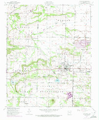 1946 Charleston1973 Print · USGSCharleston and its surrounding prairies appear here at the intersection of rail and military expansion during the mid-twentieth century. Genealogists can locate family burial sites like Nixon and Killings, or trace the grounds of the Rosenwall School and Fort Chaffee.2 unique versions available
 - 1947 Map of Lavaca, 1954 Print
 1947 Lavaca1954 Print · USGSThe Arkansas River valley in the late 1940s reveals a landscape of growing energy production and military expansion. Genealogists can trace family roots through Nixon Cem, Harmony Ch, and the streets of Charleston and Lavaca.
 - 1947 Map of Barber, 1954 Print
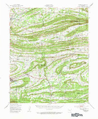 1947 Barber1954 Print · USGSSebastian County and the surrounding ridges are captured in the late 1940s, showing the intersection of military expansion and rural Arkansas life. Genealogists and historians can trace family locations through Union Ridge Cem, Milltown, and Liberty Ch.
 - 1947 Map of Barber, 1973 Print
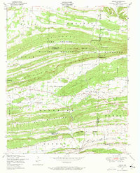 1947 Barber1973 Print · USGSIn the mid-forties, the Arkansas landscape south of the Arkansas River was defined by the expansion of military grounds and the enduring ridge-top settlements. Researchers can find old burial sites like Spencer Cemetery and trace the Chicago Rock Island and Pacific rail line through Barber.2 unique versions available
Showing maps 1-25 of 174
Top cities of Franklin County
- Ozark historical maps
- Charleston historical maps
- Altus historical maps
- Branch historical maps
- Denning historical maps
- Wiederkehr Village historical maps
Frequently asked questions
- What are the different types of historical maps available for Franklin County?
- What is the oldest map of Franklin County?
- Where can I purchase historical maps of Franklin County for my home or office?
- Where can I download high-res historical maps of Franklin County?
- Are there historical topographic maps available for Franklin County?
- Is there historical aerial imagery available for Franklin County?
- Where are historical maps of Franklin County sourced from?