1960s Maps of Franklin County, Arkansas
Explore 12 historic maps of Franklin County from the 1960s. These maps offer a rare glimpse into what life looked like during the 1960s — showing old roads, neighborhoods, homes, and landmarks that have changed or disappeared over time.
Whether you're researching your family's past, planning a metal detecting trip, or studying how Franklin County's landscape evolved across the 1960s, these high-resolution maps are a powerful tool for exploring the history of this region.
- Focus on a specific era: All maps on this page are from the 1960s, giving you a focused view of this time period.
- See what’s changed: Compare century-old streets, trails, and buildings to today's modern landscape using overlays and satellite layers.
- Research with precision: Use these maps for genealogy, historical research, land use analysis, or educational projects.
- View, download, or print: Maps are fully viewable online in high resolution, and can be downloaded or printed for your own records.
Start exploring Franklin County's history through authentic maps from the 1960s. This is your window into the past.
Franklin County, AR maps
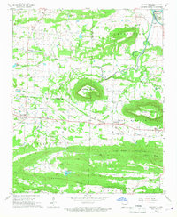
(12)- 1961 Map of Coal Hill, 1962 Print
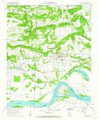 1961 Coal Hill1962 Print · USGSThe mining and rail corridor of Johnson County comes into focus in the early sixties, showing the industrial landscape before modern reclamation. Genealogists and researchers can trace family plots at Houston Cem or Hardgraves Cem and follow the old MISSOURI PACIFIC line through Coal Hill.2 unique versions available
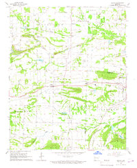
 - 1961 Map of Paris, 1962 Print
 1961 Paris1962 Print · USGSParis and the surrounding Arkansas River valley are captured in the early 1960s during a period of established mining and agriculture. Researchers can trace local family roots through numerous sites like New Subiaco Academy, Oakwood Cem, and the Missouri Pacific Railroad line.3 unique versions available
 - 1963 Map of Hunt, 1964 Print
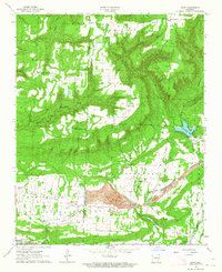 1963 Hunt1964 Print · USGSJohnson and Franklin counties appear at a crossroads of industry and wilderness in the early 1960s. Genealogists can trace family names through numerous remote burial sites like Brendle Cem and Hardgrave Cem, or locate landmarks such as the Utah Strip Mine and Horsehead Lake.2 unique versions available
 - 1964 Map of Russellville
 1964 Russellville1964 Print · USGSMid-century Central Arkansas is defined here by the river-valley towns and the surrounding mountain ranges before the full expansion of the interstate system. Genealogists and historians can trace rail-town development along the Missouri Pacific Railroad and locate landmarks like Arkansas Polytechnic College or Petit Jean State Park.
 - 1965 Map of Fort Smith
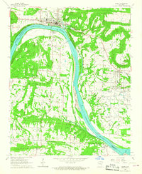
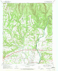
 1965 Fort Smith1965 Print · USGSEastern Oklahoma and Western Arkansas are captured here during a period of massive post-war change as new reservoirs reshaped the river valleys. Genealogists and historians can trace the rail networks of the Midland Valley RR and find established communities like Stilwell, Sallisaw, and Stigler.
 - 1965 Map of Cecil, 1967 Print
 1965 Cecil1967 Print · USGSThe Arkansas River shoreline and energy landscape of the mid-1960s are captured here during a time of industrial development. Genealogists can trace family landmarks like Patterson Cem and Oak Bend Ch, or locate the Cecil Gas Field.2 unique versions available
 - 1966 Map of Ozark, 1967 Print
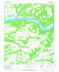
 1966 Ozark1967 Print · USGSThe Arkansas River valley undergoes major changes in the 1960s as industrial progress meets traditional settlements. Genealogists and local historians can trace family roots through Highland Cemetery and St Marys Ch, or locate sites like Webb City Sch before the reservoir waters rose.2 unique versions available
 - 1966 Map of Caulksville, 1967 Print
 1966 Caulksville1967 Print · USGSThe coal-rich foothills of Logan County are shown here in the mid-1960s as industrial mining reached its peak. Researchers can trace the Missouri Pacific rail lines and locate family landmarks like Paint Rock Cem and the Drive-in Theater.2 unique versions available
 - 1966 Map of Branch, 1967 Print
 1966 Branch1967 Print · USGSThe railroad towns of Branch and Ratcliff thrive alongside active energy and mining operations during the mid-sixties. Genealogists and historians can locate numerous family landmarks like Hunter Cem, St Anthonys Ch, and the Strip Mines of Peter Pender.2 unique versions available
 - 1967 Map of Fort Smith
 1967 Fort Smith1967 Print · USGSThe Arkansas River valley and the foothills of the Ozarks are captured here during a period of significant military and industrial activity. Researchers can trace the sprawling bounds of Camp Chaffee and Camp Gruber or locate vanished rail stops along the Midland Valley RR.
 - 1969 Map of Fern, 1971 Print
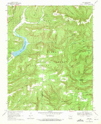 1969 Fern1971 Print · USGSCrawford and Franklin counties are shown here in the late sixties as the Ozark interior balanced rural life with forest management. Genealogists can locate family landmarks like Locke Cemetery, the settlement of Fern, and the Faith Church near the Mulberry River.3 unique versions available
 - 1969 Map of Mountainburg SE, 1971 Print
 1969 Mountainburg SE1971 Print · USGSCrawford and Franklin counties are captured here in the late sixties as the modern interstate began to reshape the Ozark foothills. Genealogists and local historians can trace family locations through Concord Cem, Piney, and the Marvin Sch.3 unique versions available
End of results
Showing maps 1-12 of 12
Top cities of Franklin County
- Ozark historical maps
- Charleston historical maps
- Altus historical maps
- Branch historical maps
- Denning historical maps
- Wiederkehr Village historical maps
Frequently asked questions
- What are the different types of historical maps available for Franklin County?
- What is the oldest map of Franklin County?
- Where can I purchase historical maps of Franklin County for my home or office?
- Where can I download high-res historical maps of Franklin County?
- Are there historical topographic maps available for Franklin County?
- Is there historical aerial imagery available for Franklin County?
- Where are historical maps of Franklin County sourced from?