1970s Maps of Fulton County, Arkansas
Explore 6 historic maps of Fulton County from the 1970s. These maps offer a rare glimpse into what life looked like during the 1970s — showing old roads, neighborhoods, homes, and landmarks that have changed or disappeared over time.
Whether you're researching your family's past, planning a metal detecting trip, or studying how Fulton County's landscape evolved across the 1970s, these high-resolution maps are a powerful tool for exploring the history of this region.
- Focus on a specific era: All maps on this page are from the 1970s, giving you a focused view of this time period.
- See what’s changed: Compare century-old streets, trails, and buildings to today's modern landscape using overlays and satellite layers.
- Research with precision: Use these maps for genealogy, historical research, land use analysis, or educational projects.
- View, download, or print: Maps are fully viewable online in high resolution, and can be downloaded or printed for your own records.
Start exploring Fulton County's history through authentic maps from the 1970s. This is your window into the past.
Fulton County, AR maps
(6)- 1976 Map of Salem SW, 1977 Print
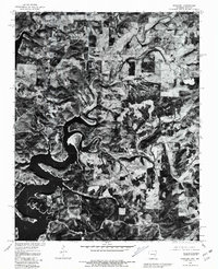
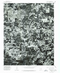 1976 Salem SW1977 Print · USGSMid-seventies Fulton County comes into focus in this detailed orthophotoquad, showing the rural crossroads and river valleys as they were decades ago. Trace the settlement patterns at Bexar and Union, or follow the winding course of the Strawberry River.
 - 1976 Map of Salem SE, 1977 Print
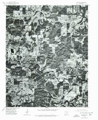 1976 Salem SE1977 Print · USGSThe northern Arkansas landscape comes into focus in the mid-1970s through this aerial orthophotoquad. Local historians can trace the rural layout of Salem and Wheeling or study the natural course of the South Fork Spring River.
 - 1976 Map of Salem NE, 1977 Print
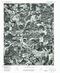 1976 Salem NE1977 Print · USGSFulton County land patterns and river bends are captured from the air during the mid-seventies. Researchers can trace rural property lines and woodlots near the South Fork Spring River and the settlements of Moko and Salem.
 - 1976 Map of Salem NW, 1977 Print
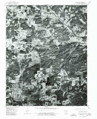 1976 Salem NW1977 Print · USGSNear the Arkansas and Missouri border in the mid-seventies, this orthophoto captures the rural homesteads and agricultural layout of Fulton County. Researchers can trace the exact buildings and roads around Viola during this period of Ozark development.
 - 1979 Map of Norfork Dam North, 1981 Print
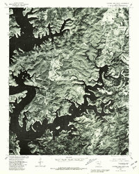 1979 Norfork Dam North1981 Print · USGSIn the late seventies, the complex shoreline of Norfork Lake and the surrounding Baxter County highlands are captured in sharp detail. Researchers can trace land use patterns near Henderson and Ruth or follow the winding course of Big Creek.
 - 1979 Map of Gamaliel, 1981 Print
 1979 Gamaliel1981 Print · USGSBaxter County at the turn of the eighties shows a landscape defined by the winding waters of the Ozarks. Local researchers can trace land use patterns around Gamaliel and Cumi, or follow the shoreline of Norfork Lake.
End of results
Showing maps 1-6 of 6
Top cities of Fulton County
Frequently asked questions
- What are the different types of historical maps available for Fulton County?
- What is the oldest map of Fulton County?
- Where can I purchase historical maps of Fulton County for my home or office?
- Where can I download high-res historical maps of Fulton County?
- Are there historical topographic maps available for Fulton County?
- Is there historical aerial imagery available for Fulton County?
- Where are historical maps of Fulton County sourced from?